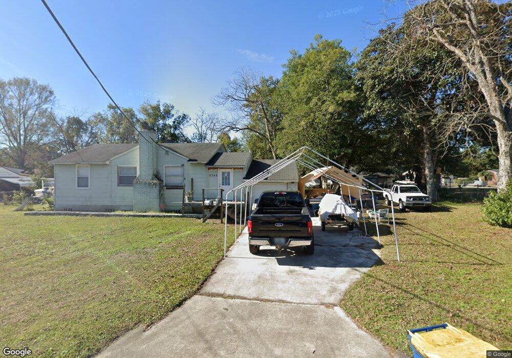
8342 Paul Jones Dr Jacksonville, FL 32208
Lake Forest NeighborhoodEstimated Value: $140,000 - $210,000
3
Beds
1
Bath
1,494
Sq Ft
$114/Sq Ft
Est. Value
About This Home
This home is located at 8342 Paul Jones Dr, Jacksonville, FL 32208 and is currently estimated at $170,774, approximately $114 per square foot. 8342 Paul Jones Dr is a home located in Duval County with nearby schools including North Shore Elementary School, Matthew W. Gilbert Middle School, and Jean Ribault High School.
Ownership History
Date
Name
Owned For
Owner Type
Purchase Details
Closed on
Nov 15, 2019
Sold by
Yedlicka Cynthia D and Yedlicka Cynthia Y
Bought by
Cox David B
Current Estimated Value
Purchase Details
Closed on
Aug 18, 2009
Sold by
Suncoast Property Investors Inc
Bought by
Cox David B and Cox Cindy Y
Purchase Details
Closed on
Jul 10, 2009
Sold by
Homeworld Properties Inc
Bought by
Suncoast Property Investors Inc and Suncoast Property Rentals Inc
Purchase Details
Closed on
Jun 30, 2009
Sold by
Herndon Gail
Bought by
La Salle Bank National Association
Purchase Details
Closed on
May 20, 2009
Sold by
Hernoon Gail
Bought by
Lasalle Bank
Purchase Details
Closed on
Nov 16, 2006
Sold by
Prosperity Inc
Bought by
Herndon Gail
Home Financials for this Owner
Home Financials are based on the most recent Mortgage that was taken out on this home.
Original Mortgage
$97,200
Interest Rate
6.33%
Mortgage Type
Stand Alone First
Purchase Details
Closed on
Nov 15, 2005
Sold by
Franklin Credit Management Corp
Bought by
Prosperity Inc
Home Financials for this Owner
Home Financials are based on the most recent Mortgage that was taken out on this home.
Original Mortgage
$69,000
Interest Rate
5.84%
Mortgage Type
Purchase Money Mortgage
Purchase Details
Closed on
Aug 22, 2005
Sold by
Ramsey David M and Cook Roger
Bought by
Franklin Credit Management Corp
Purchase Details
Closed on
May 19, 1999
Sold by
Cook Roger
Bought by
Ramsey David M and Ramsey Sarah K
Home Financials for this Owner
Home Financials are based on the most recent Mortgage that was taken out on this home.
Original Mortgage
$45,000
Interest Rate
6.94%
Purchase Details
Closed on
Mar 2, 1998
Sold by
Hud
Bought by
Cook Roger
Home Financials for this Owner
Home Financials are based on the most recent Mortgage that was taken out on this home.
Original Mortgage
$37,000
Interest Rate
16%
Mortgage Type
Balloon
Create a Home Valuation Report for This Property
The Home Valuation Report is an in-depth analysis detailing your home's value as well as a comparison with similar homes in the area
Home Values in the Area
Average Home Value in this Area
Purchase History
| Date | Buyer | Sale Price | Title Company |
|---|---|---|---|
| Cox David B | -- | Attorney | |
| Cox David B | $35,900 | Sunshine Title Corporation | |
| Suncoast Property Investors Inc | $30,000 | Sunshine Title Corporation | |
| Paul Jones Homeworld Properties Inc | $28,000 | None Available | |
| La Salle Bank National Association | $1,100 | Attorney | |
| Lasalle Bank | $1,100 | None Available | |
| Herndon Gail | $121,500 | Secure Title Inc | |
| Prosperity Inc | $54,000 | -- | |
| Franklin Credit Management Corp | -- | -- | |
| Franklin Credit Management Corp | -- | -- | |
| Ramsey David M | $60,000 | Accu Title Corp | |
| Cook Roger | $30,000 | -- |
Source: Public Records
Mortgage History
| Date | Status | Borrower | Loan Amount |
|---|---|---|---|
| Previous Owner | Herndon Gail | $97,200 | |
| Previous Owner | Prosperity Inc | $69,000 | |
| Previous Owner | Ramsey David M | $45,000 | |
| Previous Owner | Cook Roger | $37,000 |
Source: Public Records
Tax History Compared to Growth
Tax History
| Year | Tax Paid | Tax Assessment Tax Assessment Total Assessment is a certain percentage of the fair market value that is determined by local assessors to be the total taxable value of land and additions on the property. | Land | Improvement |
|---|---|---|---|---|
| 2025 | $2,162 | $115,175 | -- | -- |
| 2024 | $2,088 | $117,279 | $40,950 | $76,329 |
| 2023 | $2,088 | $121,184 | $40,950 | $80,234 |
| 2022 | $1,792 | $108,196 | $29,250 | $78,946 |
| 2021 | $1,594 | $81,544 | $23,400 | $58,144 |
| 2020 | $1,456 | $70,671 | $14,625 | $56,046 |
| 2019 | $1,433 | $70,557 | $14,625 | $55,932 |
| 2018 | $1,313 | $61,120 | $14,625 | $46,495 |
| 2017 | $1,263 | $57,653 | $14,625 | $43,028 |
| 2016 | $1,233 | $55,030 | $0 | $0 |
| 2015 | $1,198 | $52,200 | $0 | $0 |
| 2014 | $1,160 | $49,649 | $0 | $0 |
Source: Public Records
Map
Nearby Homes
- 8384 Delaware Ave
- 8440 Concord Blvd W
- 8198 Paul Jones Dr
- 8141 Paul Jones Dr
- 0 Concord Blvd W
- 8135 Paul Jones Dr
- 1049 Stark St
- 8037 Marion Cir
- 8044 Delaware Ave
- 8032 Lexington Dr
- 1023 Brandywine St
- 1012 Brandywine St
- 865 Brandywine St
- 8103 Moore Ave
- 8647 Madison Ave
- 1134 Bunker Hill Blvd
- 7770 Calvin St
- 8063 Appian Way W
- 9015 Polk Ave
- 0 Maxwell Rd Unit 2090004
- 8332 Paul Jones Dr
- 8401 Delaware Ave
- 8421 Delaware Ave
- 8317 Lexington Dr
- 8341 Paul Jones Dr
- 8405 Paul Jones Dr
- 8318 Paul Jones Dr
- 8331 Paul Jones Dr
- 8417 Paul Jones Dr
- 8307 Lexington Dr
- 8319 Paul Jones Dr
- 8308 Paul Jones Dr
- 8431 Paul Jones Dr
- 8346 Concord Blvd E
- 8265 Lexington Dr
- 8402 Delaware Ave
- 8414 Delaware Ave
- 8358 Concord Blvd E
- 8332 Concord Blvd E
- 8379 Delaware Ave