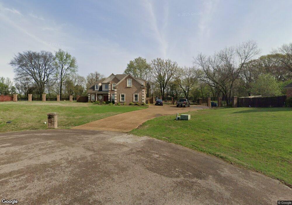
8346 Meadow Vale Cove Olive Branch, MS 38654
Estimated Value: $393,000 - $501,098
5
Beds
4
Baths
3,590
Sq Ft
$128/Sq Ft
Est. Value
About This Home
This home is located at 8346 Meadow Vale Cove, Olive Branch, MS 38654 and is currently estimated at $459,275, approximately $127 per square foot. 8346 Meadow Vale Cove is a home located in DeSoto County with nearby schools including Olive Branch Elementary School, Chickasaw Elementary School, and Olive Branch Middle School.
Ownership History
Date
Name
Owned For
Owner Type
Purchase Details
Closed on
Jun 30, 2011
Sold by
Bank Of America National Association
Bought by
Loper Johnny S and Loper Weslynne
Current Estimated Value
Home Financials for this Owner
Home Financials are based on the most recent Mortgage that was taken out on this home.
Original Mortgage
$224,189
Interest Rate
4.54%
Mortgage Type
Future Advance Clause Open End Mortgage
Purchase Details
Closed on
Sep 13, 2010
Sold by
Mcghee Darryl and Mcghee Montrese
Bought by
Bank Of America National Association
Create a Home Valuation Report for This Property
The Home Valuation Report is an in-depth analysis detailing your home's value as well as a comparison with similar homes in the area
Home Values in the Area
Average Home Value in this Area
Purchase History
| Date | Buyer | Sale Price | Title Company |
|---|---|---|---|
| Loper Johnny S | -- | Resource Title National Agen | |
| Bank Of America National Association | $230,000 | None Available |
Source: Public Records
Mortgage History
| Date | Status | Borrower | Loan Amount |
|---|---|---|---|
| Previous Owner | Loper Johnny S | $224,189 |
Source: Public Records
Tax History Compared to Growth
Tax History
| Year | Tax Paid | Tax Assessment Tax Assessment Total Assessment is a certain percentage of the fair market value that is determined by local assessors to be the total taxable value of land and additions on the property. | Land | Improvement |
|---|---|---|---|---|
| 2024 | $3,770 | $29,822 | $4,000 | $25,822 |
| 2023 | $3,770 | $29,822 | $0 | $0 |
| 2022 | $3,770 | $29,822 | $4,000 | $25,822 |
| 2021 | $3,770 | $29,822 | $4,000 | $25,822 |
| 2020 | $3,497 | $27,820 | $4,000 | $23,820 |
| 2019 | $3,497 | $27,820 | $4,000 | $23,820 |
| 2017 | $3,349 | $49,194 | $26,597 | $22,597 |
| 2016 | $3,349 | $26,597 | $4,000 | $22,597 |
| 2015 | $3,649 | $49,194 | $26,597 | $22,597 |
| 2014 | $3,500 | $27,697 | $0 | $0 |
| 2013 | $3,798 | $27,697 | $0 | $0 |
Source: Public Records
Map
Nearby Homes
- 8017 Camptown Ln
- 8140 Hunters Hill Cove
- 7885 Hunters Bend Cove
- 1930 Plan at Allendale
- 7888 Allenwood Ln
- 7880 Allenwood Ln
- 8390 Ms-178
- 9004 Lakeside Cove
- 7826 Ferndale Dr
- 7843 Ferndale Dr
- 7905 Gardendale Dr
- 7899 Gardendale Dr
- 8870 Collinswood Dr
- 7881 Gardendale Dr
- 7875 Gardendale Dr
- 7759 Ferndale Dr
- 7867 Gardendale Dr
- 7736 Ferndale Dr
- 7859 Gardendale Dr
- 7721 Ferndale Dr
- 8351 Meadow Vale Cove
- 8340 Meadow Vale Cove
- 7803 Windersgate Cir
- 8245 Hunters Creek Dr
- 8312 Mellen Dr
- 8225 Hunters Creek Dr
- 7789 Windersgate Cir
- 7935 Camptown Ln
- 7944 Camptown Ln
- 7817 Windersgate Cir
- 8265 Hunters Creek Dr
- 8205 Hunters Creek Dr
- 8294 King''S Crossing
- 8240 Hunters Creek Dr
- 8298 Mellen Dr
- 8301 Mellen Dr
- 7955 Camptown Ln
- 7964 Camptown Ln
- 8220 Hunters Creek Dr
- 8220 Hunters Run Cove