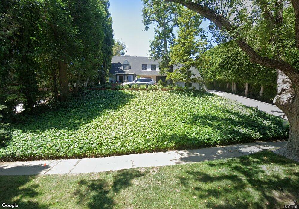
835 Devon Ave Los Angeles, CA 90024
Westwood NeighborhoodEstimated Value: $5,490,000 - $5,606,000
4
Beds
4
Baths
4,092
Sq Ft
$1,352/Sq Ft
Est. Value
About This Home
This home is located at 835 Devon Ave, Los Angeles, CA 90024 and is currently estimated at $5,532,493, approximately $1,352 per square foot. 835 Devon Ave is a home located in Los Angeles County with nearby schools including Warner Avenue Elementary, Ralph Waldo Emerson Community Charter Middle School, and University High School Charter.
Ownership History
Date
Name
Owned For
Owner Type
Purchase Details
Closed on
Apr 22, 2008
Sold by
Furman Gary and Furman Norma
Bought by
Furman Gary N and Furman Norma T
Current Estimated Value
Home Financials for this Owner
Home Financials are based on the most recent Mortgage that was taken out on this home.
Original Mortgage
$544,185
Interest Rate
2.92%
Mortgage Type
Reverse Mortgage Home Equity Conversion Mortgage
Purchase Details
Closed on
Mar 25, 2008
Sold by
Furman Gary and Furman Norma
Bought by
Furman Gary N and Furman Norma T
Home Financials for this Owner
Home Financials are based on the most recent Mortgage that was taken out on this home.
Original Mortgage
$544,185
Interest Rate
2.92%
Mortgage Type
Reverse Mortgage Home Equity Conversion Mortgage
Create a Home Valuation Report for This Property
The Home Valuation Report is an in-depth analysis detailing your home's value as well as a comparison with similar homes in the area
Home Values in the Area
Average Home Value in this Area
Purchase History
| Date | Buyer | Sale Price | Title Company |
|---|---|---|---|
| Furman Gary N | -- | Lenders Choice Title Company | |
| Furman Gary N | -- | None Available |
Source: Public Records
Mortgage History
| Date | Status | Borrower | Loan Amount |
|---|---|---|---|
| Closed | Furman Gary N | $544,185 |
Source: Public Records
Tax History
| Year | Tax Paid | Tax Assessment Tax Assessment Total Assessment is a certain percentage of the fair market value that is determined by local assessors to be the total taxable value of land and additions on the property. | Land | Improvement |
|---|---|---|---|---|
| 2025 | $5,864 | $446,418 | $203,719 | $242,699 |
| 2024 | $5,864 | $437,666 | $199,725 | $237,941 |
| 2023 | $5,764 | $429,085 | $195,809 | $233,276 |
| 2022 | $5,519 | $420,672 | $191,970 | $228,702 |
| 2021 | $5,428 | $412,424 | $188,206 | $224,218 |
| 2019 | $5,276 | $400,193 | $182,625 | $217,568 |
| 2018 | $5,122 | $392,347 | $179,045 | $213,302 |
| 2016 | $4,863 | $377,114 | $172,094 | $205,020 |
| 2015 | $4,796 | $371,450 | $169,509 | $201,941 |
| 2014 | $4,824 | $364,175 | $166,189 | $197,986 |
Source: Public Records
Map
Nearby Homes
- 10375 Wilshire Blvd Unit 9HK
- 10375 Wilshire Blvd Unit 2F
- 10375 Wilshire Blvd Unit 8F
- 10380 Wilshire Blvd Unit 1501
- 10350 Wilshire Blvd Unit 702
- 10350 Wilshire Blvd Unit 404
- 834 Devon Ave
- 10336 Wilshire Blvd Unit 703
- 10336 Wilshire Blvd Unit 201
- 10357 Ashton Ave
- 10361 Ashton Ave
- 850 Birchwood Dr
- 865 Comstock Ave Unit 10D
- 865 Comstock Ave Unit 16F
- 865 Comstock Ave Unit 7D
- 865 Comstock Ave Unit PHD
- 875 Comstock Ave Unit 16A
- 875 Comstock Ave Unit PHA
- 10370 Ashton Ave
- 1250 S Beverly Glen Blvd Unit 107
- 827 Devon Ave
- 843 Devon Ave
- 819 Devon Ave
- 851 Devon Ave
- 826 Devon Ave
- 836 S Beverly Glen Blvd
- 811 Devon Ave
- 828 S Beverly Glen Blvd
- 818 S Beverly Glen Blvd
- 849 Birchwood Dr
- 842 Devon Ave
- 10351 Wilshire Blvd
- 10351 Wilshire Blvd Unit 4
- 10351 Wilshire Blvd
- 10351 Wilshire Blvd Unit PH4
- 10351 Wilshire Blvd Unit PH3
- 10351 Wilshire Blvd Unit PH2
- 10351 Wilshire Blvd Unit PH1
- 10351 Wilshire Blvd Unit 404
- 10351 Wilshire Blvd Unit 403
Your Personal Tour Guide
Ask me questions while you tour the home.