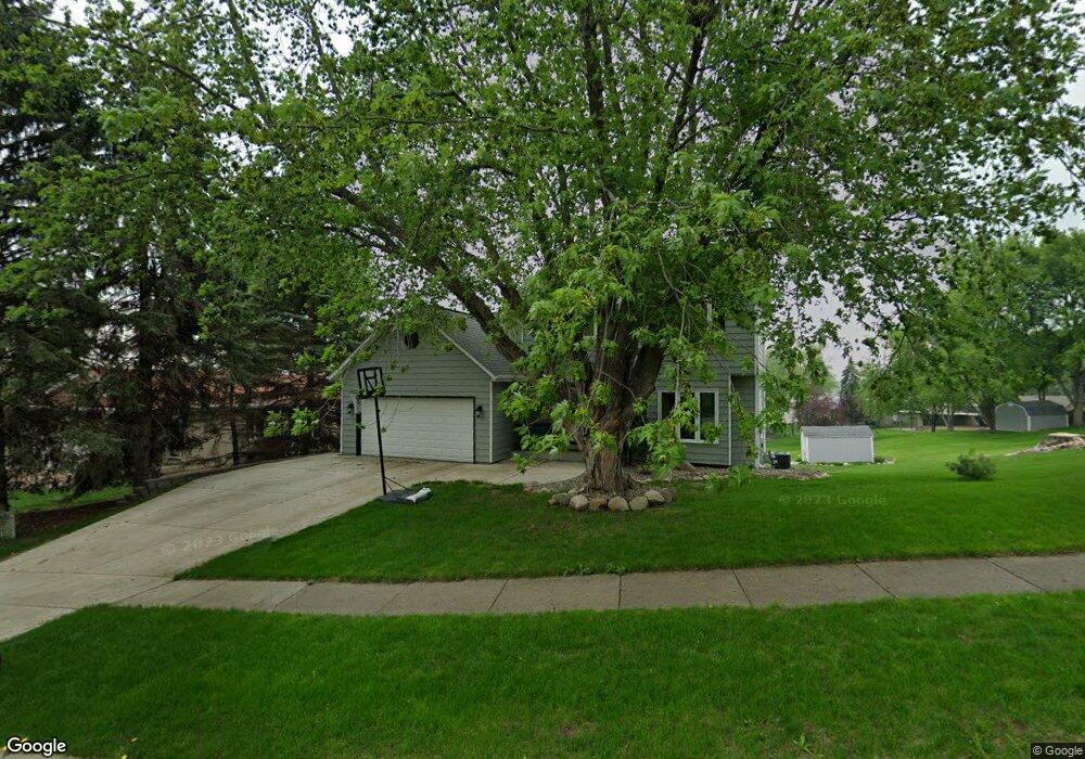
8350 141st St W Saint Paul, MN 55124
Alimagnet NeighborhoodEstimated Value: $418,000 - $456,000
4
Beds
2
Baths
1,642
Sq Ft
$265/Sq Ft
Est. Value
About This Home
This home is located at 8350 141st St W, Saint Paul, MN 55124 and is currently estimated at $435,587, approximately $265 per square foot. 8350 141st St W is a home located in Dakota County with nearby schools including Westview Elementary School, Valley Middle School, and Apple Valley Senior High School.
Ownership History
Date
Name
Owned For
Owner Type
Purchase Details
Closed on
Jun 12, 2003
Sold by
Powers Jeffrey K and Powers Kimberly A
Bought by
Voss Scott and Voss Tzitel
Current Estimated Value
Purchase Details
Closed on
Jan 25, 2002
Sold by
Johnson Gregg W and Johnson Laurie A
Bought by
Powers Jeffrey K and Powers Kimberly A
Create a Home Valuation Report for This Property
The Home Valuation Report is an in-depth analysis detailing your home's value as well as a comparison with similar homes in the area
Home Values in the Area
Average Home Value in this Area
Purchase History
| Date | Buyer | Sale Price | Title Company |
|---|---|---|---|
| Voss Scott | $27,200 | -- | |
| Powers Jeffrey K | $239,000 | -- |
Source: Public Records
Tax History Compared to Growth
Tax History
| Year | Tax Paid | Tax Assessment Tax Assessment Total Assessment is a certain percentage of the fair market value that is determined by local assessors to be the total taxable value of land and additions on the property. | Land | Improvement |
|---|---|---|---|---|
| 2024 | $4,472 | $398,500 | $92,900 | $305,600 |
| 2023 | $4,472 | $395,400 | $93,100 | $302,300 |
| 2022 | $3,820 | $379,600 | $92,800 | $286,800 |
| 2021 | $3,658 | $333,300 | $80,700 | $252,600 |
| 2020 | $3,684 | $313,500 | $76,800 | $236,700 |
| 2019 | $3,238 | $306,700 | $73,200 | $233,500 |
| 2018 | $3,151 | $284,000 | $69,700 | $214,300 |
| 2017 | $3,215 | $265,900 | $66,300 | $199,600 |
| 2016 | $3,291 | $258,000 | $63,200 | $194,800 |
| 2015 | $3,001 | $246,923 | $58,724 | $188,199 |
| 2014 | -- | $226,322 | $55,879 | $170,443 |
| 2013 | -- | $218,583 | $51,409 | $167,174 |
Source: Public Records
Map
Nearby Homes
- 14208 Heritage Ln
- 14132 Heywood Path
- 13902 Herald Way
- 13910 Herald Ct
- 13780 Hanover Way
- 13761 Hollybrook Cir
- 8681 144th Street Ct
- 13751 Hollybrook Cir
- 441 Walnut Ln
- 14115 Pennock Ave Unit 301
- 14115 Pennock Ave Unit 303
- 13731 Hollybrook Cir
- 13727 Hollybrook Cir
- The Magnolia Plan at Eagle Pointe - Townhomes
- The Sophia Plan at Eagle Pointe - Townhomes
- The Amelia Plan at Eagle Pointe - Townhomes
- The Nolan Plan at Eagle Pointe - Townhomes
- 7662 142nd St W
- 14242 Glencove Trail
- 13609 Hollybrook Dr
- 8310 141st St W
- 14155 Hayes Rd
- 8370 141st St W
- 14130 Heritage Ct
- 8335 141st St W
- 8355 141st St W
- 14160 Heritage Ct
- 8315 141st St W
- 8375 141st St W
- 14175 Hayes Rd
- 14190 Heritage Ct
- 14195 Hayes Rd
- 14195 Hayes Rd
- 14041 Hayes Rd
- 14020 Heritage Ct
- 14105 Heritage Ct
- 14085 Heritage Ct
- 14135 Heritage Ct
- 14035 Hayes Rd
- 8274 142nd Street Rd W