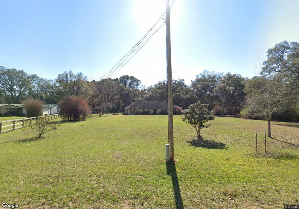
8357 Mobile Hwy Pensacola, FL 32526
Beulah NeighborhoodEstimated Value: $315,287 - $446,000
--
Bed
2
Baths
2,272
Sq Ft
$159/Sq Ft
Est. Value
About This Home
This home is located at 8357 Mobile Hwy, Pensacola, FL 32526 and is currently estimated at $361,572, approximately $159 per square foot. 8357 Mobile Hwy is a home located in Escambia County with nearby schools including Beulah Elementary School, Beulah Middle School, and Pine Forest High School.
Ownership History
Date
Name
Owned For
Owner Type
Purchase Details
Closed on
Feb 25, 2003
Sold by
White Selton L and White Selton Larry
Bought by
Mccall Darrell W and Hall Kristin L
Current Estimated Value
Home Financials for this Owner
Home Financials are based on the most recent Mortgage that was taken out on this home.
Original Mortgage
$130,150
Outstanding Balance
$56,237
Interest Rate
5.95%
Estimated Equity
$305,335
Create a Home Valuation Report for This Property
The Home Valuation Report is an in-depth analysis detailing your home's value as well as a comparison with similar homes in the area
Home Values in the Area
Average Home Value in this Area
Purchase History
| Date | Buyer | Sale Price | Title Company |
|---|---|---|---|
| Mccall Darrell W | $137,000 | -- |
Source: Public Records
Mortgage History
| Date | Status | Borrower | Loan Amount |
|---|---|---|---|
| Open | Mccall Darrell W | $130,150 |
Source: Public Records
Tax History Compared to Growth
Tax History
| Year | Tax Paid | Tax Assessment Tax Assessment Total Assessment is a certain percentage of the fair market value that is determined by local assessors to be the total taxable value of land and additions on the property. | Land | Improvement |
|---|---|---|---|---|
| 2024 | $1,535 | $151,010 | -- | -- |
| 2023 | $1,535 | $146,612 | $0 | $0 |
| 2022 | $1,494 | $142,342 | $0 | $0 |
| 2021 | $1,488 | $138,197 | $0 | $0 |
| 2020 | $1,449 | $136,289 | $0 | $0 |
| 2019 | $1,420 | $133,225 | $0 | $0 |
| 2018 | $1,415 | $130,741 | $0 | $0 |
| 2017 | $1,409 | $128,052 | $0 | $0 |
| 2016 | $1,396 | $125,419 | $0 | $0 |
| 2015 | $1,382 | $124,548 | $0 | $0 |
| 2014 | $1,373 | $123,560 | $0 | $0 |
Source: Public Records
Map
Nearby Homes
- 8271 Mobile Hwy
- 9454 Lutoo Ln
- 8251 Mobile Hwy
- 6031 Crimson Pointe Blvd
- 9687 Angel Oak Dr
- 9691 Angel Oak Dr
- 9699 Angel Oak Dr
- 9528 Crimson Pointe Cir
- 9511 Crimson Pointe Cir
- 9570 Tower Ridge Rd
- 6000 W Nine Mile Rd
- 5900 BLK Beulah Church Rd
- 9920 Rebel Rd
- 9953 Suwanee Ln
- 6654 Sun Tree Cir
- 8056 Stream Ridge Rd
- 7616 Burnside Loop
- 8129 Mobile Hwy
- 14000 Tower Ridge Rd
- 8124 Mobile Hwy
- 8371 Mobile Hwy
- 8350 Mobile Hwy
- 8351 Mobile Hwy
- 8340 Mobile Hwy
- 8330 Mobile Hwy
- 8320 Mobile Hwy
- 8959 Mobile Hwy
- 9314 Bridlewood Rd
- 9101 Mobile Hwy
- 9442 Lutoo Ln
- 6121 Chester Dr
- 9131 Mobile Hwy Unit Lot 1
- 9131 Mobile Hwy Unit 6
- 9131 Mobile Hwy Unit 3
- 9131 Mobile Hwy Unit 8
- 9131 Mobile Hwy Unit 12
- 9131 Mobile Hwy Unit LT7
- 9446 Lutoo Ln
- 9450 Lutoo Ln
- 9435 Lutoo Ln