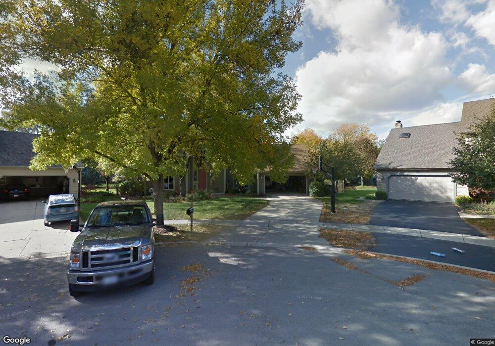
836 Mobile Ct Naperville, IL 60540
Hobson West NeighborhoodEstimated Value: $774,000 - $899,000
4
Beds
3
Baths
3,465
Sq Ft
$243/Sq Ft
Est. Value
About This Home
This home is located at 836 Mobile Ct, Naperville, IL 60540 and is currently estimated at $842,794, approximately $243 per square foot. 836 Mobile Ct is a home located in DuPage County with nearby schools including Elmwood Elementary School, Lincoln Jr. High School, and Naperville Central High School.
Ownership History
Date
Name
Owned For
Owner Type
Purchase Details
Closed on
Sep 25, 2024
Sold by
Kincaide Geoffrey B and Kincaide Julie T
Bought by
Geoffrey B Kincaide Trust
Current Estimated Value
Purchase Details
Closed on
Jul 25, 2006
Sold by
Wilkinson Christine D and Christine D Wilkinson Trust
Bought by
Kincaide Geoff B and Kincaide Julie T
Home Financials for this Owner
Home Financials are based on the most recent Mortgage that was taken out on this home.
Original Mortgage
$210,000
Interest Rate
6.85%
Mortgage Type
Purchase Money Mortgage
Purchase Details
Closed on
Aug 31, 2005
Sold by
Wilkinson Christine D
Bought by
Wilkinson Christine D and Christine D Wilkinson Trust
Home Financials for this Owner
Home Financials are based on the most recent Mortgage that was taken out on this home.
Original Mortgage
$392,000
Interest Rate
5.75%
Mortgage Type
Fannie Mae Freddie Mac
Purchase Details
Closed on
Jun 24, 2005
Sold by
Wilkinson Robert M and Wilkinson Christine D
Bought by
Wilkinson Christine D and Wilkinson Robert M
Purchase Details
Closed on
Oct 6, 1998
Sold by
Dugan William E and Dugan Andrea M
Bought by
Wilkinson Robert M and Wilkinson Christine D
Home Financials for this Owner
Home Financials are based on the most recent Mortgage that was taken out on this home.
Original Mortgage
$250,500
Interest Rate
7.12%
Purchase Details
Closed on
Jul 25, 1994
Sold by
Miner William S and Miner Mary Beth
Bought by
Dugan William E and Dugan Andrea M
Home Financials for this Owner
Home Financials are based on the most recent Mortgage that was taken out on this home.
Original Mortgage
$210,000
Interest Rate
6.75%
Create a Home Valuation Report for This Property
The Home Valuation Report is an in-depth analysis detailing your home's value as well as a comparison with similar homes in the area
Home Values in the Area
Average Home Value in this Area
Purchase History
| Date | Buyer | Sale Price | Title Company |
|---|---|---|---|
| Geoffrey B Kincaide Trust | -- | None Listed On Document | |
| Kincaide Geoff B | $545,000 | First American Title | |
| Wilkinson Christine D | -- | Ctic | |
| Wilkinson Christine D | -- | Ctic | |
| Wilkinson Christine D | -- | -- | |
| Wilkinson Robert M | $334,000 | Collar Counties Title Plant | |
| Dugan William E | $281,000 | -- |
Source: Public Records
Mortgage History
| Date | Status | Borrower | Loan Amount |
|---|---|---|---|
| Previous Owner | Kincaide Geoff B | $210,000 | |
| Previous Owner | Wilkinson Christine D | $392,000 | |
| Previous Owner | Wilkinson Robert M | $250,500 | |
| Previous Owner | Dugan William E | $210,000 |
Source: Public Records
Tax History
| Year | Tax Paid | Tax Assessment Tax Assessment Total Assessment is a certain percentage of the fair market value that is determined by local assessors to be the total taxable value of land and additions on the property. | Land | Improvement |
|---|---|---|---|---|
| 2024 | $16,125 | $270,924 | $97,000 | $173,924 |
| 2023 | $15,276 | $243,440 | $87,160 | $156,280 |
| 2022 | $14,395 | $228,780 | $81,320 | $147,460 |
| 2021 | $13,893 | $220,620 | $78,420 | $142,200 |
| 2020 | $13,849 | $220,620 | $78,420 | $142,200 |
| 2019 | $13,362 | $209,840 | $74,590 | $135,250 |
| 2018 | $12,409 | $203,350 | $71,780 | $131,570 |
| 2017 | $12,159 | $196,460 | $69,350 | $127,110 |
| 2016 | $11,869 | $188,540 | $66,550 | $121,990 |
| 2015 | $11,892 | $179,020 | $63,190 | $115,830 |
| 2014 | $11,639 | $163,680 | $59,560 | $104,120 |
| 2013 | $11,558 | $164,810 | $59,970 | $104,840 |
Source: Public Records
Map
Nearby Homes
- 840 Mobile Ct
- 316 Hemlock Ln
- 845 Tulip Ln
- 7S410 Arbor Dr
- 1161 Banyon Ct
- 1033 Emerald Dr
- 808 Shiloh Cir
- 816 S River Rd
- 1246 Ardmore Dr
- 854 Raintree Dr
- 731 S River Rd
- 1095 Devonshire Ave
- 316 Sycamore Dr Unit 11
- 1210 Lawnmeadow Ln
- 7S146 Wild Cherry Rd
- 313 W Gartner Rd
- 509 Aurora Ave Unit 616
- 817 Cardiff Rd
- 511 Aurora Ave Unit 606
- 534 Grimes Ave
- 839 Mobile Ct
- 844 Mobile Ct
- 847 Mobile Ct
- 908 Savannah Cir
- 912 Savannah Cir
- 904 Savannah Cir
- 916 Savannah Cir
- 848 Mobile Ct
- 855 Mobile Ct
- 900 Savannah Cir
- 920 Savannah Cir
- 852 Mobile Ct
- 905 Savannah Cir Unit 4
- 856 Mobile Ct
- 901 Savannah Cir
- 924 Savannah Cir
- 923 Savannah Cir
- 865 Appomattox Cir
- 857 Appomattox Cir
- 837 Manassas Ct Unit 4
Your Personal Tour Guide
Ask me questions while you tour the home.