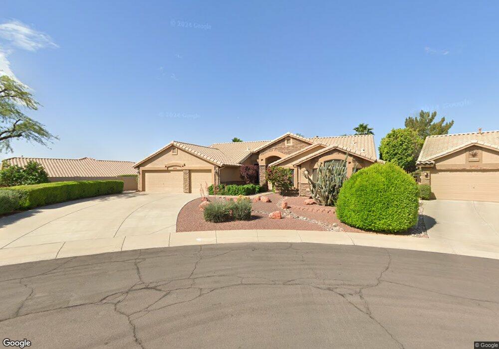
8365 W Morrow Dr Peoria, AZ 85382
Estimated Value: $508,246 - $571,000
3
Beds
3
Baths
2,171
Sq Ft
$251/Sq Ft
Est. Value
About This Home
This home is located at 8365 W Morrow Dr, Peoria, AZ 85382 and is currently estimated at $545,562, approximately $251 per square foot. 8365 W Morrow Dr is a home located in Maricopa County with nearby schools including Apache Elementary School, Sunrise Mountain High School, and Sonoran Science Academy-Peoria.
Ownership History
Date
Name
Owned For
Owner Type
Purchase Details
Closed on
Mar 22, 2021
Sold by
Sandall Paul R and Sandall Gretchen M
Bought by
Sandall Frank B and Sandall Beth A
Current Estimated Value
Home Financials for this Owner
Home Financials are based on the most recent Mortgage that was taken out on this home.
Original Mortgage
$305,000
Outstanding Balance
$226,206
Interest Rate
2.73%
Mortgage Type
New Conventional
Estimated Equity
$319,356
Purchase Details
Closed on
Sep 29, 2017
Sold by
Sandall Frank B and Sandall Beth A
Bought by
Sandall Frank B and Sandall Beth A
Purchase Details
Closed on
Apr 17, 2008
Sold by
Pinson Michael J and Turriciano Janis K
Bought by
Sandall Paul R and Sandall Gretchen M
Home Financials for this Owner
Home Financials are based on the most recent Mortgage that was taken out on this home.
Original Mortgage
$354,000
Interest Rate
5.88%
Mortgage Type
New Conventional
Purchase Details
Closed on
Sep 10, 2004
Sold by
Pinson Michael J
Bought by
Pinson Michael J and Turriciano Janis K
Home Financials for this Owner
Home Financials are based on the most recent Mortgage that was taken out on this home.
Original Mortgage
$260,000
Interest Rate
5.37%
Mortgage Type
Purchase Money Mortgage
Purchase Details
Closed on
Aug 4, 2004
Sold by
Lutton Dale and Lutton Ann
Bought by
Pinson Michael J
Home Financials for this Owner
Home Financials are based on the most recent Mortgage that was taken out on this home.
Original Mortgage
$260,000
Interest Rate
5.37%
Mortgage Type
Purchase Money Mortgage
Purchase Details
Closed on
Aug 2, 2004
Sold by
Turriciano Janis K
Bought by
Pinson Michael J
Home Financials for this Owner
Home Financials are based on the most recent Mortgage that was taken out on this home.
Original Mortgage
$260,000
Interest Rate
5.37%
Mortgage Type
Purchase Money Mortgage
Purchase Details
Closed on
Aug 12, 1994
Sold by
First Service Title Agency Inc
Bought by
Lutton Dale and Lutton Ann
Home Financials for this Owner
Home Financials are based on the most recent Mortgage that was taken out on this home.
Original Mortgage
$138,900
Interest Rate
8.58%
Mortgage Type
New Conventional
Create a Home Valuation Report for This Property
The Home Valuation Report is an in-depth analysis detailing your home's value as well as a comparison with similar homes in the area
Home Values in the Area
Average Home Value in this Area
Purchase History
| Date | Buyer | Sale Price | Title Company |
|---|---|---|---|
| Sandall Frank B | -- | Pioneer Title Agency Inc | |
| Sandall Frank B | -- | None Available | |
| Sandall Paul R | $443,000 | Pioneer Title Agency Inc | |
| Pinson Michael J | -- | Capital Title Agency Inc | |
| Pinson Michael J | $325,000 | Capital Title Agency Inc | |
| Pinson Michael J | -- | Capital Title Agency Inc | |
| Lutton Dale | $173,880 | First Service Title Agency I |
Source: Public Records
Mortgage History
| Date | Status | Borrower | Loan Amount |
|---|---|---|---|
| Open | Sandall Frank B | $305,000 | |
| Previous Owner | Sandall Paul R | $354,000 | |
| Previous Owner | Pinson Michael J | $260,000 | |
| Previous Owner | Lutton Dale | $138,900 |
Source: Public Records
Tax History Compared to Growth
Tax History
| Year | Tax Paid | Tax Assessment Tax Assessment Total Assessment is a certain percentage of the fair market value that is determined by local assessors to be the total taxable value of land and additions on the property. | Land | Improvement |
|---|---|---|---|---|
| 2025 | $2,968 | $31,333 | -- | -- |
| 2024 | $2,906 | $29,841 | -- | -- |
| 2023 | $2,906 | $36,510 | $7,300 | $29,210 |
| 2022 | $2,849 | $30,320 | $6,060 | $24,260 |
| 2021 | $2,981 | $28,830 | $5,760 | $23,070 |
| 2020 | $3,001 | $27,620 | $5,520 | $22,100 |
| 2019 | $2,911 | $25,630 | $5,120 | $20,510 |
| 2018 | $2,811 | $24,210 | $4,840 | $19,370 |
| 2017 | $2,805 | $22,580 | $4,510 | $18,070 |
| 2016 | $2,770 | $21,270 | $4,250 | $17,020 |
| 2015 | $2,579 | $21,160 | $4,230 | $16,930 |
Source: Public Records
Map
Nearby Homes
- 18729 N 84th Dr
- 8402 W Rosemonte Dr
- 18830 N 83rd Ln
- 8449 W Rockwood Dr
- 8517 W Rockwood Dr
- 8529 W Rockwood Dr
- 8502 W Kimberly Way
- 8333 W Wescott Dr
- 8370 W Audrey Ln
- 8420 W Audrey Ln
- 8546 W Wescott Dr
- 8332 W Troy St
- 8502 W Topeka Dr
- 19405 N 83rd Dr
- 18227 N 85th Dr
- 8331 W Fullam St
- 8737 W Kimberly Way
- 19016 N 79th Ln
- 8390 W Oraibi Dr
- 8720 W Willowbrook Dr
- 8404 W Rockwood Dr
- 8410 W Rockwood Dr
- 8371 W Morrow Dr
- 8360 W Rockwood Dr
- 8380 W Morrow Dr
- 18719 N 84th Dr
- 18739 N 84th Dr
- 8374 W Morrow Dr
- 8353 W Morrow Dr
- 8407 W Rosemonte Dr
- 8413 W Rosemonte Dr
- 8401 W Rosemonte Dr
- 8407 W Rockwood Dr
- 8419 W Rosemonte Dr
- 8401 W Rockwood Dr
- 8413 W Rockwood Dr
- 8348 W Rockwood Dr
- 8368 W Morrow Dr
- 8347 W Morrow Dr