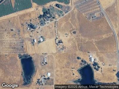
8387 Porter Rd Sheridan, CA 95681
Estimated Value: $401,000 - $734,000
3
Beds
2
Baths
1,560
Sq Ft
$384/Sq Ft
Est. Value
About This Home
This home is located at 8387 Porter Rd, Sheridan, CA 95681 and is currently estimated at $598,915, approximately $383 per square foot. 8387 Porter Rd is a home located in Placer County with nearby schools including Glen Edwards Middle and Lincoln High.
Ownership History
Date
Name
Owned For
Owner Type
Purchase Details
Closed on
Apr 1, 2008
Sold by
Perrigo Brant and Perrigo Michelle
Bought by
Macias Pablo
Current Estimated Value
Purchase Details
Closed on
Jun 12, 2002
Sold by
Janfeshan Samad P and Ashrafi Mitra
Bought by
Perrigo Brant and Perrigo Michelle
Home Financials for this Owner
Home Financials are based on the most recent Mortgage that was taken out on this home.
Original Mortgage
$176,000
Interest Rate
6.74%
Mortgage Type
Construction
Create a Home Valuation Report for This Property
The Home Valuation Report is an in-depth analysis detailing your home's value as well as a comparison with similar homes in the area
Home Values in the Area
Average Home Value in this Area
Purchase History
| Date | Buyer | Sale Price | Title Company |
|---|---|---|---|
| Macias Pablo | $287,000 | Fidelity National Title Co | |
| Perrigo Brant | $140,000 | Chicago Title Co |
Source: Public Records
Mortgage History
| Date | Status | Borrower | Loan Amount |
|---|---|---|---|
| Open | Macias Pablo | $170,000 | |
| Closed | Macias Chavez Pablo | $70,000 | |
| Previous Owner | Perrigo Brant W | $50,000 | |
| Previous Owner | Perrigo Brant | $250,000 | |
| Previous Owner | Perrigo Brant | $202,500 | |
| Previous Owner | Perrigo Brant | $176,000 |
Source: Public Records
Tax History Compared to Growth
Tax History
| Year | Tax Paid | Tax Assessment Tax Assessment Total Assessment is a certain percentage of the fair market value that is determined by local assessors to be the total taxable value of land and additions on the property. | Land | Improvement |
|---|---|---|---|---|
| 2023 | $3,883 | $362,328 | $284,058 | $78,270 |
| 2022 | $3,775 | $355,225 | $278,489 | $76,736 |
| 2021 | $3,702 | $348,261 | $273,029 | $75,232 |
| 2020 | $3,683 | $344,691 | $270,230 | $74,461 |
| 2019 | $3,588 | $337,933 | $264,932 | $73,001 |
| 2018 | $3,500 | $331,308 | $259,738 | $71,570 |
| 2017 | $3,388 | $324,813 | $254,646 | $70,167 |
| 2016 | $3,308 | $318,445 | $249,653 | $68,792 |
Source: Public Records
Map
Nearby Homes
- 4680 H St
- 1408 Riosa Rd
- 700 Karchner Rd
- 7394 Camp Far Rd W
- 2636 Spenceville Rd
- 5160 Ranch House Rd
- 2750 Spenceville Rd
- 7497 McCourtney Rd
- 100 Serene Estates Ln
- 3926 Hokan Ln
- 19227 Matthew Rd
- 113 Hudson Ct
- 8675 Valley Rd
- 143 Melton Way
- 6030 McCourtney Rd
- 112 Kristin Dr
- 213 Main St
- 8161 Camp Far Rd W
- 506 D St
- 312 Olive St
