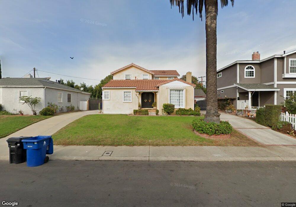
8401 Flight Ave Los Angeles, CA 90045
Westchester NeighborhoodEstimated Value: $970,000 - $2,002,482
3
Beds
2
Baths
3,040
Sq Ft
$520/Sq Ft
Est. Value
About This Home
This home is located at 8401 Flight Ave, Los Angeles, CA 90045 and is currently estimated at $1,582,121, approximately $520 per square foot. 8401 Flight Ave is a home located in Los Angeles County with nearby schools including Westport Heights Elementary, Wright Middle School STEAM Magnet, and Westchester Enriched Sciences Magnets.
Ownership History
Date
Name
Owned For
Owner Type
Purchase Details
Closed on
Mar 18, 1997
Sold by
Federal Home Loan Mortgage Corporation
Bought by
Denis Jose and Denis Jacqueline
Current Estimated Value
Home Financials for this Owner
Home Financials are based on the most recent Mortgage that was taken out on this home.
Original Mortgage
$194,750
Outstanding Balance
$23,386
Interest Rate
7.63%
Estimated Equity
$1,558,735
Purchase Details
Closed on
Nov 18, 1996
Sold by
Sander Michael T and The Prudential Home Mtg Compan
Bought by
Federal Home Loan Mortgage Corporation
Purchase Details
Closed on
Jun 21, 1995
Sold by
Sander Emma Rebecca
Bought by
Sander Paul H and Sander Debra A
Purchase Details
Closed on
May 10, 1995
Sold by
Sander Michael T
Bought by
Sander Emma Rebecca
Create a Home Valuation Report for This Property
The Home Valuation Report is an in-depth analysis detailing your home's value as well as a comparison with similar homes in the area
Home Values in the Area
Average Home Value in this Area
Purchase History
| Date | Buyer | Sale Price | Title Company |
|---|---|---|---|
| Denis Jose | $205,000 | First American Title Co | |
| Federal Home Loan Mortgage Corporation | $188,500 | American Title Ins Co | |
| Sander Paul H | -- | -- | |
| Sander Emma Rebecca | -- | -- |
Source: Public Records
Mortgage History
| Date | Status | Borrower | Loan Amount |
|---|---|---|---|
| Open | Denis Jose | $194,750 |
Source: Public Records
Tax History Compared to Growth
Tax History
| Year | Tax Paid | Tax Assessment Tax Assessment Total Assessment is a certain percentage of the fair market value that is determined by local assessors to be the total taxable value of land and additions on the property. | Land | Improvement |
|---|---|---|---|---|
| 2025 | $6,562 | $526,033 | $267,096 | $258,937 |
| 2024 | $6,562 | $515,719 | $261,859 | $253,860 |
| 2023 | $6,442 | $505,608 | $256,725 | $248,883 |
| 2022 | $6,155 | $495,695 | $251,692 | $244,003 |
| 2021 | $6,062 | $485,976 | $246,757 | $239,219 |
| 2019 | $5,885 | $471,564 | $239,439 | $232,125 |
| 2018 | $5,788 | $462,319 | $234,745 | $227,574 |
| 2016 | $5,510 | $444,369 | $225,631 | $218,738 |
| 2015 | $5,431 | $437,695 | $222,242 | $215,453 |
| 2014 | $5,455 | $429,122 | $217,889 | $211,233 |
Source: Public Records
Map
Nearby Homes
- 6007 W 86th Place
- 8313 Kittyhawk Ave
- 8332 Barnsley Ave
- 8312 Barnsley Ave
- 8507 Naylor Ave
- 8812 De Haviland Ave
- 8815 Glider Ave
- 8418 Belford Ave
- 8101 Naylor Ave
- 8512 Belford Ave
- 8210 Alverstone Ave
- 8831 Glider Ave
- 7840 Boeing Ave
- 8906 Yorktown Ave
- 7832 Bleriot Ave
- 7842 Croydon Ave
- 8620 Belford Ave Unit 604
- 8620 Belford Ave Unit 608
- 8710 Belford Ave Unit 215B
- 8710 Belford Ave Unit 106B
- 8341 Flight Ave
- 8411 Flight Ave
- 8332 Airlane Ave
- 8338 Airlane Ave
- 8335 Flight Ave
- 8326 Airlane Ave
- 6020 W 83rd Place
- 8408 Airlane Ave
- 6012 W 83rd Place
- 8406 Flight Ave
- 8400 Flight Ave
- 8410 Flight Ave
- 8320 Airlane Ave
- 8340 Flight Ave
- 8325 Flight Ave
- 8334 Flight Ave
- 8416 Flight Ave
- 8422 Flight Ave
- 8330 Flight Ave
- 8337 Airlane Ave