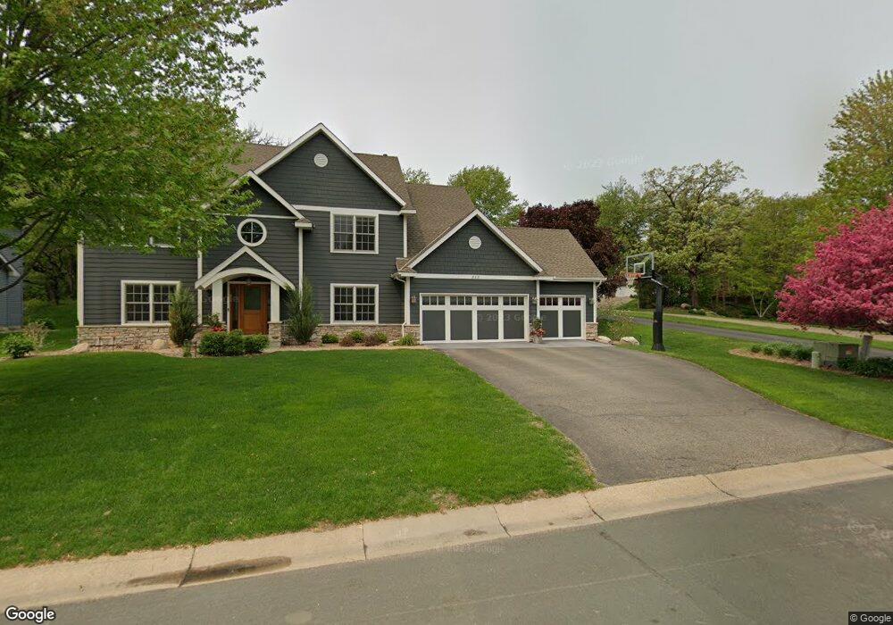
841 Govern Cir Saint Paul, MN 55123
Estimated Value: $763,000 - $862,000
5
Beds
4
Baths
2,806
Sq Ft
$289/Sq Ft
Est. Value
About This Home
This home is located at 841 Govern Cir, Saint Paul, MN 55123 and is currently estimated at $810,055, approximately $288 per square foot. 841 Govern Cir is a home located in Dakota County with nearby schools including Woodland Elementary School, Dakota Hills Middle School, and Eagan Senior High School.
Ownership History
Date
Name
Owned For
Owner Type
Purchase Details
Closed on
Jun 12, 2015
Sold by
Lund Richard S and Lunda Lynda J
Bought by
Sellner Jeffrey P and Sellner Jennifer
Current Estimated Value
Home Financials for this Owner
Home Financials are based on the most recent Mortgage that was taken out on this home.
Original Mortgage
$417,000
Outstanding Balance
$285,349
Interest Rate
0.78%
Mortgage Type
New Conventional
Estimated Equity
$524,706
Purchase Details
Closed on
Oct 18, 1996
Sold by
D R Horton Inc Minnesota
Bought by
Lund Richard S and Lund Lynda J
Create a Home Valuation Report for This Property
The Home Valuation Report is an in-depth analysis detailing your home's value as well as a comparison with similar homes in the area
Home Values in the Area
Average Home Value in this Area
Purchase History
| Date | Buyer | Sale Price | Title Company |
|---|---|---|---|
| Sellner Jeffrey P | $569,900 | Titlesmart Inc | |
| Lund Richard S | $295,224 | -- |
Source: Public Records
Mortgage History
| Date | Status | Borrower | Loan Amount |
|---|---|---|---|
| Open | Sellner Jeffrey P | $417,000 |
Source: Public Records
Tax History Compared to Growth
Tax History
| Year | Tax Paid | Tax Assessment Tax Assessment Total Assessment is a certain percentage of the fair market value that is determined by local assessors to be the total taxable value of land and additions on the property. | Land | Improvement |
|---|---|---|---|---|
| 2024 | $8,550 | $778,700 | $270,700 | $508,000 |
| 2023 | $8,550 | $743,300 | $271,500 | $471,800 |
| 2022 | $7,250 | $727,100 | $270,800 | $456,300 |
| 2021 | $7,002 | $622,700 | $235,500 | $387,200 |
| 2020 | $6,958 | $591,200 | $224,300 | $366,900 |
| 2019 | $6,246 | $574,600 | $213,600 | $361,000 |
| 2018 | $6,383 | $546,600 | $203,400 | $343,200 |
| 2017 | $6,643 | $541,200 | $193,800 | $347,400 |
| 2016 | $6,880 | $537,300 | $184,500 | $352,800 |
| 2015 | $6,761 | $549,400 | $184,500 | $364,900 |
| 2014 | -- | $549,000 | $179,500 | $369,500 |
| 2013 | -- | $487,400 | $162,900 | $324,500 |
Source: Public Records
Map
Nearby Homes
- 826 Hidden Meadow Trail
- 3806 Bridgewater Dr
- 785 Canter Glen Cir
- 977 Greensboro Ln
- 3675 Woodland Trail
- 999 Northview Park Rd
- 4124 New York Ave
- 3902 Canter Glen Dr
- 4027 Camberwell Dr N
- 3631 Woodcrest Cir
- 3664 Falcon Way
- 3655 Falcon Way
- 3860 Westbury Ln
- 4080 Camberwell Dr N
- 4162 Pennsylvania Ave
- 4125 Pennsylvania Ave
- 711 Stonebridge Cir
- 1067 Hummingbird Ln
- 804 Great Oaks Trail
- 3551 Blue Jay Way Unit 201
- 837 Govern Cir
- 845 Govern Cir
- 3812 N Ridge Dr
- 849 Govern Cir
- 3808 N Ridge Dr
- 3816 N Ridge Dr
- 853 Govern Cir
- 833 Govern Cir
- 865 Govern Cir
- 869 Govern Cir
- 3804 N Ridge Dr
- 857 Govern Cir
- 3820 N Ridge Dr
- 873 Govern Cir
- 821 Govern Cir
- 3824 N Ridge Dr
- 877 Govern Cir
- 861 Govern Cir
- 842 Govern Cir
- 838 Bear Paw Trail