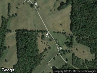
8449 Davies Rd Dillsboro, IN 47018
Estimated Value: $193,000 - $209,000
3
Beds
1
Bath
1,104
Sq Ft
$184/Sq Ft
Est. Value
About This Home
This home is located at 8449 Davies Rd, Dillsboro, IN 47018 and is currently estimated at $202,864, approximately $183 per square foot. 8449 Davies Rd is a home located in Dearborn County with nearby schools including Dillsboro Elementary School, South Dearborn Middle School, and South Dearborn High School.
Ownership History
Date
Name
Owned For
Owner Type
Purchase Details
Closed on
May 24, 2021
Sold by
Baxter Harold G Jr Est
Bought by
Kathryn M Baxter Ret
Current Estimated Value
Purchase Details
Closed on
Jul 24, 2020
Sold by
Baker Rachel N
Bought by
Baxter Harold J and Baxter Kathryn M
Purchase Details
Closed on
Aug 6, 2012
Sold by
Baxter Harold G and Baxter Kathryn M
Bought by
Baxter Harold G and Baxter Kathryn M
Create a Home Valuation Report for This Property
The Home Valuation Report is an in-depth analysis detailing your home's value as well as a comparison with similar homes in the area
Home Values in the Area
Average Home Value in this Area
Purchase History
| Date | Buyer | Sale Price | Title Company |
|---|---|---|---|
| Kathryn M Baxter Ret | -- | None Available | |
| Baxter Harold J | -- | None Available | |
| Baxter Harold G | -- | -- |
Source: Public Records
Mortgage History
| Date | Status | Borrower | Loan Amount |
|---|---|---|---|
| Previous Owner | Baxter Harold G | $126,000 | |
| Previous Owner | Baxter Harold G | $33,500 | |
| Previous Owner | Baxter Harold G | $135,000 |
Source: Public Records
Tax History Compared to Growth
Tax History
| Year | Tax Paid | Tax Assessment Tax Assessment Total Assessment is a certain percentage of the fair market value that is determined by local assessors to be the total taxable value of land and additions on the property. | Land | Improvement |
|---|---|---|---|---|
| 2024 | $2,186 | $109,300 | $23,300 | $86,000 |
| 2023 | $2,117 | $104,600 | $23,300 | $81,300 |
| 2022 | $1,918 | $95,300 | $23,300 | $72,000 |
| 2021 | $1,780 | $88,200 | $23,300 | $64,900 |
| 2020 | $1,786 | $88,800 | $23,300 | $65,500 |
| 2019 | $1,836 | $91,500 | $23,300 | $68,200 |
| 2018 | $1,843 | $91,500 | $23,300 | $68,200 |
| 2017 | $1,770 | $87,800 | $23,300 | $64,500 |
| 2016 | $674 | $88,700 | $23,300 | $65,400 |
| 2014 | $582 | $90,500 | $23,300 | $67,200 |
Source: Public Records
Map
Nearby Homes
- 9214 State Road 62
- 6963 Bells Branch Rd
- 0-0 Spangler Rd
- 5900 S Co Road 700 E
- 0 Liana Dr Unit 196421
- 0 Liana Dr Unit 196420
- 0 Liana Dr Unit 196419
- 0 Liana Dr Unit 196417
- 0 Liana Dr Unit 196416
- 0 Liana Dr Unit 196415
- 13260 Bank St
- 12857 North St
- 12625 North St
- 0-0 Seeger Ln
- 12459 North St
- 10625 Indiana 262
- 8266 Indiana 262
- 5307 Bells Branch Rd
- 5929 State Road 62
- 0 Bocock Rd
- 8449 Davies Rd
- 8365 Davies Rd
- 8625 Davies Rd
- 7997 Pruss Rd
- 7985 Pruss Rd
- 8744 Davies Rd
- 8943 State Road 62
- 8748 Davies Rd
- 0 Davies Rd
- 7957 Pruss Rd
- 8055 Davies Rd
- 8834 Davies Rd
- 14765 Sangamaw Rd
- 14256 Hayes Branch Ln
- 8905 Davies Rd
- 8075 Indiana 62
- 8075 St Rt 62
- 14650 Sangamaw Rd
- 8691 Noah Ln
- 14335 Sangamaw Rd
