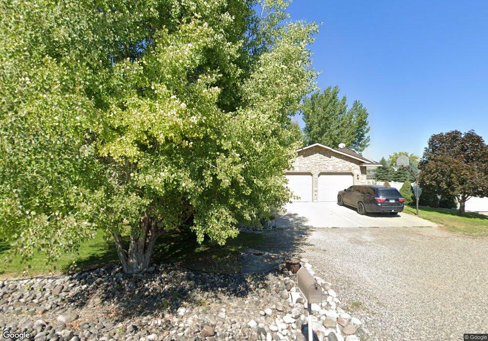
8465 Sail Fish Dr Billings, MT 59106
Estimated Value: $502,000 - $553,539
3
Beds
2
Baths
2,432
Sq Ft
$221/Sq Ft
Est. Value
About This Home
This home is located at 8465 Sail Fish Dr, Billings, MT 59106 and is currently estimated at $537,385, approximately $220 per square foot. 8465 Sail Fish Dr is a home located in Yellowstone County with nearby schools including Elder Grove Elementary School, Billings West High School, and Yellowstone Academy.
Ownership History
Date
Name
Owned For
Owner Type
Purchase Details
Closed on
Apr 1, 2024
Sold by
Quast Dustin G
Bought by
Widdicombe Breanne N and Widdicombe Shawn R
Current Estimated Value
Home Financials for this Owner
Home Financials are based on the most recent Mortgage that was taken out on this home.
Original Mortgage
$449,910
Outstanding Balance
$443,046
Interest Rate
6.77%
Mortgage Type
New Conventional
Estimated Equity
$94,339
Create a Home Valuation Report for This Property
The Home Valuation Report is an in-depth analysis detailing your home's value as well as a comparison with similar homes in the area
Home Values in the Area
Average Home Value in this Area
Purchase History
| Date | Buyer | Sale Price | Title Company |
|---|---|---|---|
| Widdicombe Breanne N | -- | Stewart Title |
Source: Public Records
Mortgage History
| Date | Status | Borrower | Loan Amount |
|---|---|---|---|
| Open | Widdicombe Breanne N | $449,910 |
Source: Public Records
Tax History Compared to Growth
Tax History
| Year | Tax Paid | Tax Assessment Tax Assessment Total Assessment is a certain percentage of the fair market value that is determined by local assessors to be the total taxable value of land and additions on the property. | Land | Improvement |
|---|---|---|---|---|
| 2025 | $3,446 | $504,600 | $105,593 | $399,007 |
| 2024 | $3,446 | $453,100 | $79,344 | $373,756 |
| 2023 | $3,329 | $432,000 | $79,344 | $352,656 |
| 2022 | $3,379 | $362,200 | $0 | $0 |
| 2021 | $3,380 | $362,200 | $0 | $0 |
| 2020 | $3,410 | $327,900 | $0 | $0 |
| 2019 | $3,316 | $327,900 | $0 | $0 |
| 2018 | $3,022 | $294,200 | $0 | $0 |
| 2017 | $2,495 | $294,200 | $0 | $0 |
| 2016 | $2,497 | $284,200 | $0 | $0 |
| 2015 | $2,399 | $284,200 | $0 | $0 |
| 2014 | $2,338 | $144,372 | $0 | $0 |
Source: Public Records
Map
Nearby Homes
- 8625 Sail Fish Dr
- 8242 Wisner Ave
- 8129 Wisner Ave
- 8428 Stillwater Dr
- 8039 Wisner Ave
- 8650 Longmeadow Dr
- 8405 Blue Marlin Dr
- 8542 Monad Rd
- 545 Pike Ct
- 7920 Eland Ave
- 615 Kenya Ct
- 7906 Monad Rd
- 243 S 80th St W
- 7804 Monad Rd
- 7801 Monad Rd
- 7623 N Leopard Ave
- 6399 Signal Peak Ave
- 7824 Penta Cir
- 7805 Penta Cir
- 329 S Homewood Park Dr
- 8435 Sail Fish Dr
- 8470 Sail Fish Dr
- 8515 Sail Fish Dr
- 8440 Sail Fish Dr
- 8520 Sail Fish Dr
- 8420 Sail Fish Dr
- 8535 Sail Fish Dr
- 8410 Sail Fish Dr
- LT10A BLK2 Sail Fish Dr
- LT11A BLK2 Sail Fish Dr
- LT4ABLK2 Sail Fish Dr
- BLK2 LT9A Sail Fish Dr
- BLK2LT7A Sail Fish Dr
- BLK2 LT4A Sail Fish Dr
- BLK 2LT 9A Sail Fish Dr
- BLK2 LT10A 11a Sail Fish Dr
- LT7A BLK2 Sail Fish Dr
- LT5 BLK 2 Sail Fish Dr
- BLK2 LT7A Sail Fish Dr
- BLK2 LT6A Sail Fish Dr