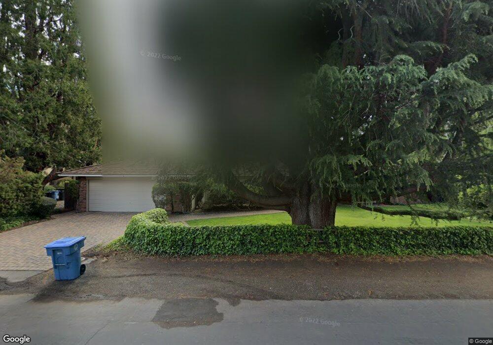
849 Los Robles Ave Palo Alto, CA 94306
Barron Park NeighborhoodEstimated Value: $3,226,000 - $3,471,799
3
Beds
2
Baths
1,640
Sq Ft
$2,052/Sq Ft
Est. Value
About This Home
This home is located at 849 Los Robles Ave, Palo Alto, CA 94306 and is currently estimated at $3,364,950, approximately $2,051 per square foot. 849 Los Robles Ave is a home located in Santa Clara County with nearby schools including Juana Briones Elementary School, Ellen Fletcher Middle, and Henry M. Gunn High School.
Ownership History
Date
Name
Owned For
Owner Type
Purchase Details
Closed on
Nov 18, 2021
Sold by
Blacker Colt Dennis and Olave Louis E
Bought by
Blacker Colt Dennis and Olave Louis E
Current Estimated Value
Purchase Details
Closed on
Sep 16, 2016
Sold by
Blacker Coit Dennis and Olave Louis E
Bought by
Blacker Coit Dennis and Olave Louis E
Home Financials for this Owner
Home Financials are based on the most recent Mortgage that was taken out on this home.
Original Mortgage
$1,500,000
Interest Rate
3.75%
Mortgage Type
Adjustable Rate Mortgage/ARM
Create a Home Valuation Report for This Property
The Home Valuation Report is an in-depth analysis detailing your home's value as well as a comparison with similar homes in the area
Home Values in the Area
Average Home Value in this Area
Purchase History
| Date | Buyer | Sale Price | Title Company |
|---|---|---|---|
| Blacker Colt Dennis | -- | None Available | |
| Blacker Coit Dennis | -- | Wfg National Title Ins Co |
Source: Public Records
Mortgage History
| Date | Status | Borrower | Loan Amount |
|---|---|---|---|
| Closed | Blacker Coit Dennis | $1,500,000 |
Source: Public Records
Tax History Compared to Growth
Tax History
| Year | Tax Paid | Tax Assessment Tax Assessment Total Assessment is a certain percentage of the fair market value that is determined by local assessors to be the total taxable value of land and additions on the property. | Land | Improvement |
|---|---|---|---|---|
| 2025 | $10,871 | $862,932 | $636,601 | $226,331 |
| 2024 | $10,871 | $846,013 | $624,119 | $221,894 |
| 2023 | $10,707 | $829,426 | $611,882 | $217,544 |
| 2022 | $10,658 | $813,164 | $599,885 | $213,279 |
| 2021 | $10,365 | $797,221 | $588,123 | $209,098 |
| 2020 | $10,162 | $789,047 | $582,093 | $206,954 |
| 2019 | $10,045 | $773,577 | $570,680 | $202,897 |
| 2018 | $9,782 | $758,410 | $559,491 | $198,919 |
| 2017 | $9,608 | $743,540 | $548,521 | $195,019 |
| 2016 | $9,351 | $728,962 | $537,766 | $191,196 |
| 2015 | $9,253 | $718,014 | $529,689 | $188,325 |
| 2014 | $8,998 | $703,950 | $519,314 | $184,636 |
Source: Public Records
Map
Nearby Homes
- 923 Shauna Ln
- 772 Paul Ave
- 717 Los Robles Ave
- 4132 Thain Way
- 645 Maybell Ave Unit A
- 3888 Magnolia Dr
- 4198 Cherry Oaks Place
- 715 Matadero Ave
- 4173 El Camino Real Unit 1
- 4287 Pomona Ave
- 4250 El Camino Real Unit B120
- 579 Glenbrook Dr
- 3585 El Camino Real
- 342 Carolina Ln
- 26 Roosevelt Cir
- 360 Fernando Ave
- 3213 Alma St
- 4225 Park Blvd
- 5 Plan at Acacia
- 4X Plan at Acacia
- 4009 Orme St
- 845 Los Robles Ave
- 4015 Orme St
- 852 Los Robles Ave
- 862 Los Robles Ave
- 4014 Amaranta Ave
- 870 Los Robles Ave
- 4025 Orme St
- 4020 Amaranta Ave
- 850 Los Robles Ave
- 842 Los Robles Ave
- 878 Los Robles Ave
- 4029 Orme St
- 4010 Orme St
- 832 Los Robles Ave
- 4016 Orme St
- 826 Los Robles Ave
- 884 Los Robles Ave
- 4024 Amaranta Ave
- 843 La Para Ave