Estimated Value: $339,000 - $355,000
2
Beds
2
Baths
634
Sq Ft
$548/Sq Ft
Est. Value
About This Home
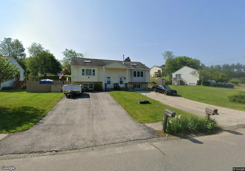
This home is located at 85 Derryfield Rd Unit L, Derry, NH 03038 and is currently estimated at $347,461, approximately $548 per square foot. 85 Derryfield Rd Unit L is a home located in Rockingham County with nearby schools including Grinnell School, Gilbert H. Hood Middle School, and Pinkerton Academy.
Ownership History
Date
Name
Owned For
Owner Type
Purchase Details
Closed on
Dec 1, 2015
Sold by
Ginnard Joanne
Bought by
Ginnard Thomas M
Current Estimated Value
Home Financials for this Owner
Home Financials are based on the most recent Mortgage that was taken out on this home.
Original Mortgage
$100,000
Outstanding Balance
$79,083
Interest Rate
3.87%
Mortgage Type
Purchase Money Mortgage
Estimated Equity
$268,378
Purchase Details
Closed on
Mar 1, 1993
Bought by
Ginnard Thomas M
Create a Home Valuation Report for This Property
The Home Valuation Report is an in-depth analysis detailing your home's value as well as a comparison with similar homes in the area
Home Values in the Area
Average Home Value in this Area
Purchase History
| Date | Buyer | Sale Price | Title Company |
|---|---|---|---|
| Ginnard Thomas M | -- | -- | |
| Ginnard Thomas M | $36,500 | -- |
Source: Public Records
Mortgage History
| Date | Status | Borrower | Loan Amount |
|---|---|---|---|
| Open | Ginnard Thomas M | $100,000 |
Source: Public Records
Tax History Compared to Growth
Tax History
| Year | Tax Paid | Tax Assessment Tax Assessment Total Assessment is a certain percentage of the fair market value that is determined by local assessors to be the total taxable value of land and additions on the property. | Land | Improvement |
|---|---|---|---|---|
| 2024 | $5,517 | $295,200 | $0 | $295,200 |
| 2023 | $5,087 | $246,000 | $0 | $246,000 |
| 2022 | $4,684 | $246,000 | $0 | $246,000 |
| 2021 | $4,368 | $176,400 | $0 | $176,400 |
| 2020 | $4,294 | $176,400 | $0 | $176,400 |
| 2019 | $4,122 | $157,800 | $89,300 | $68,500 |
| 2018 | $4,108 | $157,800 | $89,300 | $68,500 |
| 2017 | $3,896 | $135,000 | $84,800 | $50,200 |
| 2016 | $3,653 | $135,000 | $84,800 | $50,200 |
| 2015 | $2,669 | $91,300 | $42,400 | $48,900 |
| 2014 | $2,686 | $91,300 | $42,400 | $48,900 |
| 2013 | $2,847 | $90,400 | $41,500 | $48,900 |
Source: Public Records
Map
Nearby Homes
- 90L Derryfield Rd
- 13 Gamache Rd
- 30 Kendall Pond Rd Unit 77
- 30 Kendall Pond Rd Unit 87
- 24 Sheffield Way
- 44 Sheffield Way Unit 6B
- 65 Fordway Extension Unit 211
- 37 Highland Ave Unit 1
- 12 Elise Ave Unit 6
- 14 Elise Ave Unit 7
- 8 Elise Ave Unit Lot 4
- 24 South Ave
- 7 Elise Ave Unit Lot 93
- 29 Central St
- 31 South Ave Unit B
- 31 South Ave Unit L
- 1 Elise Ave Unit Lot 96
- 36 Elise Ave Unit Lot 18
- 12 Morrison Dr
- 40 Elise Ave Unit Lot 20
- 85 Derryfield Rd Unit R
- 85 Derryfield Rd Unit 85 Derryfield Road D
- 81 Derryfield Rd Unit R
- 81 Derryfield Rd Unit L
- 4 Little John Ct Unit R
- 4 Little John Ct Unit L
- 4 Little John Ct Unit 1
- 4 Little John Ct
- 3 Johnny Hill Rd Unit 24/F/3
- 3 Johnny Hill Rd
- 3L Matthew Dr
- 3 Matthew Dr
- 77 Derryfield Rd Unit R
- 77 Derryfield Rd Unit L
- 80 Derryfield Rd Unit R
- 80 Derryfield Rd Unit L
- 82 Derryfield Rd Unit R
- 82 Derryfield Rd Unit L
- 82 Derryfield Rd
- 82 Derryfield Rd