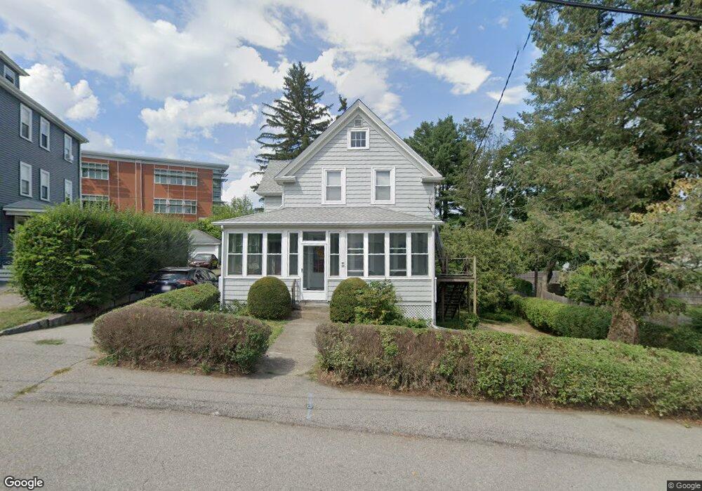
85 Nightingale Ave Quincy, MA 02169
South Quincy NeighborhoodEstimated Value: $553,000 - $587,795
2
Beds
1
Bath
946
Sq Ft
$595/Sq Ft
Est. Value
About This Home
This home is located at 85 Nightingale Ave, Quincy, MA 02169 and is currently estimated at $562,449, approximately $594 per square foot. 85 Nightingale Ave is a home located in Norfolk County with nearby schools including Lincoln-Hancock Community School, South West Middle School, and Quincy High School.
Ownership History
Date
Name
Owned For
Owner Type
Purchase Details
Closed on
Jul 30, 1997
Sold by
Colham Colleen
Bought by
Galloucis Andrew and Allin Joan C
Current Estimated Value
Home Financials for this Owner
Home Financials are based on the most recent Mortgage that was taken out on this home.
Original Mortgage
$121,500
Interest Rate
7.55%
Mortgage Type
Purchase Money Mortgage
Purchase Details
Closed on
Jan 25, 1996
Sold by
Mulcahy John P and Mulcahy Theresa M
Bought by
Glennon Mary
Home Financials for this Owner
Home Financials are based on the most recent Mortgage that was taken out on this home.
Original Mortgage
$124,174
Interest Rate
7.13%
Mortgage Type
Purchase Money Mortgage
Create a Home Valuation Report for This Property
The Home Valuation Report is an in-depth analysis detailing your home's value as well as a comparison with similar homes in the area
Home Values in the Area
Average Home Value in this Area
Purchase History
| Date | Buyer | Sale Price | Title Company |
|---|---|---|---|
| Galloucis Andrew | $128,000 | -- | |
| Glennon Mary | $134,500 | -- |
Source: Public Records
Mortgage History
| Date | Status | Borrower | Loan Amount |
|---|---|---|---|
| Open | Glennon Mary | $89,000 | |
| Closed | Glennon Mary | $120,500 | |
| Closed | Glennon Mary | $121,500 | |
| Previous Owner | Glennon Mary | $124,174 |
Source: Public Records
Tax History Compared to Growth
Tax History
| Year | Tax Paid | Tax Assessment Tax Assessment Total Assessment is a certain percentage of the fair market value that is determined by local assessors to be the total taxable value of land and additions on the property. | Land | Improvement |
|---|---|---|---|---|
| 2025 | $5,689 | $493,400 | $318,800 | $174,600 |
| 2024 | $5,331 | $473,000 | $304,000 | $169,000 |
| 2023 | $4,984 | $447,800 | $277,200 | $170,600 |
| 2022 | $4,693 | $391,700 | $232,400 | $159,300 |
| 2021 | $4,647 | $382,800 | $232,400 | $150,400 |
| 2020 | $4,571 | $367,700 | $232,400 | $135,300 |
| 2019 | $4,350 | $346,600 | $219,800 | $126,800 |
| 2018 | $4,209 | $315,500 | $204,200 | $111,300 |
| 2017 | $4,162 | $293,700 | $194,800 | $98,900 |
| 2016 | $3,815 | $265,700 | $170,600 | $95,100 |
| 2015 | $3,746 | $256,600 | $170,600 | $86,000 |
| 2014 | $3,693 | $248,500 | $170,600 | $77,900 |
Source: Public Records
Map
Nearby Homes
- 203 Centre St
- 56 Town Hill St Unit 56
- 21 Arthur St
- 64 Garfield St Unit B
- 72 Centre St Unit J
- 36 Greystone St Unit 36
- 94 Brook Rd Unit 3
- 21 Totman St Unit 204
- 21 Totman St Unit 202
- 21 Totman St Unit 309
- 21 Totman St Unit 306
- 21 Totman St Unit 410
- 21 Totman St Unit Model-1
- 21 Totman St Unit 2
- 57 Buckley St
- 55 Station St Unit 1
- 347 Centre St
- 33 Brook Rd
- 57A West St
- 46 Suomi Rd
- 89 Nightingale Ave
- 91 Nightingale Ave
- 87 Nightingale Ave
- 97 Nightingale Ave Unit 1
- 95 Nightingale Ave
- 97 Nightingale Ave Unit 97 Nightingale Ave.
- 97 Nightingale Ave Unit 2
- 95 Nightingale Ave Unit 2
- 95 1/2 Nightingale Ave Unit 1
- 95 Nightingale Ave Unit 1
- 81 Nightingale Ave Unit 2
- 99 Nightingale Ave
- 99 Nightingale Ave Unit 2
- 99 Nightingale Ave Unit 1
- 75 Roberts St
- 92 Nightingale Ave
- 103 Nightingale Ave
- 100 Nightingale Ave
- 79 Roberts St
- 84 Nightingale Ave