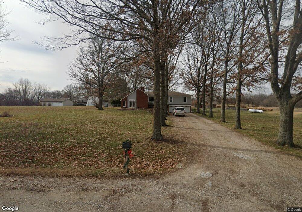
852 N 1710 Rd Lawrence, KS 66049
Scenic Riverway NeighborhoodEstimated Value: $471,000 - $791,000
3
Beds
2
Baths
1,952
Sq Ft
$298/Sq Ft
Est. Value
About This Home
This home is located at 852 N 1710 Rd, Lawrence, KS 66049 and is currently estimated at $582,034, approximately $298 per square foot. 852 N 1710 Rd is a home located in Douglas County with nearby schools including Langston Hughes Elementary School, Southwest Middle School, and Lawrence Free State High School.
Ownership History
Date
Name
Owned For
Owner Type
Purchase Details
Closed on
Sep 26, 2024
Sold by
Waisner Scott W and Waisner Jeanne M
Bought by
Scott W Waisner Revocable Living Trust and Jeanne M Waisner Revocable Living Trust
Current Estimated Value
Create a Home Valuation Report for This Property
The Home Valuation Report is an in-depth analysis detailing your home's value as well as a comparison with similar homes in the area
Home Values in the Area
Average Home Value in this Area
Purchase History
| Date | Buyer | Sale Price | Title Company |
|---|---|---|---|
| Scott W Waisner Revocable Living Trust | -- | None Listed On Document |
Source: Public Records
Tax History
| Year | Tax Paid | Tax Assessment Tax Assessment Total Assessment is a certain percentage of the fair market value that is determined by local assessors to be the total taxable value of land and additions on the property. | Land | Improvement |
|---|---|---|---|---|
| 2025 | $6,197 | $55,198 | $9,888 | $45,310 |
| 2024 | $5,952 | $53,079 | $9,560 | $43,519 |
| 2023 | $5,611 | $48,274 | $8,904 | $39,370 |
| 2022 | $5,222 | $44,555 | $7,593 | $36,962 |
| 2021 | $4,517 | $37,322 | $7,462 | $29,860 |
| 2020 | $4,206 | $34,968 | $7,462 | $27,506 |
| 2019 | $3,999 | $33,303 | $7,200 | $26,103 |
| 2018 | $3,997 | $33,028 | $7,120 | $25,908 |
| 2017 | $4,017 | $32,721 | $7,120 | $25,601 |
| 2016 | $3,627 | $30,608 | $3,347 | $27,261 |
| 2015 | $3,621 | $30,361 | $3,347 | $27,014 |
| 2014 | $3,540 | $29,953 | $3,347 | $26,606 |
Source: Public Records
Map
Nearby Homes
- 835 N 1710 Rd
- 5616 Maggie Way
- Lot 2 N Running Ridge Rd
- 5901 Maggie Way
- 1770 E 960 Rd
- 5802 Three Forks Ct
- 5602 Fort Laramie Ct
- 323 N Eaton Dr
- 205 Campbell Ct
- 5800 Johnson Dr
- 5806 Johnson Dr
- 5802 Johnson Dr
- 5237 Carson Dr
- 5117 Parker Ct
- 5714 Silverstone Dr
- 5617 Johnson Dr
- 5629 Johnson Dr
- 916 Silver Rain Rd
- 5245 Overland Dr Unit C9
- 5245 Overland Dr Unit C8
Your Personal Tour Guide
Ask me questions while you tour the home.