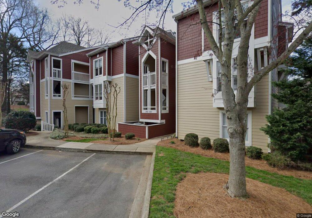
852 Southwest Dr Unit 52 Davidson, NC 28036
Estimated Value: $662,000 - $690,080
3
Beds
2
Baths
1,260
Sq Ft
$538/Sq Ft
Est. Value
About This Home
This home is located at 852 Southwest Dr Unit 52, Davidson, NC 28036 and is currently estimated at $677,770, approximately $537 per square foot. 852 Southwest Dr Unit 52 is a home located in Mecklenburg County with nearby schools including Davidson Elementary School, William Amos Hough High School, and Davidson Day School.
Ownership History
Date
Name
Owned For
Owner Type
Purchase Details
Closed on
Dec 19, 2021
Sold by
Woodland Richard J and Richard J Woodland & Patricia
Bought by
Woodland S & K Llc
Current Estimated Value
Purchase Details
Closed on
Nov 29, 2004
Sold by
Zalonis John and Gravley Zalonis Terri
Bought by
Woodland Richard J and Trust A Of The Richard J Woodland & Patr
Purchase Details
Closed on
Nov 15, 2002
Sold by
Charles William Edward and Charles Ellen C
Bought by
Zalonis John and Gravley Zalonis Terri
Purchase Details
Closed on
Dec 9, 1998
Sold by
Bowman William J and Bowman Cynthia K
Bought by
Charles William E and Charles Ellen G
Home Financials for this Owner
Home Financials are based on the most recent Mortgage that was taken out on this home.
Original Mortgage
$131,200
Interest Rate
6.84%
Mortgage Type
Purchase Money Mortgage
Create a Home Valuation Report for This Property
The Home Valuation Report is an in-depth analysis detailing your home's value as well as a comparison with similar homes in the area
Home Values in the Area
Average Home Value in this Area
Purchase History
| Date | Buyer | Sale Price | Title Company |
|---|---|---|---|
| Woodland S & K Llc | -- | None Available | |
| Woodland Richard J | $254,500 | -- | |
| Zalonis John | $205,000 | -- | |
| Charles William E | $164,000 | -- |
Source: Public Records
Mortgage History
| Date | Status | Borrower | Loan Amount |
|---|---|---|---|
| Previous Owner | Charles William E | $131,200 |
Source: Public Records
Tax History Compared to Growth
Tax History
| Year | Tax Paid | Tax Assessment Tax Assessment Total Assessment is a certain percentage of the fair market value that is determined by local assessors to be the total taxable value of land and additions on the property. | Land | Improvement |
|---|---|---|---|---|
| 2025 | $4,273 | $563,856 | -- | $563,856 |
| 2024 | $4,273 | $563,856 | -- | $563,856 |
| 2023 | $4,212 | $563,856 | $0 | $563,856 |
| 2022 | $3,163 | $331,600 | $0 | $331,600 |
| 2021 | $3,107 | $331,600 | $0 | $331,600 |
| 2020 | $3,047 | $331,600 | $0 | $331,600 |
| 2019 | $3,101 | $331,600 | $0 | $331,600 |
| 2018 | $3,384 | $281,000 | $120,000 | $161,000 |
| 2017 | $3,360 | $281,000 | $120,000 | $161,000 |
| 2016 | $3,356 | $281,000 | $120,000 | $161,000 |
| 2015 | $3,353 | $281,000 | $120,000 | $161,000 |
| 2014 | $3,351 | $303,600 | $120,000 | $183,600 |
Source: Public Records
Map
Nearby Homes
- 719 Southwest Dr Unit 19
- 854 Southwest Dr Unit 54
- 765 Southwest Dr Unit 15
- 657 Portside Dr
- 1018 Southwest Dr Unit 18
- 817 Southwest Dr
- 941 Southwest Dr Unit 41
- 1125 Torrence Cir Unit 67
- 302 Northwest Dr
- 368 Northwest Dr
- 1238 Torrence Cir
- 1331 Torrence Cir Unit 1331
- 819 Northeast Dr Unit 70
- 706 Northeast Dr
- 714 Northeast Dr Unit 53
- 795 Peninsula Dr
- 930 Jetton St
- 950 Jetton St Unit 3
- 21528 Norman Shores Dr
- 21216 Norman Shores Dr
- 851 Southwest Dr Unit 51
- 853 Southwest Dr Unit 53
- 850 Southwest Dr
- 850 Southwest Dr Unit 50
- 849 Southwest Dr Unit 49
- 857 Southwest Dr
- 857 Southwest Dr Unit 57
- 856 Southwest Dr Unit 56
- 855 Southwest Dr
- 855 Southwest Dr Unit 55
- 840 Southwest Dr
- 845 Southwest Dr Unit 45
- 841 Southwest Dr Unit 41
- 846 Southwest Dr
- 842 Southwest Dr
- 847 Southwest Dr Unit 47
- 767 Southwest Dr Unit 18
- 843 Southwest Dr Unit 43
- 766 Southwest Dr Unit 17
- 766 Southwest Dr Unit 17 U/F 395