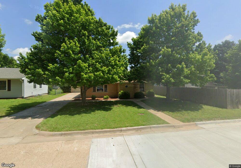
853 Kenison Rd Salina, KS 67401
Estimated Value: $149,000 - $220,000
2
Beds
1
Bath
1,142
Sq Ft
$155/Sq Ft
Est. Value
About This Home
This home is located at 853 Kenison Rd, Salina, KS 67401 and is currently estimated at $177,126, approximately $155 per square foot. 853 Kenison Rd is a home located in Saline County with nearby schools including Heusner Elementary School, Lakewood Middle School, and Salina High School Central.
Ownership History
Date
Name
Owned For
Owner Type
Purchase Details
Closed on
May 21, 2020
Sold by
Goode Barbara L and Goode Gregory R
Bought by
Houk Coleman
Current Estimated Value
Home Financials for this Owner
Home Financials are based on the most recent Mortgage that was taken out on this home.
Original Mortgage
$107,350
Outstanding Balance
$95,127
Interest Rate
3.3%
Mortgage Type
New Conventional
Estimated Equity
$81,999
Purchase Details
Closed on
Aug 28, 2012
Sold by
Goode Barbara L and Johnson Barbara L
Bought by
Goode Barbara L and Goode Gregory R
Create a Home Valuation Report for This Property
The Home Valuation Report is an in-depth analysis detailing your home's value as well as a comparison with similar homes in the area
Home Values in the Area
Average Home Value in this Area
Purchase History
| Date | Buyer | Sale Price | Title Company |
|---|---|---|---|
| Houk Coleman | -- | None Available | |
| Goode Barbara L | -- | -- |
Source: Public Records
Mortgage History
| Date | Status | Borrower | Loan Amount |
|---|---|---|---|
| Open | Houk Coleman | $107,350 |
Source: Public Records
Tax History Compared to Growth
Tax History
| Year | Tax Paid | Tax Assessment Tax Assessment Total Assessment is a certain percentage of the fair market value that is determined by local assessors to be the total taxable value of land and additions on the property. | Land | Improvement |
|---|---|---|---|---|
| 2025 | $1,959 | $14,743 | $1,590 | $13,153 |
| 2024 | $1,959 | $15,318 | $1,600 | $13,718 |
| 2023 | $1,959 | $14,766 | $1,348 | $13,418 |
| 2022 | $1,900 | $14,679 | $1,587 | $13,092 |
| 2021 | $1,756 | $12,995 | $1,587 | $11,408 |
| 2020 | $1,639 | $12,006 | $1,472 | $10,534 |
| 2019 | $846 | $12,386 | $1,472 | $10,914 |
| 2018 | $1,537 | $11,443 | $1,472 | $9,971 |
| 2017 | $0 | $10,891 | $1,472 | $9,419 |
| 2016 | $0 | $10,591 | $1,765 | $8,826 |
| 2015 | -- | $10,143 | $1,800 | $8,343 |
| 2013 | -- | $0 | $0 | $0 |
Source: Public Records
Map
Nearby Homes
- 718 E Wilson St
- 717 Morningside Dr
- 951 S 2nd St
- 952 Pearl Ave
- 1100 Quincy St
- 237 E Minneapolis Ave
- 748 S 5th St
- 818 S Santa fe Ave
- 220 E Ellsworth Ave
- 121 W Wilson St
- 500 E Jewell Ave
- 815 Highland Ave
- 1418 Sunrise Dr
- 1203 Martin Ave
- 1219 Fredrich Dr
- 813 E Claflin Ave
- 1218 E Beloit Ave
- 960 S 9th St
- 1100 S 9th St
- 1301 E Ellsworth Ave
- 631 E Wilson St
- 849 Kenison Rd
- 637 E Wilson St
- 845 Kenison Rd
- 645 E Wilson St
- 854 Kenison Rd
- 848 Kenison Rd
- 839 Kenison Rd
- 615 E Wilson St
- 848 Sunrise Dr
- 630 E Wilson St
- 844 Kenison Rd
- 852 Sunrise Dr
- 842 Sunrise Dr
- 840 Kenison Rd
- 642 E Wilson St
- 640 Mcadams Rd
- 630 Mcadams Rd
- 636 Mcadams Rd
- 900 Kenison Rd