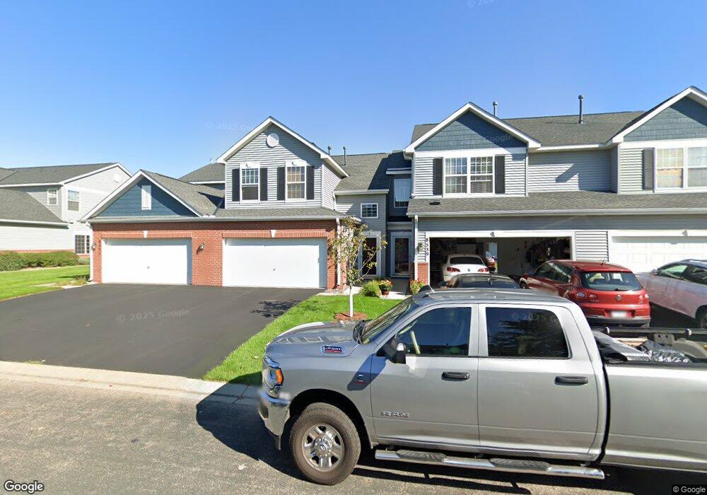
8535 Grove Cir Unit 212 Shakopee, MN 55379
Estimated Value: $270,433 - $275,000
3
Beds
2
Baths
1,687
Sq Ft
$162/Sq Ft
Est. Value
About This Home
This home is located at 8535 Grove Cir Unit 212, Shakopee, MN 55379 and is currently estimated at $272,858, approximately $161 per square foot. 8535 Grove Cir Unit 212 is a home located in Scott County with nearby schools including Eagle Ridge Middle School, Burnsville High School, and Living Hope Lutheran School.
Ownership History
Date
Name
Owned For
Owner Type
Purchase Details
Closed on
Sep 29, 2015
Sold by
Munson Shirley J and Munson Edward L
Bought by
Nguyen Kimicia and Ta Kim
Current Estimated Value
Home Financials for this Owner
Home Financials are based on the most recent Mortgage that was taken out on this home.
Original Mortgage
$131,200
Outstanding Balance
$103,332
Interest Rate
3.91%
Mortgage Type
New Conventional
Estimated Equity
$169,526
Purchase Details
Closed on
Aug 1, 2003
Sold by
The Ryland Group Inc
Bought by
Munson Shirley J and Munson Edward L
Create a Home Valuation Report for This Property
The Home Valuation Report is an in-depth analysis detailing your home's value as well as a comparison with similar homes in the area
Home Values in the Area
Average Home Value in this Area
Purchase History
| Date | Buyer | Sale Price | Title Company |
|---|---|---|---|
| Nguyen Kimicia | $164,000 | Trademark Title Services Inc | |
| Munson Shirley J | $196,736 | -- |
Source: Public Records
Mortgage History
| Date | Status | Borrower | Loan Amount |
|---|---|---|---|
| Open | Nguyen Kimicia | $131,200 |
Source: Public Records
Tax History Compared to Growth
Tax History
| Year | Tax Paid | Tax Assessment Tax Assessment Total Assessment is a certain percentage of the fair market value that is determined by local assessors to be the total taxable value of land and additions on the property. | Land | Improvement |
|---|---|---|---|---|
| 2025 | $2,462 | $261,300 | $60,800 | $200,500 |
| 2024 | $2,450 | $249,300 | $57,900 | $191,400 |
| 2023 | $2,536 | $245,800 | $56,800 | $189,000 |
| 2022 | $2,154 | $248,300 | $58,200 | $190,100 |
| 2021 | $2,074 | $199,600 | $45,600 | $154,000 |
| 2020 | $2,128 | $183,700 | $28,900 | $154,800 |
| 2019 | $2,120 | $194,800 | $30,500 | $164,300 |
| 2018 | $2,024 | $0 | $0 | $0 |
| 2016 | $1,890 | $0 | $0 | $0 |
| 2014 | -- | $0 | $0 | $0 |
Source: Public Records
Map
Nearby Homes
- 8042 Stratford Cir S
- 1782 Switchgrass Cir
- 1339 Yorkshire Ln
- 7499 Derby Ln
- 8490 Moraine Cir
- 7450 Ridge Creek Trail
- 8574 Mcguire Ct E
- 9009 Preserve Trail
- 13134 Falcons Way
- 7427 Water St
- 7696 Waverly Ave
- 9007 Meadow Place
- 8867 Preserve Place
- 7660 Waverly Ave
- 7698 22nd Ave E
- 7638 22nd Ave S
- 7499 22nd Ave S
- 7675 22nd Ave S
- 7687 22nd Ave S
- 6869 Falmouth Curve
- 8531 Grove Cir
- 8539 Grove Cir
- 8543 Grove Cir Unit 214
- 8507 Grove Cir
- 8551 Grove Cir
- 8511 Grove Cir
- 8522 Grove Cir Unit 315
- 8515 Grove Cir Unit 113
- 8534 Grove Cir
- 8534 Grove Cir Unit 312
- 8526 Grove Cir Unit 314
- 8530 Grove Cir
- 8518 Grove Cir
- 8519 Grove Cir
- 8538 Grove Cir
- 8445 Grove Cir Unit 916
- 8440 Grove Cir Unit 811
- 8448 Grove Cir Unit 616
- 8523 Grove Cir Unit 115
- 8424 Grove Cir