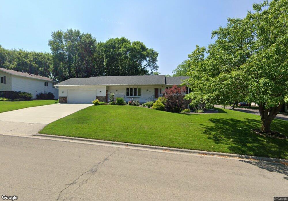
855 16th St SW Owatonna, MN 55060
Estimated Value: $319,000 - $359,000
3
Beds
2
Baths
2,328
Sq Ft
$148/Sq Ft
Est. Value
About This Home
This home is located at 855 16th St SW, Owatonna, MN 55060 and is currently estimated at $343,994, approximately $147 per square foot. 855 16th St SW is a home located in Steele County with nearby schools including Wilson Elementary School, Owatonna Middle School, and Owatonna Senior High School.
Ownership History
Date
Name
Owned For
Owner Type
Purchase Details
Closed on
Oct 24, 2017
Sold by
Olson Justin and Olson Abby L
Bought by
Gustafson Clark C
Current Estimated Value
Home Financials for this Owner
Home Financials are based on the most recent Mortgage that was taken out on this home.
Original Mortgage
$158,320
Outstanding Balance
$109,654
Interest Rate
3.85%
Mortgage Type
New Conventional
Estimated Equity
$234,340
Purchase Details
Closed on
Dec 7, 2010
Sold by
Deutsche Bank National Trust Company
Bought by
Swanson Abby
Home Financials for this Owner
Home Financials are based on the most recent Mortgage that was taken out on this home.
Original Mortgage
$115,167
Interest Rate
4.22%
Mortgage Type
FHA
Purchase Details
Closed on
Jan 15, 2010
Sold by
Born Joel M and Born Dawn M
Bought by
Deutsche Bank National Trust Company
Create a Home Valuation Report for This Property
The Home Valuation Report is an in-depth analysis detailing your home's value as well as a comparison with similar homes in the area
Home Values in the Area
Average Home Value in this Area
Purchase History
| Date | Buyer | Sale Price | Title Company |
|---|---|---|---|
| Gustafson Clark C | $197,900 | Minnesota Secured Title | |
| Swanson Abby | $106,000 | West Title Llc | |
| Deutsche Bank National Trust Company | $166,001 | None Available |
Source: Public Records
Mortgage History
| Date | Status | Borrower | Loan Amount |
|---|---|---|---|
| Open | Gustafson Clark C | $158,320 | |
| Previous Owner | Swanson Abby | $115,167 |
Source: Public Records
Tax History Compared to Growth
Tax History
| Year | Tax Paid | Tax Assessment Tax Assessment Total Assessment is a certain percentage of the fair market value that is determined by local assessors to be the total taxable value of land and additions on the property. | Land | Improvement |
|---|---|---|---|---|
| 2025 | $4,626 | $312,100 | $44,200 | $267,900 |
| 2024 | $4,258 | $323,500 | $39,800 | $283,700 |
| 2023 | $4,176 | $291,000 | $35,500 | $255,500 |
| 2022 | $3,380 | $272,900 | $33,800 | $239,100 |
| 2021 | $3,224 | $204,036 | $29,008 | $175,028 |
| 2020 | $3,178 | $193,550 | $29,008 | $164,542 |
| 2019 | $2,828 | $183,848 | $29,008 | $154,840 |
| 2018 | $2,496 | $175,224 | $26,950 | $148,274 |
| 2017 | $2,350 | $157,388 | $24,892 | $132,496 |
| 2016 | $2,372 | $150,332 | $24,892 | $125,440 |
| 2015 | -- | $0 | $0 | $0 |
| 2014 | -- | $0 | $0 | $0 |
Source: Public Records
Map
Nearby Homes
- 1055 Robert Place SW
- 349 13th St SW
- 1138 Hawthorne Ave
- 358 18th St SW
- 318 13th St SW
- 1801 Linn Dr
- 1132 Butternut Ave
- xxx Anderson Place
- 228 13th St SW
- 919 Mosher Ave
- 222 W Mckinley St
- 1031 1031 Grandview Ave
- 1031 Grandview Ave
- 1047 S Oak Ave
- 640 Lemond Rd
- 540 Allan Ave
- 1031 S Cedar Ave
- 203 E Mckinley St
- 360 Thomas Ave
- 625 Linn Ave
- 855 855 16th-Street-sw
- 1631 10th Ave SW
- 755 16th St SW
- 1580 Sunset Dr SW
- 1651 10th Ave SW
- 550 17th St SW
- 705 16th St SW
- 1585 Sunset Dr SW
- 1640 10th Ave SW
- 1010 16th St SW
- 1640 10th Ave SW
- 530 17th St SW
- 530 530 17th-Street-sw
- 1570 Sunset Dr SW
- 700 16th St SW
- 1035 16th St SW
- 1670 10th Ave SW
- 1045 Robert Place SW
- 1565 Sunset Dr SW
- 650 16th St SW