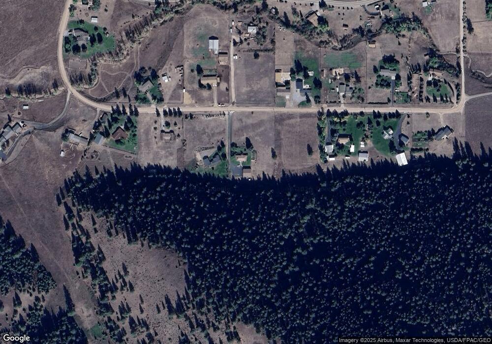
855 Lost Mine Loop Rd Missoula, MT 59803
Estimated Value: $724,536 - $847,000
3
Beds
2
Baths
1,512
Sq Ft
$520/Sq Ft
Est. Value
About This Home
This home is located at 855 Lost Mine Loop Rd, Missoula, MT 59803 and is currently estimated at $786,512, approximately $520 per square foot. 855 Lost Mine Loop Rd is a home located in Missoula County with nearby schools including Chief Charlo School, Meadow Hill Middle School, and Sentinel High School.
Ownership History
Date
Name
Owned For
Owner Type
Purchase Details
Closed on
Jan 7, 2025
Sold by
Johnson Martin R and Martin-Denning Terry
Bought by
Fine Dani R
Current Estimated Value
Home Financials for this Owner
Home Financials are based on the most recent Mortgage that was taken out on this home.
Original Mortgage
$400,000
Outstanding Balance
$397,222
Interest Rate
6.81%
Mortgage Type
New Conventional
Estimated Equity
$389,290
Create a Home Valuation Report for This Property
The Home Valuation Report is an in-depth analysis detailing your home's value as well as a comparison with similar homes in the area
Purchase History
| Date | Buyer | Sale Price | Title Company |
|---|---|---|---|
| Fine Dani R | -- | Title Services | |
| Fine Dani R | -- | Title Services |
Source: Public Records
Mortgage History
| Date | Status | Borrower | Loan Amount |
|---|---|---|---|
| Open | Fine Dani R | $400,000 | |
| Closed | Fine Dani R | $400,000 |
Source: Public Records
Tax History
| Year | Tax Paid | Tax Assessment Tax Assessment Total Assessment is a certain percentage of the fair market value that is determined by local assessors to be the total taxable value of land and additions on the property. | Land | Improvement |
|---|---|---|---|---|
| 2025 | $2,459 | $681,500 | $256,750 | $424,750 |
| 2024 | $3,940 | $532,800 | $170,000 | $362,800 |
| 2023 | $3,488 | $532,800 | $170,000 | $362,800 |
| 2022 | $1,992 | $342,300 | $0 | $0 |
| 2021 | $1,984 | $342,300 | $0 | $0 |
| 2020 | $2,252 | $359,700 | $0 | $0 |
| 2019 | $2,247 | $359,700 | $0 | $0 |
| 2018 | $1,475 | $291,200 | $0 | $0 |
| 2017 | $1,312 | $291,200 | $0 | $0 |
| 2016 | $1,237 | $277,300 | $0 | $0 |
| 2015 | $1,140 | $277,300 | $0 | $0 |
| 2014 | $1,347 | $157,303 | $0 | $0 |
Source: Public Records
Map
Nearby Homes
- 9859 Miller Creek Rd
- 10079 Miller Creek Rd
- 10365 Miller Creek Rd
- 2846 Brushpopper Ln
- 3181 Evans Ridge Rd
- 8489 Wise River Rd
- 2965 Terrace Dr
- 3495 Loraine Dr
- 6308 Hillview Way
- 4200 Inclination Way
- 7075 Stonehaven Ave
- 6455 S Meadowwood Ln
- 7055 Guinevere Dr
- 106 Willow Ridge Ct
- 7006 Max Dr
- Lot 23 Max Dr
- 7037 Max Dr
- 7113 Helenka Rose Dr
- 7239 Shaver Dr Unit B
- 7239 Shaver Dr Unit A
- 875 Lost Mine Loop Rd
- 975 Lost Mine Loop Rd
- 750 Lost Mine Loop Rd
- 730 Lost Mine Loop Rd
- 900 Lost Mine Loop Rd
- 675 Lost Mine Loop Rd
- 1025 Lost Mine Loop Rd
- 650 Lost Mine Loop Rd
- 980 Lost Mine Loop Rd
- 850 Lost Mine Loop Rd
- 625 Lost Mine Loop Rd
- 9793 Miller Creek Rd
- 1055 Lost Mine Loop Rd
- 600 Lost Mine Loop Rd
- 585 Lost Mine Loop Rd
- 9815 Miller Creek Rd
- 9815 Miller Creek Rd
- 1150 Lost Mine Loop Rd
- 570 Lost Mine Loop Rd
- 1160 Lost Mine Loop Rd
