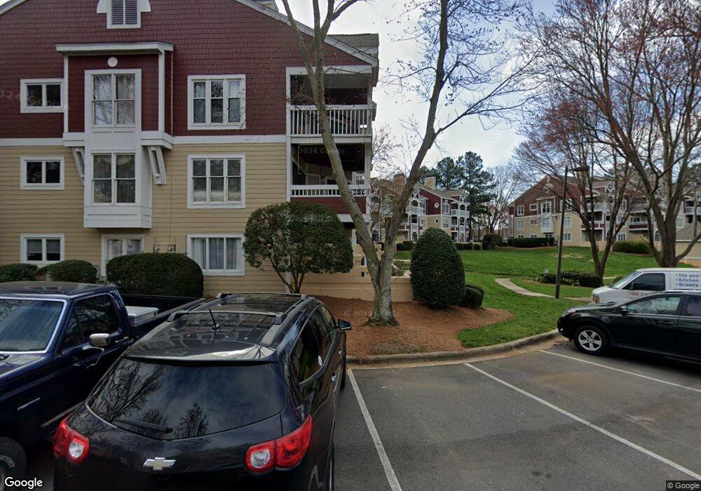
855 Southwest Dr Davidson, NC 28036
Estimated Value: $590,000 - $698,537
3
Beds
2
Baths
1,255
Sq Ft
$520/Sq Ft
Est. Value
About This Home
This home is located at 855 Southwest Dr, Davidson, NC 28036 and is currently estimated at $652,134, approximately $519 per square foot. 855 Southwest Dr is a home located in Mecklenburg County with nearby schools including Davidson Elementary School, William Amos Hough High School, and Davidson Day School.
Ownership History
Date
Name
Owned For
Owner Type
Purchase Details
Closed on
Jun 6, 2017
Sold by
Culbreth Michael W and Culbreth Mabel E
Bought by
Tobias Chester W and Tobias Patricia L
Current Estimated Value
Home Financials for this Owner
Home Financials are based on the most recent Mortgage that was taken out on this home.
Original Mortgage
$224,000
Outstanding Balance
$184,244
Interest Rate
3.62%
Mortgage Type
Adjustable Rate Mortgage/ARM
Estimated Equity
$467,890
Create a Home Valuation Report for This Property
The Home Valuation Report is an in-depth analysis detailing your home's value as well as a comparison with similar homes in the area
Home Values in the Area
Average Home Value in this Area
Purchase History
| Date | Buyer | Sale Price | Title Company |
|---|---|---|---|
| Tobias Chester W | $280,000 | The Co Of North Carolina |
Source: Public Records
Mortgage History
| Date | Status | Borrower | Loan Amount |
|---|---|---|---|
| Open | Tobias Chester W | $224,000 |
Source: Public Records
Tax History Compared to Growth
Tax History
| Year | Tax Paid | Tax Assessment Tax Assessment Total Assessment is a certain percentage of the fair market value that is determined by local assessors to be the total taxable value of land and additions on the property. | Land | Improvement |
|---|---|---|---|---|
| 2025 | -- | $563,856 | -- | $563,856 |
| 2024 | -- | $563,856 | -- | $563,856 |
| 2023 | $4,212 | $563,856 | $0 | $563,856 |
| 2022 | $2,945 | $324,700 | $0 | $324,700 |
| 2021 | $3,044 | $324,700 | $0 | $324,700 |
| 2020 | $2,984 | $324,700 | $0 | $324,700 |
| 2019 | $3,101 | $331,600 | $0 | $331,600 |
| 2018 | $3,208 | $266,000 | $105,000 | $161,000 |
| 2017 | $3,185 | $266,000 | $105,000 | $161,000 |
| 2016 | $3,181 | $266,000 | $105,000 | $161,000 |
| 2015 | $3,178 | $266,000 | $105,000 | $161,000 |
| 2014 | $3,176 | $303,600 | $120,000 | $183,600 |
Source: Public Records
Map
Nearby Homes
- 854 Southwest Dr Unit 54
- 719 Southwest Dr Unit 19
- 725 Southwest Dr Unit 25
- 765 Southwest Dr Unit 15
- 1018 Southwest Dr Unit 18
- 817 Southwest Dr
- 657 Portside Dr
- 941 Southwest Dr Unit 41
- 1125 Torrence Cir Unit 67
- 302 Northwest Dr
- 1238 Torrence Cir
- 1331 Torrence Cir Unit 1331
- 368 Northwest Dr
- 795 Peninsula Dr
- 706 Northeast Dr
- 714 Northeast Dr Unit 53
- 21528 Norman Shores Dr
- 930 Jetton St
- 950 Jetton St Unit 3
- 21216 Norman Shores Dr
- 856 Southwest Dr Unit 56
- 855 Southwest Dr Unit 55
- 857 Southwest Dr
- 857 Southwest Dr Unit 57
- 850 Southwest Dr
- 850 Southwest Dr Unit 50
- 849 Southwest Dr Unit 49
- 851 Southwest Dr Unit 51
- 852 Southwest Dr Unit 52
- 853 Southwest Dr Unit 53
- 869 Southwest Dr
- 870 Southwest Dr
- 872 Southwest Dr Unit 872
- 872 Southwest Dr Unit 72 Bldg 6
- 872 Southwest Dr Unit 72/Bldg 6
- 872 Southwest Dr Unit 72
- 867 Southwest Dr
- 871 Southwest Dr Unit 71
- 868 Southwest Dr
- 713 Southwest Dr Unit 13