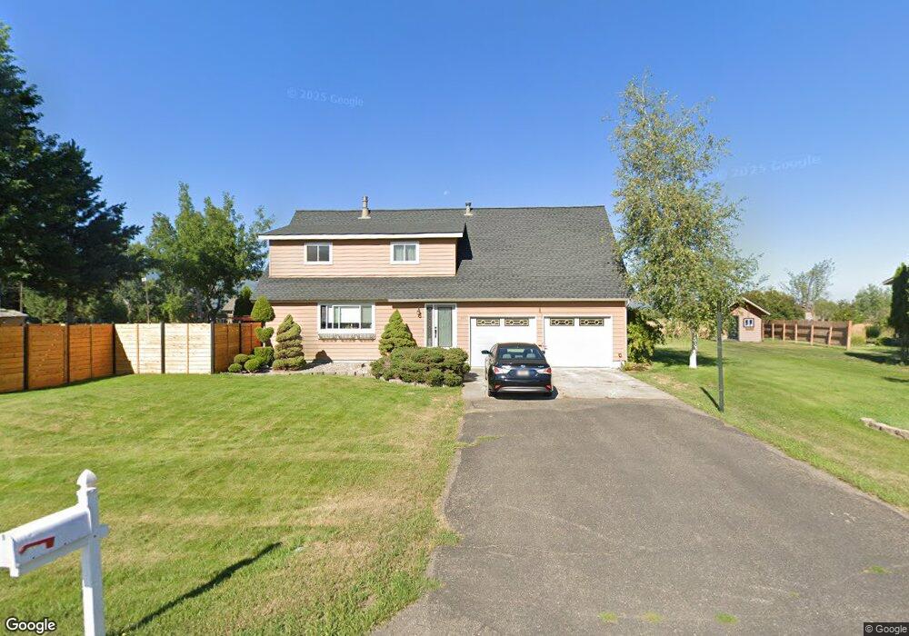
855 Tox Dr Missoula, MT 59804
Estimated Value: $662,936 - $709,000
3
Beds
2
Baths
1,698
Sq Ft
$407/Sq Ft
Est. Value
About This Home
This home is located at 855 Tox Dr, Missoula, MT 59804 and is currently estimated at $690,645, approximately $406 per square foot. 855 Tox Dr is a home located in Missoula County with nearby schools including Hawthorne Elementary School, Porter Middle School, and Big Sky High School.
Ownership History
Date
Name
Owned For
Owner Type
Purchase Details
Closed on
Apr 14, 2025
Sold by
T & T Construction
Bought by
Tox Drive Homeowners Association
Current Estimated Value
Purchase Details
Closed on
Mar 16, 2001
Sold by
Horner Mark J
Bought by
Horner Mark J and Horner Lori M
Home Financials for this Owner
Home Financials are based on the most recent Mortgage that was taken out on this home.
Original Mortgage
$141,000
Interest Rate
6.97%
Create a Home Valuation Report for This Property
The Home Valuation Report is an in-depth analysis detailing your home's value as well as a comparison with similar homes in the area
Home Values in the Area
Average Home Value in this Area
Purchase History
| Date | Buyer | Sale Price | Title Company |
|---|---|---|---|
| Tox Drive Homeowners Association | -- | None Listed On Document | |
| Tox Drive Homeowners Association | -- | None Listed On Document | |
| Horner Mark J | -- | -- |
Source: Public Records
Mortgage History
| Date | Status | Borrower | Loan Amount |
|---|---|---|---|
| Previous Owner | Horner Mark J | $141,000 |
Source: Public Records
Tax History Compared to Growth
Tax History
| Year | Tax Paid | Tax Assessment Tax Assessment Total Assessment is a certain percentage of the fair market value that is determined by local assessors to be the total taxable value of land and additions on the property. | Land | Improvement |
|---|---|---|---|---|
| 2025 | $5,332 | $648,600 | $256,560 | $392,040 |
| 2024 | $5,768 | $508,400 | $234,900 | $273,500 |
| 2023 | $5,145 | $508,400 | $234,900 | $273,500 |
| 2022 | $4,000 | $340,400 | $0 | $0 |
| 2021 | $3,882 | $340,400 | $0 | $0 |
| 2020 | $3,798 | $321,000 | $0 | $0 |
| 2019 | $3,788 | $321,000 | $0 | $0 |
| 2018 | $3,397 | $289,900 | $0 | $0 |
| 2017 | $3,058 | $289,900 | $0 | $0 |
| 2016 | $3,052 | $276,300 | $0 | $0 |
| 2015 | $2,823 | $276,300 | $0 | $0 |
| 2014 | $2,429 | $132,235 | $0 | $0 |
Source: Public Records
Map
Nearby Homes
- 455 Stonybrook Dr
- 3330 S 3rd St W
- 306 Tower St
- 796 Eliza Ct
- NHN Howard St
- 1324 Pony Place
- 365 Hiberta St
- 815 Gary Dr
- 2816 S 3rd St W
- 1522 Clements Rd
- 2712 Spurgin Rd
- 3522 South Ave W
- 2719 Juneau Ct
- 2705 Emery Place
- 1312 27th Ave
- 3720 Sierra Dr
- 2123 27th Ave
- 2783 Renae Ct
- 2275 Ruth Louise Ln
- 1708 27th Ave