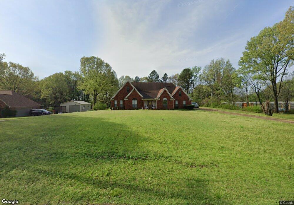
8559 Windersgate Dr Olive Branch, MS 38654
Estimated Value: $332,778 - $368,000
3
Beds
2
Baths
2,529
Sq Ft
$137/Sq Ft
Est. Value
About This Home
This home is located at 8559 Windersgate Dr, Olive Branch, MS 38654 and is currently estimated at $346,695, approximately $137 per square foot. 8559 Windersgate Dr is a home located in DeSoto County with nearby schools including Olive Branch Elementary School, Chickasaw Elementary School, and Olive Branch Middle School.
Ownership History
Date
Name
Owned For
Owner Type
Purchase Details
Closed on
Feb 23, 2012
Sold by
Houston Gina S and Houston Sr Eddie G
Bought by
Horne Gina S and Horne Barry
Current Estimated Value
Purchase Details
Closed on
May 27, 2010
Sold by
Swinny Alfred Glenn
Bought by
Houston Gina S
Home Financials for this Owner
Home Financials are based on the most recent Mortgage that was taken out on this home.
Original Mortgage
$157,874
Interest Rate
5.03%
Mortgage Type
FHA
Create a Home Valuation Report for This Property
The Home Valuation Report is an in-depth analysis detailing your home's value as well as a comparison with similar homes in the area
Home Values in the Area
Average Home Value in this Area
Purchase History
| Date | Buyer | Sale Price | Title Company |
|---|---|---|---|
| Horne Gina S | -- | None Available | |
| Houston Gina S | -- | Realty Title |
Source: Public Records
Mortgage History
| Date | Status | Borrower | Loan Amount |
|---|---|---|---|
| Previous Owner | Houston Gina S | $157,874 |
Source: Public Records
Tax History
| Year | Tax Paid | Tax Assessment Tax Assessment Total Assessment is a certain percentage of the fair market value that is determined by local assessors to be the total taxable value of land and additions on the property. | Land | Improvement |
|---|---|---|---|---|
| 2025 | $2,702 | $23,339 | $2,500 | $20,839 |
| 2024 | $2,311 | $16,936 | $2,500 | $14,436 |
| 2023 | $2,311 | $16,936 | $0 | $0 |
| 2022 | $2,311 | $16,936 | $2,500 | $14,436 |
| 2021 | $2,311 | $16,936 | $2,500 | $14,436 |
| 2020 | $2,154 | $15,781 | $2,500 | $13,281 |
| 2019 | $2,154 | $15,781 | $2,500 | $13,281 |
| 2017 | $2,112 | $28,290 | $15,395 | $12,895 |
| 2016 | $2,112 | $15,395 | $2,500 | $12,895 |
| 2015 | $2,112 | $28,290 | $15,395 | $12,895 |
| 2014 | $2,216 | $16,153 | $0 | $0 |
| 2013 | $1,852 | $16,153 | $0 | $0 |
Source: Public Records
Map
Nearby Homes
- 8390 Ms-178
- 8321 Windersgate Dr
- 8237 Windersgate Dr
- 7384 Woodland Dr
- 8870 Collinswood Dr
- 7689 Germantown Rd
- 7827 Germantown Rd
- 7325 E Shahkoka Dr
- 7530 Dogwood Ln
- 7935 Hickory Cove
- 7523 Dogwood Ln
- 9073 Lyon Cove
- 7922 Allendale Cove
- 7961 Allendale Cove
- 0 Westbranch Rd
- 8484 Goodman Rd
- 8568 Goodman Rd
- 8654 Goodman Rd
- 7738 Windersgate Cir
- 8280 Germantown Rd
- 8583 Windersgate Dr
- 8531 Windersgate Dr
- 8609 Windersgate Dr
- 8503 Windersgate Dr
- 8536 Windersgate Dr
- 8578 Windersgate Dr
- 8637 Windersgate Dr
- 8606 Windersgate Dr
- 8508 Windersgate Dr
- 8632 Windersgate Dr
- 8447 Windersgate Dr
- 8480 Windersgate Dr
- 8669 Windersgate Dr
- 8660 Windersgate Dr
- 8510 Highway 178
- 8569 Collinswood Dr
- 8452 Windersgate Dr
- 8555 Collinswood Dr
- 8419 Windersgate Dr
- 8597 Collinswood Dr
Your Personal Tour Guide
Ask me questions while you tour the home.