Estimated Value: $367,000 - $443,000
2
Beds
2
Baths
1,019
Sq Ft
$404/Sq Ft
Est. Value
About This Home
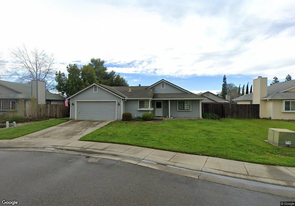
This home is located at 856 Range Way, Galt, CA 95632 and is currently estimated at $411,364, approximately $403 per square foot. 856 Range Way is a home located in Sacramento County with nearby schools including Vernon E. Greer Elementary School, Robert L. McCaffrey Middle School, and Galt High School.
Ownership History
Date
Name
Owned For
Owner Type
Purchase Details
Closed on
Jun 10, 2014
Sold by
Kutil Helen J
Bought by
Kutil Helen J and Helen J Kutil Trust
Current Estimated Value
Purchase Details
Closed on
Aug 8, 2000
Sold by
Kutil Brown Brown Daniel A and Kutil Cynthia R
Bought by
Kutil Helen J
Home Financials for this Owner
Home Financials are based on the most recent Mortgage that was taken out on this home.
Original Mortgage
$92,000
Outstanding Balance
$33,758
Interest Rate
8.39%
Estimated Equity
$377,606
Create a Home Valuation Report for This Property
The Home Valuation Report is an in-depth analysis detailing your home's value as well as a comparison with similar homes in the area
Home Values in the Area
Average Home Value in this Area
Purchase History
| Date | Buyer | Sale Price | Title Company |
|---|---|---|---|
| Kutil Helen J | -- | None Available | |
| Kutil Helen J | $113,500 | Fidelity National Title Co |
Source: Public Records
Mortgage History
| Date | Status | Borrower | Loan Amount |
|---|---|---|---|
| Open | Kutil Helen J | $92,000 |
Source: Public Records
Tax History
| Year | Tax Paid | Tax Assessment Tax Assessment Total Assessment is a certain percentage of the fair market value that is determined by local assessors to be the total taxable value of land and additions on the property. | Land | Improvement |
|---|---|---|---|---|
| 2025 | $1,882 | $170,996 | $37,654 | $133,342 |
| 2024 | $1,882 | $167,644 | $36,916 | $130,728 |
| 2023 | $1,850 | $164,358 | $36,193 | $128,165 |
| 2022 | $1,776 | $161,136 | $35,484 | $125,652 |
| 2021 | $1,778 | $157,978 | $34,789 | $123,189 |
| 2020 | $1,763 | $156,359 | $34,433 | $121,926 |
| 2019 | $1,719 | $153,294 | $33,758 | $119,536 |
| 2018 | $1,717 | $150,290 | $33,097 | $117,193 |
| 2017 | $1,649 | $147,345 | $32,449 | $114,896 |
| 2016 | $1,585 | $144,457 | $31,813 | $112,644 |
| 2015 | $1,455 | $142,288 | $31,336 | $110,952 |
| 2014 | $1,450 | $139,502 | $30,723 | $108,779 |
Source: Public Records
Map
Nearby Homes
Your Personal Tour Guide
Ask me questions while you tour the home.