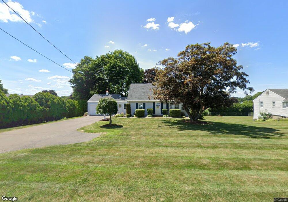
859 Maple St Wethersfield, CT 06109
Estimated Value: $375,000 - $456,998
3
Beds
3
Baths
1,505
Sq Ft
$283/Sq Ft
Est. Value
About This Home
This home is located at 859 Maple St, Wethersfield, CT 06109 and is currently estimated at $426,250, approximately $283 per square foot. 859 Maple St is a home located in Hartford County with nearby schools including Highcrest School, Silas Deane Middle School, and Wethersfield High School.
Ownership History
Date
Name
Owned For
Owner Type
Purchase Details
Closed on
Mar 24, 2025
Sold by
Strong Judy A
Bought by
Judy A Strong Lt and Strong
Current Estimated Value
Purchase Details
Closed on
May 31, 1995
Sold by
Dounouk David B and Dounouk Nancy
Bought by
Strong Judy A
Home Financials for this Owner
Home Financials are based on the most recent Mortgage that was taken out on this home.
Original Mortgage
$123,200
Interest Rate
8.2%
Mortgage Type
Unknown
Create a Home Valuation Report for This Property
The Home Valuation Report is an in-depth analysis detailing your home's value as well as a comparison with similar homes in the area
Home Values in the Area
Average Home Value in this Area
Purchase History
| Date | Buyer | Sale Price | Title Company |
|---|---|---|---|
| Judy A Strong Lt | -- | None Available | |
| Judy A Strong Lt | -- | None Available | |
| Strong Judy A | $154,000 | -- | |
| Strong Judy A | $154,000 | -- |
Source: Public Records
Mortgage History
| Date | Status | Borrower | Loan Amount |
|---|---|---|---|
| Previous Owner | Strong Judy A | $200,000 | |
| Previous Owner | Strong Judy A | $123,200 | |
| Previous Owner | Strong Judy A | $30,000 |
Source: Public Records
Tax History
| Year | Tax Paid | Tax Assessment Tax Assessment Total Assessment is a certain percentage of the fair market value that is determined by local assessors to be the total taxable value of land and additions on the property. | Land | Improvement |
|---|---|---|---|---|
| 2025 | $10,897 | $264,350 | $91,730 | $172,620 |
| 2024 | $7,910 | $183,020 | $72,820 | $110,200 |
| 2023 | $7,647 | $183,020 | $72,820 | $110,200 |
| 2022 | $7,518 | $183,020 | $72,820 | $110,200 |
| 2021 | $7,443 | $183,020 | $72,820 | $110,200 |
| 2020 | $7,447 | $183,020 | $72,820 | $110,200 |
| 2019 | $7,456 | $183,020 | $72,820 | $110,200 |
| 2018 | $7,377 | $180,900 | $70,600 | $110,300 |
| 2017 | $7,194 | $180,900 | $70,600 | $110,300 |
| 2016 | $6,972 | $180,900 | $70,600 | $110,300 |
| 2015 | $6,909 | $180,900 | $70,600 | $110,300 |
| 2014 | $6,646 | $180,900 | $70,600 | $110,300 |
Source: Public Records
Map
Nearby Homes
- 72 Concord Dr
- 50 Concord Dr Unit 50
- 268 Fox Hill Rd
- 22 Winesap Cir Unit 22
- 18 Mcintosh Cir Unit 18
- 25 Sutton Rd
- 1610 Silas Deane Hwy
- 59 Chapin Ave
- 155 Old Common Rd
- 3 Colonial Dr Unit C
- 25 Heather Hill
- 5 Robeth Ln
- 31 Ox Yoke Dr
- 89 Merriman Rd
- 0 Collier Rd
- 101 Collier Rd
- 9 Dogwood Ct
- 38 Wheeler Rd
- 2220 Harbor View Dr
- 38 Butternut Ln
- 867 Maple St
- 851 Maple St
- 46 Cloverdale Cir
- 54 Cloverdale Cir
- 40 Cloverdale Cir
- 839 Maple St
- 875 Maple St
- 62 Cloverdale Cir
- 870 Maple St
- 68 Cloverdale Cir
- 36 Cloverdale Cir
- 831 Maple St
- 881 Maple St
- 878 Maple St
- 47 Cloverdale Cir
- 55 Cloverdale Cir
- 29 Cloverdale Cir
- 74 Cloverdale Cir
- 817 Maple St
- 888 Maple St
Your Personal Tour Guide
Ask me questions while you tour the home.