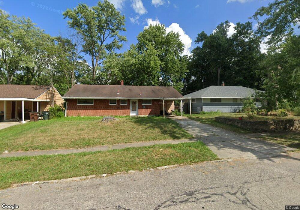
8594 Bobolink Dr Cincinnati, OH 45231
Finneytown NeighborhoodEstimated Value: $108,000 - $150,000
3
Beds
2
Baths
1,169
Sq Ft
$110/Sq Ft
Est. Value
About This Home
This home is located at 8594 Bobolink Dr, Cincinnati, OH 45231 and is currently estimated at $128,401, approximately $109 per square foot. 8594 Bobolink Dr is a home located in Hamilton County with nearby schools including Mt Healthy High School, St. Vivian School, and Central Baptist Academy.
Ownership History
Date
Name
Owned For
Owner Type
Purchase Details
Closed on
Jun 3, 2016
Sold by
Golden Real Estate
Bought by
Generation Two Properties Llc
Current Estimated Value
Purchase Details
Closed on
Nov 26, 2007
Sold by
Mcdonald Dennis M
Bought by
Mcdonald Patricia M
Home Financials for this Owner
Home Financials are based on the most recent Mortgage that was taken out on this home.
Original Mortgage
$71,250
Interest Rate
6.47%
Mortgage Type
Unknown
Purchase Details
Closed on
Jun 15, 2004
Sold by
U S Bank Na
Bought by
Mcdonald Dennis M
Home Financials for this Owner
Home Financials are based on the most recent Mortgage that was taken out on this home.
Original Mortgage
$44,900
Interest Rate
7.87%
Mortgage Type
Unknown
Purchase Details
Closed on
Mar 25, 2004
Sold by
Smith Jesse C and Smith Tonda J
Bought by
U S Bank Na and Firstar Bank Na
Create a Home Valuation Report for This Property
The Home Valuation Report is an in-depth analysis detailing your home's value as well as a comparison with similar homes in the area
Home Values in the Area
Average Home Value in this Area
Purchase History
| Date | Buyer | Sale Price | Title Company |
|---|---|---|---|
| Generation Two Properties Llc | $42,500 | Chicago Title | |
| Mcdonald Patricia M | -- | Concord Title Agency Inc | |
| Mcdonald Dennis M | $49,900 | Prominent Title Agency Llc | |
| U S Bank Na | $30,000 | -- |
Source: Public Records
Mortgage History
| Date | Status | Borrower | Loan Amount |
|---|---|---|---|
| Previous Owner | Mcdonald Patricia M | $71,250 | |
| Previous Owner | Mcdonald Dennis M | $44,900 |
Source: Public Records
Tax History
| Year | Tax Paid | Tax Assessment Tax Assessment Total Assessment is a certain percentage of the fair market value that is determined by local assessors to be the total taxable value of land and additions on the property. | Land | Improvement |
|---|---|---|---|---|
| 2025 | $2,103 | $35,158 | $4,365 | $30,793 |
| 2023 | $2,001 | $35,158 | $4,365 | $30,793 |
| 2022 | $1,213 | $15,337 | $4,319 | $11,018 |
| 2021 | $1,207 | $15,337 | $4,319 | $11,018 |
| 2020 | $1,192 | $15,337 | $4,319 | $11,018 |
| 2019 | $1,189 | $14,204 | $4,001 | $10,203 |
| 2018 | $1,195 | $14,204 | $4,001 | $10,203 |
| 2017 | $1,151 | $14,204 | $4,001 | $10,203 |
| 2016 | $1,456 | $17,507 | $4,319 | $13,188 |
| 2015 | $1,373 | $17,507 | $4,319 | $13,188 |
| 2014 | $1,367 | $17,507 | $4,319 | $13,188 |
| 2013 | $1,408 | $18,428 | $4,547 | $13,881 |
Source: Public Records
Map
Nearby Homes
- 8609 Balboa Dr
- 1285 Landis Ln
- 1202 Ashmore Ct
- 1144 Hempstead Dr
- 7227 Bernard Ave
- 7352 Clovernook Ave
- 1116 Madeleine Cir
- 1125 Murkett Ct
- 8663 Mockingbird Ln
- 8693 Mockingbird Ln
- 1476 Foxwood Dr
- 1052 Vacationland Dr
- 1101 Meadowind Ct
- 1481 Saint Clair Ave
- 7929 Cherrywood Ct
- 8829 Mockingbird Ln
- 8433 Jonfred Ct
- 1090 W Galbraith Rd
- 7923 Bobolink Dr
- 1280 Brushwood Ave
- 8594 Bobolink Ave
- 8588 Bobolink Ave
- 8600 Bobolink Ave
- 8600 Balboa Dr
- 8618 Bobolink Ave
- 8618 Bobolink Dr
- 8570 Bobolink Ave
- 8608 Balboa Dr
- 8570 Bobolink Dr
- 8615 Bobolink Ave
- 8636 Bobolink Ave
- 8636 Bobolink Dr
- 8609 Desoto Dr
- 8601 Balboa Dr
- 8615 Bobolink Dr
- 8569 Bobolink Ave
- 8616 Balboa Dr
- 8654 Bobolink Ave
- 8610 Desoto Dr
- 8654 Bobolink Dr
Your Personal Tour Guide
Ask me questions while you tour the home.