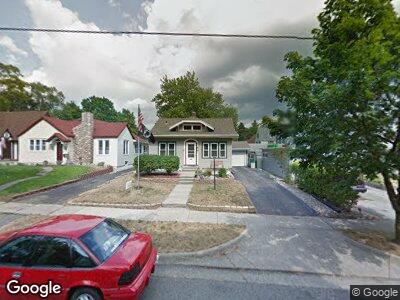
86 Broad St N Battle Creek, MI 49017
Estimated Value: $126,000 - $144,000
2
Beds
1
Bath
898
Sq Ft
$150/Sq Ft
Est. Value
About This Home
This home is located at 86 Broad St N, Battle Creek, MI 49017 and is currently estimated at $134,874, approximately $150 per square foot. 86 Broad St N is a home located in Calhoun County with nearby schools including Verona Elementary School, Northwestern Middle School, and Battle Creek Central High School.
Ownership History
Date
Name
Owned For
Owner Type
Purchase Details
Closed on
Mar 29, 2006
Sold by
Talbott Gayle Irene
Bought by
Talbott Gayle Irene and Living Trust Of Gayle Irene Ta
Current Estimated Value
Home Financials for this Owner
Home Financials are based on the most recent Mortgage that was taken out on this home.
Original Mortgage
$71,200
Interest Rate
6.42%
Mortgage Type
Credit Line Revolving
Purchase Details
Closed on
Mar 22, 2004
Sold by
Talbott Gayle I
Bought by
Talbott Gayle Irene and Living Trust Of Gayle Irene Ta
Create a Home Valuation Report for This Property
The Home Valuation Report is an in-depth analysis detailing your home's value as well as a comparison with similar homes in the area
Home Values in the Area
Average Home Value in this Area
Purchase History
| Date | Buyer | Sale Price | Title Company |
|---|---|---|---|
| Talbott Gayle Irene | -- | Fatic | |
| Talbott Gayle Irene | -- | Fatic | |
| Talbott Gayle Irene | -- | -- |
Source: Public Records
Mortgage History
| Date | Status | Borrower | Loan Amount |
|---|---|---|---|
| Closed | Talbott Gayle Irene | $71,200 |
Source: Public Records
Tax History Compared to Growth
Tax History
| Year | Tax Paid | Tax Assessment Tax Assessment Total Assessment is a certain percentage of the fair market value that is determined by local assessors to be the total taxable value of land and additions on the property. | Land | Improvement |
|---|---|---|---|---|
| 2024 | $1,040 | $45,835 | $0 | $0 |
| 2023 | $1,189 | $39,756 | $0 | $0 |
| 2022 | $939 | $34,807 | $0 | $0 |
| 2021 | $1,121 | $29,505 | $0 | $0 |
| 2020 | $1,110 | $30,643 | $0 | $0 |
| 2019 | $1,051 | $28,016 | $0 | $0 |
| 2018 | $1,051 | $26,629 | $1,224 | $25,405 |
| 2017 | $1,018 | $26,133 | $0 | $0 |
| 2016 | $1,017 | $25,901 | $0 | $0 |
| 2015 | $1,320 | $21,959 | $2,293 | $19,666 |
| 2014 | $1,320 | $28,649 | $2,293 | $26,356 |
Source: Public Records
Map
Nearby Homes
- 131 Mckinley Ave N
- 38 East Ave N
- 132 Union St N
- 120 Radley St
- 48 Union St N
- 15 Broad St S
- 25 East Ave S
- 176 Union St N
- 140 East Ave N
- 84 Magnolia Ave
- 261 Emmett St E
- 28 Orchard Place
- 29 Wren St
- 28 Convis St
- 31 Orchard Place
- 25 Orchard Place
- 723 Capital Ave NE
- 85 Mckinley Ave S
- 45 Merritt St
- 229 Laurel Dr