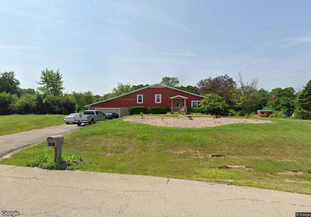
86 Tomahawk Trail Oswego, IL 60543
South Oswego NeighborhoodEstimated Value: $483,000 - $569,000
4
Beds
3
Baths
3,100
Sq Ft
$169/Sq Ft
Est. Value
About This Home
This home is located at 86 Tomahawk Trail, Oswego, IL 60543 and is currently estimated at $524,457, approximately $169 per square foot. 86 Tomahawk Trail is a home located in Kendall County with nearby schools including Hunt Club Elementary School, Traughber Junior High School, and Oswego High School.
Ownership History
Date
Name
Owned For
Owner Type
Purchase Details
Closed on
Apr 12, 2018
Sold by
Comerstone Capital Llc
Bought by
Cutshall Meredith
Current Estimated Value
Home Financials for this Owner
Home Financials are based on the most recent Mortgage that was taken out on this home.
Original Mortgage
$253,000
Interest Rate
4.5%
Mortgage Type
New Conventional
Purchase Details
Closed on
May 3, 2017
Sold by
Pnc Bank Natinal Assn
Bought by
Cornerstone Capital Llc
Home Financials for this Owner
Home Financials are based on the most recent Mortgage that was taken out on this home.
Original Mortgage
$500,000
Interest Rate
4%
Mortgage Type
Credit Line Revolving
Purchase Details
Closed on
Feb 14, 2017
Sold by
Bagley James P and Bagley James
Bought by
Pnc Bank Na
Purchase Details
Closed on
Apr 1, 1993
Bought by
Bagley James P and Bagley Amy L
Purchase Details
Closed on
Feb 1, 1988
Purchase Details
Closed on
Nov 1, 1986
Create a Home Valuation Report for This Property
The Home Valuation Report is an in-depth analysis detailing your home's value as well as a comparison with similar homes in the area
Home Values in the Area
Average Home Value in this Area
Purchase History
| Date | Buyer | Sale Price | Title Company |
|---|---|---|---|
| Cutshall Meredith | -- | Fidelity National Title Insu | |
| Cornerstone Capital Llc | $295,000 | Fidelity National Title | |
| Pnc Bank Na | -- | Premier Title | |
| Bagley James P | $185,000 | -- | |
| -- | $147,000 | -- | |
| -- | $135,000 | -- |
Source: Public Records
Mortgage History
| Date | Status | Borrower | Loan Amount |
|---|---|---|---|
| Previous Owner | Cutshall Meredith | $253,000 | |
| Previous Owner | Cornerstone Capital Llc | $500,000 | |
| Closed | Bagley James P | -- |
Source: Public Records
Tax History Compared to Growth
Tax History
| Year | Tax Paid | Tax Assessment Tax Assessment Total Assessment is a certain percentage of the fair market value that is determined by local assessors to be the total taxable value of land and additions on the property. | Land | Improvement |
|---|---|---|---|---|
| 2024 | $9,903 | $140,959 | $24,105 | $116,854 |
| 2023 | $9,682 | $128,070 | $22,957 | $105,113 |
| 2022 | $9,682 | $123,089 | $22,957 | $100,132 |
| 2021 | $10,166 | $124,964 | $23,307 | $101,657 |
| 2020 | $9,226 | $112,002 | $22,978 | $89,024 |
| 2019 | $9,236 | $110,598 | $22,690 | $87,908 |
| 2018 | $9,732 | $105,593 | $21,663 | $83,930 |
| 2017 | $9,557 | $101,082 | $21,663 | $79,419 |
| 2016 | $8,444 | $94,119 | $21,396 | $72,723 |
| 2015 | $8,378 | $89,323 | $20,306 | $69,017 |
| 2014 | -- | $82,394 | $20,306 | $62,088 |
| 2013 | -- | $82,394 | $20,306 | $62,088 |
Source: Public Records
Map
Nearby Homes
- 51 Chippewa Dr
- 53 Abbeyfeale Dr
- 4713 Cherry Rd
- 5837 Whitetail Ridge Dr
- 7267 Roberts Ct
- 5893 Whitetail Ridge Dr
- 7335 Roberts Dr
- 538 Sudbury Cir
- 4700 Laughton Ave
- 609 Chestnut Dr
- 7750 Fairway Dr
- 5983 Championship Ct
- 7751 Bentgrass Cir
- 406 Windsor Dr
- 5704 Waters Edge Ct
- 5508 Legend Dr
- 482 Deerfield Dr
- 483 Deerfield Dr
- 676 Cumberland Ln
- 673 Cumberland Ln
- 66 Tomahawk Trail
- 81 Tomahawk Trail
- 102 Tomahawk Trail
- 97 Tomahawk Trail
- 28 Frontier St
- 107 Tomahawk Trail
- 29 Frontier St Unit 2
- 63 Tomahawk Trail
- 10 Northwest Pass Unit 2
- 24 W Timberlake Trail
- 110 Tomahawk Trail
- 46 Tomahawk Trail
- 49 Tomahawk Trail
- 22 Northwest Pass
- 20 W Timberlake Trail
- 121 Tomahawk Trail
- 118 Tomahawk Trail
- 3 W Timberlake Trail
- 4920 Reservation Rd
- 15 W Timberlake Trail