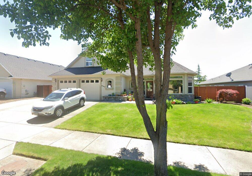
860 St Andrews Way Eagle Point, OR 97524
Estimated Value: $577,036 - $739,000
3
Beds
3
Baths
2,400
Sq Ft
$270/Sq Ft
Est. Value
About This Home
This home is located at 860 St Andrews Way, Eagle Point, OR 97524 and is currently estimated at $648,509, approximately $270 per square foot. 860 St Andrews Way is a home located in Jackson County with nearby schools including Eagle Point Middle School, White Mountain Middle School, and Eagle Point High School.
Ownership History
Date
Name
Owned For
Owner Type
Purchase Details
Closed on
Jul 14, 2003
Sold by
Eagle Ridge Building & Design Inc
Bought by
Marks Terrance and Marks Joyce
Current Estimated Value
Home Financials for this Owner
Home Financials are based on the most recent Mortgage that was taken out on this home.
Original Mortgage
$255,000
Outstanding Balance
$107,760
Interest Rate
5.18%
Mortgage Type
Purchase Money Mortgage
Estimated Equity
$540,749
Create a Home Valuation Report for This Property
The Home Valuation Report is an in-depth analysis detailing your home's value as well as a comparison with similar homes in the area
Home Values in the Area
Average Home Value in this Area
Purchase History
| Date | Buyer | Sale Price | Title Company |
|---|---|---|---|
| Marks Terrance | $355,000 | Lawyers Title Insurance Corp |
Source: Public Records
Mortgage History
| Date | Status | Borrower | Loan Amount |
|---|---|---|---|
| Open | Marks Terrance | $255,000 |
Source: Public Records
Tax History Compared to Growth
Tax History
| Year | Tax Paid | Tax Assessment Tax Assessment Total Assessment is a certain percentage of the fair market value that is determined by local assessors to be the total taxable value of land and additions on the property. | Land | Improvement |
|---|---|---|---|---|
| 2025 | $5,703 | $416,780 | $87,480 | $329,300 |
| 2024 | $5,703 | $404,650 | $84,940 | $319,710 |
| 2023 | $5,510 | $392,870 | $82,460 | $310,410 |
| 2022 | $5,359 | $392,870 | $82,460 | $310,410 |
| 2021 | $5,201 | $381,430 | $80,060 | $301,370 |
| 2020 | $5,525 | $370,330 | $77,730 | $292,600 |
| 2019 | $5,837 | $374,550 | $112,460 | $262,090 |
| 2018 | $5,726 | $363,650 | $109,190 | $254,460 |
| 2017 | $5,561 | $363,650 | $109,190 | $254,460 |
| 2016 | $5,380 | $342,780 | $102,920 | $239,860 |
| 2015 | $5,209 | $342,750 | $87,090 | $255,660 |
| 2014 | $5,025 | $323,110 | $97,010 | $226,100 |
Source: Public Records
Map
Nearby Homes
- 875 St Andrews Way
- 828 St Andrews Way
- 131 Bellerive Dr
- 162 Bellerive Dr
- 964 Pumpkin Ridge
- 888 Arrowhead Trail
- 24 Blackstone Ct
- 220 Pine Lake Dr
- 131 Spanish Bay Ct
- 118 Pebble Creek Dr
- 949 Arrowhead Trail
- 210 Bellerive Dr
- 158 Prairie Landing Dr
- 203 Bellerive Dr
- 599 Arrowhead Trail
- 997 Arrowhead Trail
- 187 Prairie Landing Dr
- 209 Keystone Way
- 135 Princeville Dr
- 23 Blue Heron Ct
- 866 St Andrews Way
- 854 St Andrews Way
- 872 St Andrews Way
- 848 St Andrews Way
- 857 St Andrews Way
- 863 St Andrews Way
- 851 St Andrews Way
- 869 St Andrews Way
- 878 St Andrews Way
- 29 Aspen Ct
- 1094 Oak Grove Ct
- 845 St Andrews Way
- 23 Aspen Ct
- 884 St Andrews Way
- 881 St Andrews Way
- 35 Aspen Ct
- 17 Aspen Ct
- 156 Aspen Ct
- 839 St Andrews Way
- 839 Saint Andrews Way