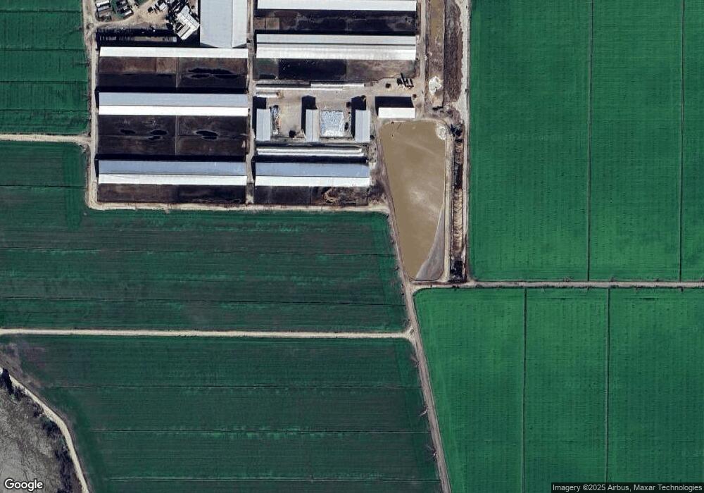
8608 Dos Rios Ln Modesto, CA 95358
Estimated Value: $798,000 - $9,020,104
7
Beds
4
Baths
3,896
Sq Ft
$1,260/Sq Ft
Est. Value
About This Home
This home is located at 8608 Dos Rios Ln, Modesto, CA 95358 and is currently estimated at $4,909,052, approximately $1,260 per square foot. 8608 Dos Rios Ln is a home located in Stanislaus County with nearby schools including Westport Elementary School, Blaker-Kinser Junior High School, and Central Valley High School.
Ownership History
Date
Name
Owned For
Owner Type
Purchase Details
Closed on
Dec 16, 2014
Sold by
Machado Edward A and Machado Lorie J
Bought by
Rivercrest Land Lp
Current Estimated Value
Purchase Details
Closed on
Mar 3, 2004
Sold by
Machado Edward A and Machado Lorie
Bought by
Machado Edward A and Machado Lorie J
Purchase Details
Closed on
Aug 30, 2000
Sold by
Faria Frank E and Faria Edward
Bought by
Faria Frank E and Faria Edward
Purchase Details
Closed on
Jun 13, 2000
Sold by
Machado Edward A and Machado Lorie J
Bought by
Machado Edward A and Machado Lorie J
Create a Home Valuation Report for This Property
The Home Valuation Report is an in-depth analysis detailing your home's value as well as a comparison with similar homes in the area
Purchase History
| Date | Buyer | Sale Price | Title Company |
|---|---|---|---|
| Rivercrest Land Lp | -- | None Available | |
| Machado Ag Inc | -- | None Available | |
| Machado Edward A | -- | -- | |
| Faria Frank E | -- | -- | |
| Machado Edward A | -- | -- |
Source: Public Records
Tax History Compared to Growth
Tax History
| Year | Tax Paid | Tax Assessment Tax Assessment Total Assessment is a certain percentage of the fair market value that is determined by local assessors to be the total taxable value of land and additions on the property. | Land | Improvement |
|---|---|---|---|---|
| 2025 | $62,935 | $5,071,594 | $1,442,107 | $3,629,487 |
| 2024 | $59,296 | $4,987,605 | $1,413,831 | $3,573,774 |
| 2023 | $56,353 | $4,893,568 | $1,386,109 | $3,507,459 |
| 2022 | $79,553 | $6,969,707 | $1,358,931 | $5,610,776 |
| 2021 | $74,031 | $6,409,835 | $1,332,286 | $5,077,549 |
| 2020 | $66,877 | $5,902,129 | $1,318,626 | $4,583,503 |
| 2019 | $64,481 | $5,610,608 | $1,292,771 | $4,317,837 |
| 2018 | $60,804 | $5,293,504 | $1,267,423 | $4,026,081 |
| 2017 | $56,249 | $4,844,084 | $1,242,572 | $3,601,512 |
| 2016 | $56,715 | $4,972,354 | $1,218,208 | $3,754,146 |
| 2015 | $57,414 | $4,846,233 | $1,199,910 | $3,646,323 |
| 2014 | $50,814 | $4,445,242 | $1,313,592 | $3,131,650 |
Source: Public Records
Map
Nearby Homes
- 3749 Shiloh Rd
- 1801 Hito Dr
- 1713 Minnie St
- 8401 Wilson St
- 10525 State Highway 33
- 0 Hart Rd Unit 225010902
- 12407 Elm Ave
- 12742 Elm Ave
- 1099 Lemon Ave
- 1 W Hamilton Rd
- 0 W Hamilton Rd Unit 225033284
- 3101 River Rd
- 449 Center Rd
- 14125 Ward Ave
- 6613 Woodland Ave
- 909 Farnham Dr
- 929 Zennor Place
- 928 Zennor Place
- 924 Zennor Place
- 921 Zennor Place
