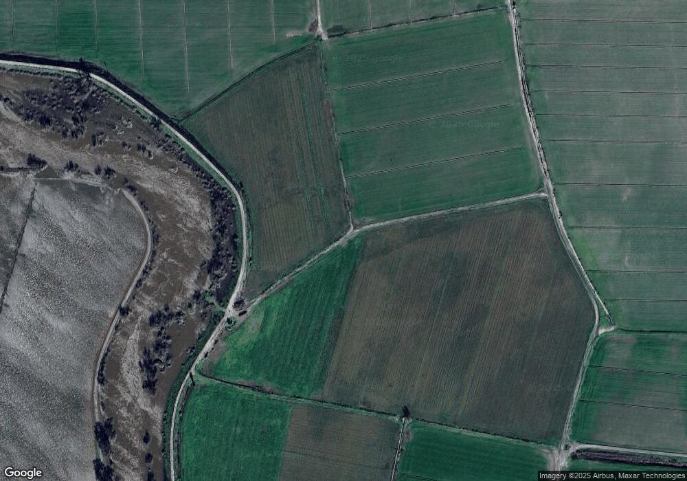
8611 Dos Rios Ln Modesto, CA 95358
Estimated Value: $1,255,000 - $21,538,622
16
Beds
9
Baths
7,636
Sq Ft
$1,493/Sq Ft
Est. Value
About This Home
This home is located at 8611 Dos Rios Ln, Modesto, CA 95358 and is currently estimated at $11,396,811, approximately $1,492 per square foot. 8611 Dos Rios Ln is a home located in Stanislaus County with nearby schools including Westport Elementary School, Blaker-Kinser Junior High School, and Central Valley High School.
Ownership History
Date
Name
Owned For
Owner Type
Purchase Details
Closed on
Oct 25, 2013
Sold by
Nutcher Michael S and Nutcher Darcy J
Bought by
River Partners
Current Estimated Value
Purchase Details
Closed on
Mar 31, 2010
Sold by
Sanders Jerald W and Sanders Carolyn D
Bought by
Nutcher Michael S and Nutcher Darcy J
Home Financials for this Owner
Home Financials are based on the most recent Mortgage that was taken out on this home.
Original Mortgage
$6,100,000
Interest Rate
4.88%
Mortgage Type
Seller Take Back
Purchase Details
Closed on
Sep 27, 1995
Sold by
Sanders Jerald W
Bought by
Sanders Carolyn D
Create a Home Valuation Report for This Property
The Home Valuation Report is an in-depth analysis detailing your home's value as well as a comparison with similar homes in the area
Home Values in the Area
Average Home Value in this Area
Purchase History
| Date | Buyer | Sale Price | Title Company |
|---|---|---|---|
| River Partners | $9,300,000 | First American Title Company | |
| Nutcher Michael S | -- | None Available | |
| Sanders Carolyn D | -- | Fidelity National Title | |
| Sanders Carolyn D | $1,874,000 | Fidelity National Title |
Source: Public Records
Mortgage History
| Date | Status | Borrower | Loan Amount |
|---|---|---|---|
| Previous Owner | Nutcher Michael S | $6,100,000 |
Source: Public Records
Tax History Compared to Growth
Tax History
| Year | Tax Paid | Tax Assessment Tax Assessment Total Assessment is a certain percentage of the fair market value that is determined by local assessors to be the total taxable value of land and additions on the property. | Land | Improvement |
|---|---|---|---|---|
| 2025 | $50,746 | $4,153,193 | $1,830,221 | $2,322,972 |
| 2024 | $49,524 | $4,235,353 | $1,955,041 | $2,280,312 |
| 2023 | $47,710 | $4,104,384 | $1,986,242 | $2,118,142 |
| 2022 | $47,486 | $4,037,589 | $1,962,512 | $2,075,077 |
| 2021 | $45,251 | $3,798,276 | $1,869,884 | $1,928,392 |
| 2020 | $43,049 | $3,680,859 | $1,772,178 | $1,908,681 |
| 2019 | $42,232 | $3,559,269 | $1,687,951 | $1,871,318 |
| 2018 | $37,560 | $3,151,577 | $1,316,760 | $1,834,817 |
| 2017 | $35,376 | $2,957,240 | $1,158,604 | $1,798,636 |
| 2016 | $32,950 | $2,872,960 | $1,109,312 | $1,763,648 |
| 2015 | $32,708 | $2,844,146 | $1,106,730 | $1,737,416 |
| 2014 | $38,317 | $2,764,997 | $1,061,317 | $1,703,680 |
Source: Public Records
Map
Nearby Homes
- 3749 Shiloh Rd
- 0 Amelia St
- 8721 Laird St
- 0 Hart Rd Unit 225010902
- 419 Burkhard Rd
- 10525 State Highway 33
- 12407 Elm Ave
- 12742 Elm Ave
- 2155 Center Rd
- 3101 River Rd
- 6613 Woodland Ave
- 1 W Hamilton Rd
- 0 W Hamilton Rd Unit 225033284
- 1099 Lemon Ave
- 3113 Needham Rd
- 0 Shoemake Ave Unit 225081121
- 441 Stei N
- 0 N Mccracken Rd Unit 225104818
- 4942 Mccracken Rd
- 1124 Pauline Ave
