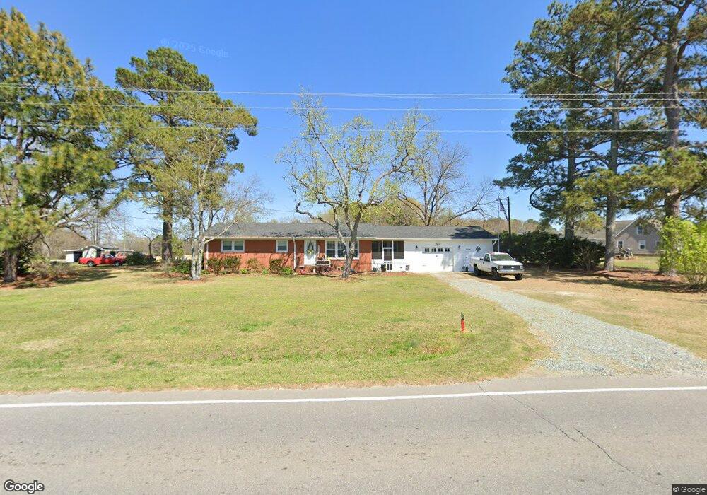
8624 Nc Highway 50 N Benson, NC 27504
Elevation NeighborhoodEstimated Value: $236,000 - $295,000
3
Beds
1
Bath
1,418
Sq Ft
$185/Sq Ft
Est. Value
About This Home
This home is located at 8624 Nc Highway 50 N, Benson, NC 27504 and is currently estimated at $262,197, approximately $184 per square foot. 8624 Nc Highway 50 N is a home located in Johnston County with nearby schools including McGee's Crossroads Elementary School, McGee's Crossroads Middle School, and West Johnston High School.
Ownership History
Date
Name
Owned For
Owner Type
Purchase Details
Closed on
Apr 15, 2017
Sold by
Parrish Theresa L
Bought by
Parrish Wranchar V and Parrish Kimberly West
Current Estimated Value
Purchase Details
Closed on
Feb 10, 2014
Sold by
Parrish Wranchar Vernon and Parrish Theresa L
Bought by
Parrish Wranchar Vernon and Parrish Teresa L
Purchase Details
Closed on
Mar 4, 2003
Sold by
Parrish Wranchar V
Bought by
Mcleod Ronald Wesley
Create a Home Valuation Report for This Property
The Home Valuation Report is an in-depth analysis detailing your home's value as well as a comparison with similar homes in the area
Home Values in the Area
Average Home Value in this Area
Purchase History
| Date | Buyer | Sale Price | Title Company |
|---|---|---|---|
| Parrish Wranchar V | -- | -- | |
| Parrish Wranchar Vernon | -- | None Available | |
| Mcleod Ronald Wesley | $99,500 | -- |
Source: Public Records
Tax History
| Year | Tax Paid | Tax Assessment Tax Assessment Total Assessment is a certain percentage of the fair market value that is determined by local assessors to be the total taxable value of land and additions on the property. | Land | Improvement |
|---|---|---|---|---|
| 2025 | $1,180 | $185,880 | $55,440 | $130,440 |
| 2024 | $829 | $102,330 | $26,330 | $76,000 |
| 2023 | $803 | $102,330 | $26,330 | $76,000 |
| 2022 | $829 | $102,330 | $26,330 | $76,000 |
| 2021 | $829 | $102,330 | $26,330 | $76,000 |
| 2020 | $860 | $102,330 | $26,330 | $76,000 |
| 2019 | $839 | $102,330 | $26,330 | $76,000 |
| 2018 | $724 | $86,240 | $20,790 | $65,450 |
| 2017 | $724 | $86,240 | $20,790 | $65,450 |
| 2016 | $724 | $86,240 | $20,790 | $65,450 |
| 2015 | $724 | $86,240 | $20,790 | $65,450 |
| 2014 | $724 | $86,240 | $20,790 | $65,450 |
Source: Public Records
Map
Nearby Homes
- 11183 N Carolina 50
- 9398 N Carolina 50
- 821 Penny Rd
- 1006 Stephenson Rd
- 4221 Zacks Mill Rd
- 750 Stephenson Rd
- 1008 Amanda Ln
- 151 Mills Pond Rd
- 235 Highcroft Cir
- 78 Bushel Basket Dr
- 299 Greenleaf Rd
- 97 Carrousel Ct
- 139 Bounty Cir
- 197 W Paige Wynd Dr
- 14 Gallop Rein Cir
- 41 Quilting Dr Unit 193
- 41 Quilting Dr
- 32 Quilting Dr Unit 215
- 32 Quilting Dr
- 123 Agriculture St
- 8624 N Carolina 50
- 8656 Nc Highway 50 N
- 8656 N Carolina 50
- 164 Shepherd Dr
- 152 Shepherd Dr
- 165 Shepherd Dr
- 00 Nc 50 Hwy
- 00 Nc 50 Hwy Unit 1.00 AC HWY 50 PLAT
- 8671 N Carolina 50
- 8739 Nc 50 Hwy N
- 00 Stephenson Rd
- 8671 Nc 50 Hwy N
- 126 Shepherd Dr
- 151 Shepherd Dr
- 127 Shepherd Dr
- 104 Shepherd Dr
- 103 Shepherd Dr
- 80 Shepherd Dr
- 81 Shepherd Dr
- 1722 Stephenson Rd
Your Personal Tour Guide
Ask me questions while you tour the home.