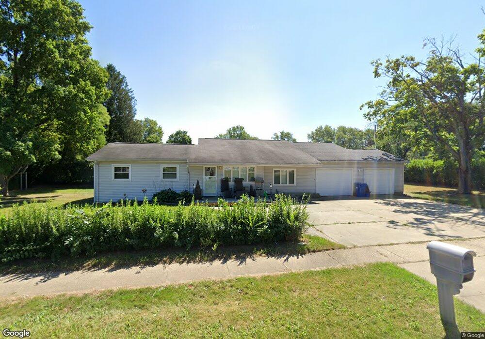
863 King St Mansfield, OH 44903
Estimated Value: $127,000 - $139,871
4
Beds
3
Baths
1,818
Sq Ft
$73/Sq Ft
Est. Value
About This Home
This home is located at 863 King St, Mansfield, OH 44903 and is currently estimated at $132,218, approximately $72 per square foot. 863 King St is a home located in Richland County with nearby schools including Foundation Academy, Mansfield Elective Academy, and Goal Digital Academy.
Ownership History
Date
Name
Owned For
Owner Type
Purchase Details
Closed on
Aug 22, 2005
Sold by
Mortimer Michael A and Mortimer Phyllis K
Bought by
Hilliard Anne L
Current Estimated Value
Home Financials for this Owner
Home Financials are based on the most recent Mortgage that was taken out on this home.
Original Mortgage
$87,797
Outstanding Balance
$46,535
Interest Rate
5.8%
Mortgage Type
FHA
Estimated Equity
$85,683
Purchase Details
Closed on
Jun 4, 2004
Sold by
Washington Mutual Bank Fa
Bought by
Mortimer Michael A and Mortimer Phyllis K
Purchase Details
Closed on
Jul 17, 2003
Sold by
Clark Willie
Bought by
Washington Mutual Bank Fa
Purchase Details
Closed on
Aug 1, 1986
Purchase Details
Closed on
Jun 1, 1985
Create a Home Valuation Report for This Property
The Home Valuation Report is an in-depth analysis detailing your home's value as well as a comparison with similar homes in the area
Home Values in the Area
Average Home Value in this Area
Purchase History
| Date | Buyer | Sale Price | Title Company |
|---|---|---|---|
| Hilliard Anne L | $88,500 | Southern Title | |
| Mortimer Michael A | $52,100 | Attorneys Title Agency Inc | |
| Washington Mutual Bank Fa | $48,000 | Chicago Title | |
| -- | $35,000 | -- | |
| -- | $35,900 | -- |
Source: Public Records
Mortgage History
| Date | Status | Borrower | Loan Amount |
|---|---|---|---|
| Open | Hilliard Anne L | $87,797 |
Source: Public Records
Tax History Compared to Growth
Tax History
| Year | Tax Paid | Tax Assessment Tax Assessment Total Assessment is a certain percentage of the fair market value that is determined by local assessors to be the total taxable value of land and additions on the property. | Land | Improvement |
|---|---|---|---|---|
| 2024 | $1,396 | $29,810 | $4,930 | $24,880 |
| 2023 | $1,396 | $29,810 | $4,930 | $24,880 |
| 2022 | $1,236 | $22,130 | $4,070 | $18,060 |
| 2021 | $1,245 | $22,130 | $4,070 | $18,060 |
| 2020 | $1,273 | $22,130 | $4,070 | $18,060 |
| 2019 | $1,411 | $22,130 | $4,070 | $18,060 |
| 2018 | $1,392 | $22,130 | $4,070 | $18,060 |
| 2017 | $1,401 | $22,130 | $4,070 | $18,060 |
| 2016 | $1,447 | $22,930 | $3,870 | $19,060 |
| 2015 | $1,447 | $22,930 | $3,870 | $19,060 |
| 2014 | $1,364 | $22,930 | $3,870 | $19,060 |
| 2012 | $520 | $22,920 | $4,070 | $18,850 |
Source: Public Records
Map
Nearby Homes
- 641 Averill Ave
- 0 State Route 314 Unit 9069650
- 0 State Route 314 Unit 9067316
- 0 State Route 314 Unit 225021979
- 741 Burger Ave
- 340 Boston Ave
- 1168 & 1171 Seminole Ave
- 1169 Seminole Ave
- 512 Burns St
- 0 W Fourth St - Trimble Lenox
- 269 Parkway Dr
- 874 Fairfax Ave
- 876 Fairfax Ave
- 0 Highway 30
- 480 Mcpherson St
- 237 Helen Ave
- 170 Western Ave
- 450 Tracy St
- 933 Fairfax Ave
- 946 Belmont Ave