Estimated Value: $171,000 - $223,000
2
Beds
1
Bath
2,088
Sq Ft
$89/Sq Ft
Est. Value
About This Home
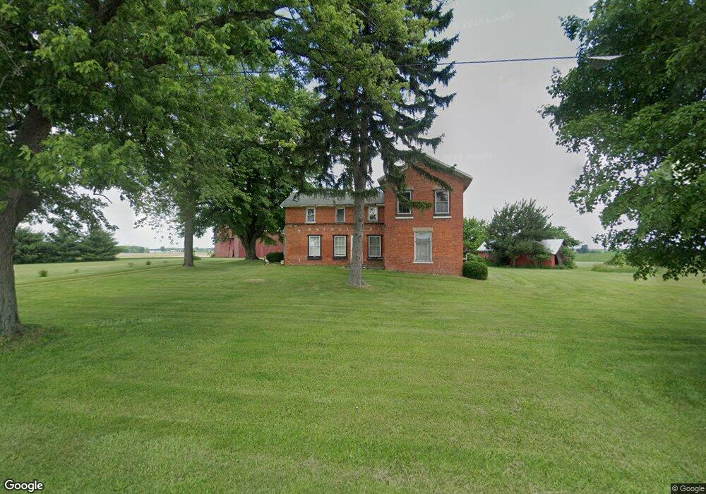
This home is located at 8634 State Route 101 N, Clyde, OH 43410 and is currently estimated at $185,223, approximately $88 per square foot. 8634 State Route 101 N is a home located in Seneca County with nearby schools including Clyde High School, Harvest Temple Christian Academy, and St. Mary's School.
Ownership History
Date
Name
Owned For
Owner Type
Purchase Details
Closed on
Jan 30, 2004
Bought by
Haas Scott T
Current Estimated Value
Create a Home Valuation Report for This Property
The Home Valuation Report is an in-depth analysis detailing your home's value as well as a comparison with similar homes in the area
Home Values in the Area
Average Home Value in this Area
Purchase History
| Date | Buyer | Sale Price | Title Company |
|---|---|---|---|
| Haas Scott T | $72,000 | -- |
Source: Public Records
Tax History Compared to Growth
Tax History
| Year | Tax Paid | Tax Assessment Tax Assessment Total Assessment is a certain percentage of the fair market value that is determined by local assessors to be the total taxable value of land and additions on the property. | Land | Improvement |
|---|---|---|---|---|
| 2024 | $2,038 | $54,080 | $12,290 | $41,790 |
| 2023 | $3,821 | $54,080 | $12,290 | $41,790 |
| 2022 | $1,687 | $38,820 | $10,890 | $27,930 |
| 2021 | $1,693 | $38,820 | $10,890 | $27,930 |
| 2020 | $3,253 | $38,819 | $10,892 | $27,927 |
| 2019 | $1,610 | $38,091 | $10,689 | $27,402 |
| 2018 | $1,607 | $38,091 | $10,689 | $27,402 |
| 2017 | $1,560 | $38,091 | $10,689 | $27,402 |
| 2016 | $1,518 | $35,683 | $9,464 | $26,219 |
| 2015 | $4,418 | $35,683 | $9,464 | $26,219 |
| 2014 | $2,685 | $35,683 | $9,464 | $26,219 |
| 2013 | $3,383 | $35,683 | $9,464 | $26,219 |
Source: Public Records
Map
Nearby Homes
- 2114 S Main St
- 0 N Sr 101 Unit 20252008
- 0 Merlin Ln Unit 20253762
- 0 Merlin Ln Unit 20253639
- 222 Bertha Ave
- 628 W Maple St
- 209 Fair St
- 315 E Grant St
- 220 Maple Ln Unit 82
- 322 Vine St
- 235 W Buckeye St
- 167 Excalibur Dr
- 104 Ken Lee Dr
- 0 Durnwald Dr
- CR 260 89.6 acres Durnwald Dr
- 118 E Buckeye St
- 741 May St
- 1337 E Sr 20
- 236 Spayd Rd
- 0 Ames St
- 8585 State Route 101 N
- 8800 State Route 101 N
- 8801 State Route 101 N
- 8398 State Route 101 N
- 8233 N Tr 179
- 8215 State Route 101 N
- 6758 N State Route 18
- 6556 N State Route 18
- 6743 N State Route 18
- 6504 N State Route 18
- 6123 N State Route 18
- 6422 N State Route 18
- 6526 N State Route 18
- 6838 N State Route 18
- 3921 County Road 195
- 3987 Cr 195
- 3950 County Road 195
- 3868 County Road 195
- 8500 County Road 21
- 8305 County Road 21