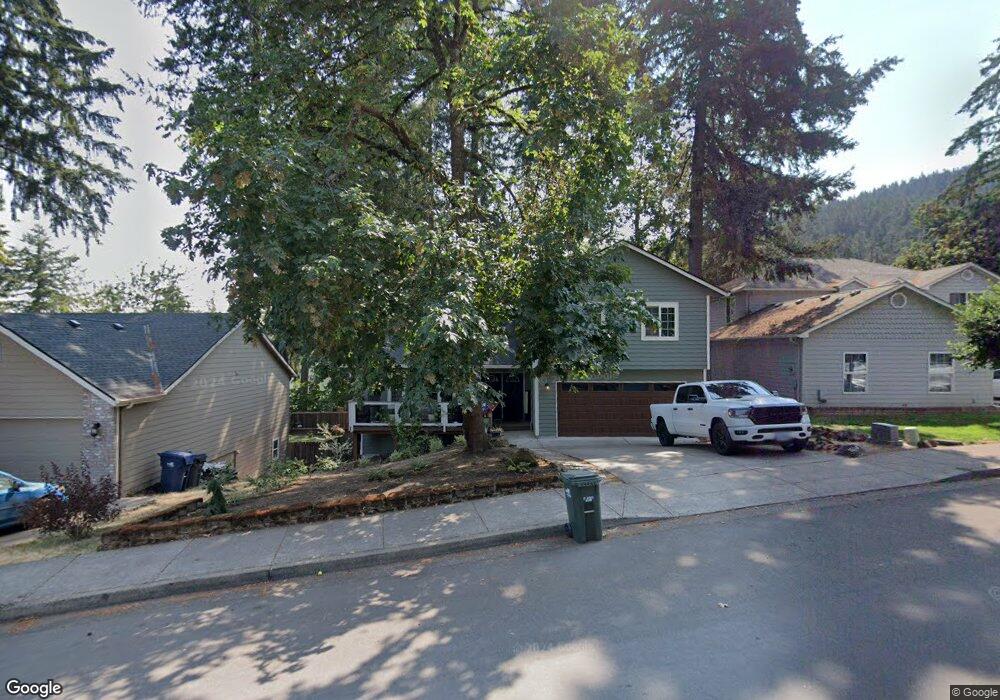
865 S 69th St Springfield, OR 97478
Thurston NeighborhoodEstimated Value: $450,000 - $505,000
3
Beds
3
Baths
1,717
Sq Ft
$276/Sq Ft
Est. Value
About This Home
This home is located at 865 S 69th St, Springfield, OR 97478 and is currently estimated at $474,427, approximately $276 per square foot. 865 S 69th St is a home located in Lane County with nearby schools including Thurston Elementary School, Thurston Middle School, and Thurston High School.
Ownership History
Date
Name
Owned For
Owner Type
Purchase Details
Closed on
Feb 22, 2021
Sold by
Hight Cory and Hight Ashley
Bought by
Hight Cory Derek and Hight Ashley Lynn
Current Estimated Value
Home Financials for this Owner
Home Financials are based on the most recent Mortgage that was taken out on this home.
Original Mortgage
$265,000
Outstanding Balance
$214,342
Interest Rate
2.7%
Mortgage Type
New Conventional
Estimated Equity
$260,085
Purchase Details
Closed on
Jan 27, 2021
Sold by
Toney Ashley and Hight Cory
Bought by
Hight Cory Derek and Hight Ashley Lynn
Home Financials for this Owner
Home Financials are based on the most recent Mortgage that was taken out on this home.
Original Mortgage
$265,000
Outstanding Balance
$214,342
Interest Rate
2.7%
Mortgage Type
New Conventional
Estimated Equity
$260,085
Purchase Details
Closed on
Aug 10, 2017
Sold by
Thompson Nathan Lee
Bought by
Hight Cory and Toney Ashley
Home Financials for this Owner
Home Financials are based on the most recent Mortgage that was taken out on this home.
Original Mortgage
$218,250
Interest Rate
3.88%
Mortgage Type
New Conventional
Purchase Details
Closed on
Sep 4, 2008
Sold by
Morequity Inc
Bought by
Thompson Nathan Lee
Home Financials for this Owner
Home Financials are based on the most recent Mortgage that was taken out on this home.
Original Mortgage
$190,018
Interest Rate
6.5%
Mortgage Type
FHA
Purchase Details
Closed on
Jan 25, 2008
Sold by
Mcclain Louis
Bought by
Morequity Inc
Purchase Details
Closed on
Aug 2, 2002
Sold by
Greenhoot William R and Greenhoot Lisa A
Bought by
Mcclain Louis
Home Financials for this Owner
Home Financials are based on the most recent Mortgage that was taken out on this home.
Original Mortgage
$131,566
Interest Rate
6.6%
Purchase Details
Closed on
Dec 19, 1997
Sold by
Springfield City Of
Bought by
Greenhoot William R and Greenhoot Lisa A
Home Financials for this Owner
Home Financials are based on the most recent Mortgage that was taken out on this home.
Original Mortgage
$22,000
Interest Rate
7.16%
Mortgage Type
Seller Take Back
Create a Home Valuation Report for This Property
The Home Valuation Report is an in-depth analysis detailing your home's value as well as a comparison with similar homes in the area
Home Values in the Area
Average Home Value in this Area
Purchase History
| Date | Buyer | Sale Price | Title Company |
|---|---|---|---|
| Hight Cory Derek | -- | Western Title & Escrow | |
| Hight Cory Derek | -- | Western Title | |
| Hight Cory | $225,000 | Western Title & Escrow Co | |
| Thompson Nathan Lee | $193,000 | Fidelity Natl Title Co Of Or | |
| Morequity Inc | $188,522 | Fidelity National Title Insu | |
| Mcclain Louis | $28,500 | Cascade Title Co | |
| Greenhoot William R | $27,500 | Evergreen Land Title Co |
Source: Public Records
Mortgage History
| Date | Status | Borrower | Loan Amount |
|---|---|---|---|
| Open | Hight Cory Derek | $265,000 | |
| Closed | Hight Cory Derek | $265,000 | |
| Previous Owner | Hight Cory | $218,250 | |
| Previous Owner | Thompson Nathan Lee | $190,018 | |
| Previous Owner | Mcclain Louis | $131,566 | |
| Previous Owner | Greenhoot William R | $22,000 |
Source: Public Records
Tax History
| Year | Tax Paid | Tax Assessment Tax Assessment Total Assessment is a certain percentage of the fair market value that is determined by local assessors to be the total taxable value of land and additions on the property. | Land | Improvement |
|---|---|---|---|---|
| 2025 | $5,252 | $286,415 | -- | -- |
| 2024 | $5,167 | $278,073 | -- | -- |
| 2023 | $5,167 | $269,974 | -- | -- |
| 2022 | $4,786 | $262,111 | $0 | $0 |
| 2021 | $4,700 | $254,477 | $0 | $0 |
| 2020 | $4,562 | $247,066 | $0 | $0 |
| 2019 | $4,425 | $239,870 | $0 | $0 |
| 2018 | $4,171 | $226,101 | $0 | $0 |
| 2017 | $4,011 | $226,101 | $0 | $0 |
| 2016 | $3,927 | $219,516 | $0 | $0 |
| 2015 | $3,815 | $213,122 | $0 | $0 |
| 2014 | $3,757 | $206,915 | $0 | $0 |
Source: Public Records
Map
Nearby Homes
- 0 S 69th Place
- 6842 Jessica Dr
- 595 S 68th Place
- 6715 Ivy St
- 7027 S E St
- 994 S 67th St
- 982 S 66th Place
- 967 S 66th Place
- 6964 Bluebelle Way
- 296 S 68th Ct
- 6981 Main St
- 6884 Forest Ridge Dr
- 0 Forest Ridge Unit 520732026
- 0 S 73rd St Unit 24191573
- 250 68th St
- 0 Forest Ridge Dr Unit 637211360
- 6887 B St
- 320 Mountaingate Dr
- 353 71st St
- 6225 Forest Ridge Dr
Your Personal Tour Guide
Ask me questions while you tour the home.