866 Andreas Canyon Dr Palm Desert, CA 92260
Estimated Value: $6,942,000 - $8,039,260
4
Beds
5
Baths
6,969
Sq Ft
$1,059/Sq Ft
Est. Value
About This Home
This home is located at 866 Andreas Canyon Dr, Palm Desert, CA 92260 and is currently estimated at $7,378,087, approximately $1,058 per square foot. 866 Andreas Canyon Dr is a home with nearby schools including La Quinta Middle School, Palm Desert High School, and George Washington Charter School.
Ownership History
Date
Name
Owned For
Owner Type
Purchase Details
Closed on
May 18, 2022
Sold by
Alan Balmuth Michael
Bought by
Michael A Balmuth Separate Property Trust
Current Estimated Value
Purchase Details
Closed on
Mar 12, 2014
Sold by
Balmuth Janet
Bought by
Balmuth Michael Alan
Purchase Details
Closed on
Mar 4, 2014
Sold by
Bighorn Development Llc
Bought by
Balmuth Michael Alan
Create a Home Valuation Report for This Property
The Home Valuation Report is an in-depth analysis detailing your home's value as well as a comparison with similar homes in the area
Home Values in the Area
Average Home Value in this Area
Purchase History
| Date | Buyer | Sale Price | Title Company |
|---|---|---|---|
| Michael A Balmuth Separate Property Trust | -- | Friedman Jennifer H | |
| Balmuth Michael Alan | -- | Lawyers Title Company | |
| Balmuth Michael Alan | -- | Lawyers Title Company |
Source: Public Records
Tax History Compared to Growth
Tax History
| Year | Tax Paid | Tax Assessment Tax Assessment Total Assessment is a certain percentage of the fair market value that is determined by local assessors to be the total taxable value of land and additions on the property. | Land | Improvement |
|---|---|---|---|---|
| 2023 | $77,324 | $6,279,658 | $2,709,999 | $3,569,659 |
| 2022 | $75,789 | $6,156,528 | $2,656,862 | $3,499,666 |
| 2021 | $74,288 | $6,035,813 | $2,604,767 | $3,431,046 |
| 2020 | $72,856 | $5,973,924 | $2,578,059 | $3,395,865 |
| 2019 | $71,449 | $5,856,789 | $2,527,509 | $3,329,280 |
| 2018 | $70,073 | $5,741,950 | $2,477,950 | $3,264,000 |
| 2017 | $68,627 | $5,629,363 | $2,429,363 | $3,200,000 |
| 2016 | $46,310 | $3,806,729 | $2,381,729 | $1,425,000 |
| 2015 | $29,235 | $2,345,954 | $2,345,954 | $0 |
| 2014 | $1,170 | $89,177 | $89,177 | $0 |
Source: Public Records
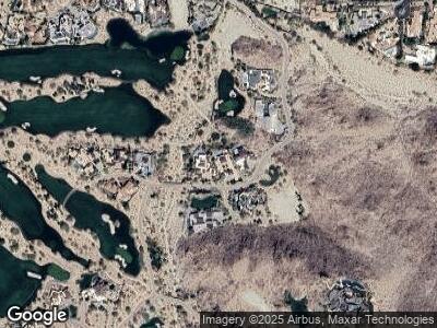
Map
Nearby Homes
- 871 Rock River
- 880 Andreas Canyon Dr
- 702 Summit Cove
- 707 Summit Cove
- 706 Summit Cove
- 49400 Della Robia Ln
- 49425 Jfk Trail
- 113 Heather Ct
- 73109 Crosby Ln
- 49281 Jfk Trail
- 49269 Jfk Trail
- 49257 Jfk Trail
- 49260 Sunrose Ln
- 1036 Vale Crest
- 49120 Sunrose Ln
- 100 Lantana View
- 73231 Mariposa Dr
- 73211 Foxtail Ln
- 1134 Lake Vista
- 1102 Lake Vista
- 866 Andreas Canyon Dr
- 868 Andreas Canyon Dr
- 865 Rock River
- 865 Rock River Dr
- 870 Andreas Canyon
- 870 Andreas Canyon Dr
- 869 Rock River Dr
- 867 Rock River
- 869 Rock River
- 864 Andreas Canyon Dr
- 872 Andreas Canyon Dr
- 861 Andreas Canyon Dr
- 880 Andreas Canyon Dr
- 876 Andreas Canyon Dr
- 862 Andreas Canyon Dr
- 874 Andreas Canyon Dr
- 860 Andreas Canyon Dr
- 878 Andreas Canyon Dr
- 700 Summit Cove
- 882 Andreas Canyon Dr