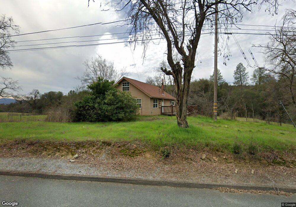
8665 S State Highway 49 Jackson, CA 95642
Estimated Value: $313,000 - $431,000
3
Beds
2
Baths
1,604
Sq Ft
$229/Sq Ft
Est. Value
About This Home
This home is located at 8665 S State Highway 49, Jackson, CA 95642 and is currently estimated at $368,020, approximately $229 per square foot. 8665 S State Highway 49 is a home located in Amador County with nearby schools including Jackson Elementary School, Jackson Junior High School, and Argonaut High School.
Ownership History
Date
Name
Owned For
Owner Type
Purchase Details
Closed on
Apr 15, 2013
Sold by
Lefebvre Pamela C
Bought by
Bohland Jerome B and Bohland Laura A
Current Estimated Value
Home Financials for this Owner
Home Financials are based on the most recent Mortgage that was taken out on this home.
Original Mortgage
$110,000
Interest Rate
4.36%
Mortgage Type
Unknown
Create a Home Valuation Report for This Property
The Home Valuation Report is an in-depth analysis detailing your home's value as well as a comparison with similar homes in the area
Home Values in the Area
Average Home Value in this Area
Purchase History
| Date | Buyer | Sale Price | Title Company |
|---|---|---|---|
| Bohland Jerome B | $128,500 | First American Title Company |
Source: Public Records
Mortgage History
| Date | Status | Borrower | Loan Amount |
|---|---|---|---|
| Previous Owner | Bohland Jerome B | $110,000 |
Source: Public Records
Tax History Compared to Growth
Tax History
| Year | Tax Paid | Tax Assessment Tax Assessment Total Assessment is a certain percentage of the fair market value that is determined by local assessors to be the total taxable value of land and additions on the property. | Land | Improvement |
|---|---|---|---|---|
| 2025 | $1,581 | $159,350 | $42,900 | $116,450 |
| 2024 | $1,581 | $156,226 | $42,059 | $114,167 |
| 2023 | $1,550 | $153,164 | $41,235 | $111,929 |
| 2022 | $1,521 | $150,162 | $40,427 | $109,735 |
| 2021 | $1,492 | $147,219 | $39,635 | $107,584 |
| 2020 | $1,478 | $145,710 | $39,229 | $106,481 |
| 2019 | $1,449 | $142,854 | $38,460 | $104,394 |
| 2018 | $1,421 | $140,054 | $37,706 | $102,348 |
| 2017 | $1,394 | $137,309 | $36,967 | $100,342 |
| 2016 | $1,366 | $134,618 | $36,243 | $98,375 |
| 2015 | -- | $132,597 | $35,699 | $96,898 |
| 2014 | -- | $130,000 | $35,000 | $95,000 |
Source: Public Records
Map
Nearby Homes
- 170 Terrace View Cir
- 225 Scottsville Dr
- 2043 Thomas Dr
- 2069 Thomas Dr
- 1571 Nevill Ct
- 581 Scottsville Blvd
- 126 Frontier Dr
- 150 Clinton Rd Unit 38
- 150 Clinton Rd Unit 17
- 150 Clinton Rd
- 33 N Pioneer Cir
- 248 Cypress Ct
- 734 Kristi Ct
- 513 Perry St
- 420 South Ave
- 7680 Middle Bar Rd
- 403 Bright Ave
- 14950 Clinton Rd
- 402 Water St
- 0 Golden Chain Hwy
- 8685 S State Highway 49
- 0 Toyon Unit ML81998462
- 7230 Amherst
- 024 Us Hwy 88
- 8202 Middle Bar Rd
- 7900 Fuller Ln
- 1650 Thomas Dr
- 101 Terrace View Cir
- 100 Terrace View Cir
- 105 Terrace View Cir
- 1700 Thomas Dr
- 110 Terrace View Cir
- 115 Terrace View Cir
- 120 Terrace View Cir
- 125 Terrace View Cir
- 8770 S State Highway 49
- 307 Terrace View Cir
- 135 Terrace View Cir
- 130 Terrace View Cir
- 145 Terrace View Cir