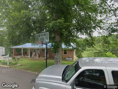
867 Dalton Cir Morristown, TN 37814
Estimated Value: $161,000 - $236,000
3
Beds
2
Baths
1,332
Sq Ft
$150/Sq Ft
Est. Value
About This Home
This home is located at 867 Dalton Cir, Morristown, TN 37814 and is currently estimated at $200,453, approximately $150 per square foot. 867 Dalton Cir is a home located in Hamblen County with nearby schools including West Elementary School, Lincoln Heights Middle School, and Morristown West High School.
Ownership History
Date
Name
Owned For
Owner Type
Purchase Details
Closed on
Oct 30, 2017
Sold by
Griffith Paul and Griffith Monica
Bought by
Clay Stephanie S
Current Estimated Value
Home Financials for this Owner
Home Financials are based on the most recent Mortgage that was taken out on this home.
Original Mortgage
$79,797
Outstanding Balance
$67,623
Interest Rate
3.83%
Mortgage Type
New Conventional
Estimated Equity
$132,830
Purchase Details
Closed on
Dec 1, 2014
Sold by
Thompson Lois Ann
Bought by
Griffith Paul and Griffith Monica
Purchase Details
Closed on
Jan 22, 1992
Bought by
Thompson James Eugene and Lois Ann
Create a Home Valuation Report for This Property
The Home Valuation Report is an in-depth analysis detailing your home's value as well as a comparison with similar homes in the area
Home Values in the Area
Average Home Value in this Area
Purchase History
| Date | Buyer | Sale Price | Title Company |
|---|---|---|---|
| Clay Stephanie S | $79,000 | Colonial Title | |
| Griffith Paul | $68,000 | -- | |
| Thompson James Eugene | $42,000 | -- |
Source: Public Records
Mortgage History
| Date | Status | Borrower | Loan Amount |
|---|---|---|---|
| Open | Clay Stephanie S | $79,797 | |
| Previous Owner | Thompson James Eugene | $76,000 | |
| Previous Owner | Thompson James Eugene | $16,000 | |
| Previous Owner | Thompson James Eugene | $34,000 | |
| Previous Owner | Thompson James E | $30,000 | |
| Previous Owner | Thompson James E | $30,000 | |
| Previous Owner | Thompson James E | $59,194 | |
| Previous Owner | James Thompson | $50,000 | |
| Previous Owner | James Thompson | $46,412 |
Source: Public Records
Tax History Compared to Growth
Tax History
| Year | Tax Paid | Tax Assessment Tax Assessment Total Assessment is a certain percentage of the fair market value that is determined by local assessors to be the total taxable value of land and additions on the property. | Land | Improvement |
|---|---|---|---|---|
| 2024 | $434 | $24,650 | $3,800 | $20,850 |
| 2023 | $434 | $24,650 | $0 | $0 |
| 2022 | $779 | $24,650 | $3,800 | $20,850 |
| 2021 | $779 | $24,650 | $3,800 | $20,850 |
| 2020 | $778 | $24,650 | $3,800 | $20,850 |
| 2019 | $605 | $17,775 | $3,550 | $14,225 |
| 2018 | $560 | $17,775 | $3,550 | $14,225 |
| 2017 | $551 | $17,775 | $3,550 | $14,225 |
| 2016 | $526 | $17,775 | $3,550 | $14,225 |
| 2015 | $490 | $17,775 | $3,550 | $14,225 |
| 2014 | -- | $17,775 | $3,550 | $14,225 |
| 2013 | -- | $26,600 | $0 | $0 |
Source: Public Records
Map
Nearby Homes
- 00 Spoone Cir
- 2151 Thomas Dr
- 500 Noes Chapel Rd
- 1411 Lakeview Cir
- 439 Lochmere Dr
- 1111 Carmichael St
- 451 Lochmere Dr
- 381 Lochmere Dr
- 472 Lochmere Dr
- 1430 Madison St
- 2517 Shields Ferry Rd
- 602 Hilltop Dr
- 2336 Washington Ave
- 321 Kensington Dr
- 378 Kensington Dr
- 2346 Wellington Point
- 480 Noes Chapel Rd
- 652 Noes Chapel Rd
- 440 Noes Chapel Rd
- 867 Dalton Cir
- 867 Dalton Cir
- 905 Dalton Cir
- 864 Dalton Cir
- 906 Dalton Cir
- 915 Dalton Cir
- 859 N Outer Dr
- 901 N Outer Dr
- 909 N Outer Dr
- 847 N Outer Dr
- 924 Dalton Cir
- 919 Dalton Cir
- 864 N Outer Dr
- 904 N Outer Dr
- 829 N Outer Dr
- 848 N Outer Dr
- 914 N Outer Dr
- 925 Dalton Cir
- 2159 Orchard St
- 2168 Orchard St