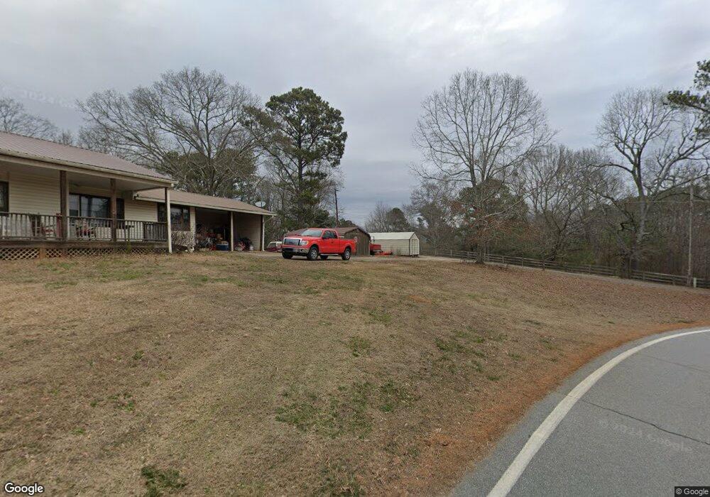
867 Sam Nelson Rd Canton, GA 30114
Sutallee NeighborhoodEstimated Value: $255,000 - $331,000
3
Beds
1
Bath
1,560
Sq Ft
$196/Sq Ft
Est. Value
About This Home
This home is located at 867 Sam Nelson Rd, Canton, GA 30114 and is currently estimated at $305,396, approximately $195 per square foot. 867 Sam Nelson Rd is a home located in Cherokee County with nearby schools including R. M. Moore Elementary School, Teasley Middle School, and Cherokee High School.
Ownership History
Date
Name
Owned For
Owner Type
Purchase Details
Closed on
May 31, 2023
Sold by
Sims Zachary
Bought by
Buice Dylan and Buice Allee
Current Estimated Value
Home Financials for this Owner
Home Financials are based on the most recent Mortgage that was taken out on this home.
Original Mortgage
$259,640
Outstanding Balance
$252,142
Interest Rate
6.39%
Mortgage Type
New Conventional
Estimated Equity
$53,254
Purchase Details
Closed on
Apr 15, 2019
Sold by
Ghorley Vickie Nelson
Bought by
Sims Zachary and Sims Amber
Home Financials for this Owner
Home Financials are based on the most recent Mortgage that was taken out on this home.
Original Mortgage
$137,373
Interest Rate
4.3%
Mortgage Type
New Conventional
Purchase Details
Closed on
Feb 16, 2007
Sold by
Ghorley Jeffrey D and Ghorley Vickie N
Bought by
Nelson Earl and Nelson Ola
Purchase Details
Closed on
Aug 18, 2006
Sold by
Wheeler Darlene
Bought by
Chorley Dean and Chorley Vickie N
Create a Home Valuation Report for This Property
The Home Valuation Report is an in-depth analysis detailing your home's value as well as a comparison with similar homes in the area
Home Values in the Area
Average Home Value in this Area
Purchase History
| Date | Buyer | Sale Price | Title Company |
|---|---|---|---|
| Buice Dylan | $292,000 | -- | |
| Sims Zachary | $131,000 | -- | |
| Nelson Earl | -- | -- | |
| Chorley Dean | -- | -- |
Source: Public Records
Mortgage History
| Date | Status | Borrower | Loan Amount |
|---|---|---|---|
| Open | Buice Dylan | $259,640 | |
| Previous Owner | Sims Zachary | $137,373 |
Source: Public Records
Tax History
| Year | Tax Paid | Tax Assessment Tax Assessment Total Assessment is a certain percentage of the fair market value that is determined by local assessors to be the total taxable value of land and additions on the property. | Land | Improvement |
|---|---|---|---|---|
| 2025 | $2,141 | $81,536 | $20,880 | $60,656 |
| 2024 | $1,993 | $76,696 | $19,000 | $57,696 |
| 2023 | $1,455 | $84,040 | $19,000 | $65,040 |
| 2022 | $1,420 | $60,880 | $18,680 | $42,200 |
| 2021 | $1,137 | $43,560 | $12,480 | $31,080 |
| 2020 | $1,059 | $40,200 | $10,840 | $29,360 |
| 2019 | $1,033 | $36,360 | $10,840 | $25,520 |
| 2018 | $1,010 | $35,320 | $10,840 | $24,480 |
| 2017 | $985 | $88,900 | $10,840 | $24,720 |
| 2016 | $985 | $84,600 | $10,840 | $23,000 |
| 2015 | $1,009 | $85,800 | $10,840 | $23,480 |
| 2014 | $977 | $82,900 | $10,120 | $23,040 |
Source: Public Records
Map
Nearby Homes
- 437 Mccurry Trail
- 110 Canyon Ridge Trail
- 310 Pepperwood Way
- 190 Ash Trail
- 107 Mountain Laurel Ct
- 236 Laurel Vista Dr
- 206 Canyon Fairway Trace
- 310 Laurel Lookout Hills
- 523 Appalachian Woods
- 319 Laurel Lookout Hills
- The Fullerton Plan at Horizon at Laurel Canyon
- The Pinehurst Plan at Horizon at Laurel Canyon
- The Wellington Plan at Horizon at Laurel Canyon
- The Waveland Plan at Horizon at Laurel Canyon
- The York Plan at Horizon at Laurel Canyon
- The Cambridge Plan at Horizon at Laurel Canyon
- 540 Laurel Canyon Pkwy
- 967 Cable Rd
- 990 Cable Rd
- 994 Cable Rd
- 855 Sam Nelson Rd
- 0 Sam Nelson Rd Unit 2988065
- 0 Sam Nelson Rd Unit 3272888
- 0 Sam Nelson Rd Unit 7210839
- 0 Sam Nelson Rd Unit 4160370
- 0 Sam Nelson Rd Unit 5054757
- 0 Sam Nelson Rd Unit 5242613
- 815 Sam Nelson Rd
- 873 Sam Nelson Rd
- 826 Sam Nelson Rd
- 826 Sam Nelson Rd
- 883 Sam Nelson Rd
- 737 Sam Nelson Rd
- 1020 Sam Nelson Rd
- 833 Sam Nelson Rd
- 697 Sam Nelson Rd
- 719 Sam Nelson Rd
- 981 Sam Nelson Rd
- 1044 Sam Nelson Rd
- 1046 Sam Nelson Rd
Your Personal Tour Guide
Ask me questions while you tour the home.