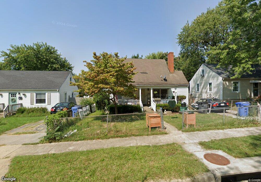
869 Darley Dr Lexington, KY 40505
Meadows-Loudon NeighborhoodEstimated Value: $212,989 - $286,000
4
Beds
2
Baths
1,515
Sq Ft
$159/Sq Ft
Est. Value
About This Home
This home is located at 869 Darley Dr, Lexington, KY 40505 and is currently estimated at $241,497, approximately $159 per square foot. 869 Darley Dr is a home located in Fayette County with nearby schools including Northern Elementary School, Bryan Station Middle School, and Bryan Station High School.
Ownership History
Date
Name
Owned For
Owner Type
Purchase Details
Closed on
Jan 6, 2010
Sold by
Fannie Mae
Bought by
Wells Larry and Wells Kayla
Current Estimated Value
Home Financials for this Owner
Home Financials are based on the most recent Mortgage that was taken out on this home.
Original Mortgage
$3,000
Interest Rate
4.75%
Mortgage Type
Purchase Money Mortgage
Purchase Details
Closed on
Nov 5, 2009
Sold by
Sarah Kathlina Marlene B Dec and Sarah Cathlino
Bought by
Federal National Mortgage Association
Create a Home Valuation Report for This Property
The Home Valuation Report is an in-depth analysis detailing your home's value as well as a comparison with similar homes in the area
Home Values in the Area
Average Home Value in this Area
Purchase History
| Date | Buyer | Sale Price | Title Company |
|---|---|---|---|
| Wells Larry | $70,000 | -- | |
| Federal National Mortgage Association | $80,000 | -- |
Source: Public Records
Mortgage History
| Date | Status | Borrower | Loan Amount |
|---|---|---|---|
| Open | Federal National Mortgage Association | $15,000 | |
| Closed | Federal National Mortgage Association | $3,000 |
Source: Public Records
Tax History Compared to Growth
Tax History
| Year | Tax Paid | Tax Assessment Tax Assessment Total Assessment is a certain percentage of the fair market value that is determined by local assessors to be the total taxable value of land and additions on the property. | Land | Improvement |
|---|---|---|---|---|
| 2024 | $1,766 | $142,800 | $0 | $0 |
| 2023 | $1,766 | $142,800 | $0 | $0 |
| 2022 | $1,240 | $97,100 | $0 | $0 |
| 2021 | $1,240 | $97,100 | $0 | $0 |
| 2020 | $1,240 | $97,100 | $0 | $0 |
| 2019 | $1,240 | $97,100 | $0 | $0 |
| 2018 | $1,162 | $91,000 | $0 | $0 |
| 2017 | $1,108 | $91,000 | $0 | $0 |
| 2015 | $1,018 | $91,000 | $0 | $0 |
| 2014 | $1,018 | $91,000 | $0 | $0 |
| 2012 | $1,018 | $91,000 | $0 | $0 |
Source: Public Records
Map
Nearby Homes
- 802 Carneal Rd
- 920 Darley Dr
- 643 E Loudon Ave
- 636 Locust Ave
- 443 Morgan Ave
- 430 Morgan Ave
- 558 Emerson Dr
- 660 Gay Place
- 462 Emerson Dr
- 806 Maple Ave
- 425 Emerson Dr
- 224 Carlisle Ave
- 568 E New Circle Rd
- 300 Locust Ave
- 750 Maple Ave
- 1406 Highlawn Ave
- 520 Wanstead Way
- 1616 Thirlstane Ct
- 1030 Strader Dr
- 147 Arceme Ave
- 865 Darley Dr
- 873 Darley Dr
- 861 Darley Dr
- 877 Darley Dr
- 857 Darley Dr
- 860 Marcellus Dr
- 856 Marcellus Dr
- 864 Marcellus Dr
- 852 Marcellus Dr
- 868 Marcellus Dr
- 864 Darley Dr
- 853 Darley Dr
- 1218 Highland Park Dr
- 868 Darley Dr
- 860 Darley Dr
- 1222 Highland Park Dr
- 1214 Highland Park Dr
- 848 Marcellus Dr
- 872 Darley Dr
- 856 Darley Dr