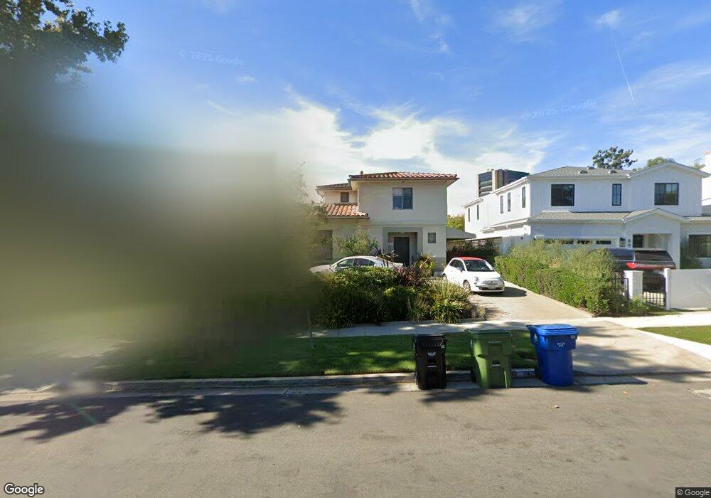
869 Malcolm Ave Los Angeles, CA 90024
Westwood NeighborhoodEstimated Value: $3,299,134 - $3,809,000
4
Beds
4
Baths
3,148
Sq Ft
$1,124/Sq Ft
Est. Value
About This Home
This home is located at 869 Malcolm Ave, Los Angeles, CA 90024 and is currently estimated at $3,538,784, approximately $1,124 per square foot. 869 Malcolm Ave is a home located in Los Angeles County with nearby schools including Warner Avenue Elementary, Ralph Waldo Emerson Community Charter Middle School, and University High School Charter.
Ownership History
Date
Name
Owned For
Owner Type
Purchase Details
Closed on
Jul 8, 2014
Sold by
Pelavin Erica
Bought by
The Richard Neil Pelavin & Erica Joan Pe
Current Estimated Value
Purchase Details
Closed on
Jul 7, 2014
Sold by
Horowitz Karen
Bought by
Horowitz Eric Arie and Horowitz Karen Louise
Purchase Details
Closed on
Dec 15, 2012
Sold by
Goldenberg Irene T and The Herbert & Irene Goldenberg
Bought by
Pelavin Erica and Horowitz Karen
Purchase Details
Closed on
Jun 25, 2010
Sold by
Goldenberg Irene T and The Herbert & Irene Goldenberg
Bought by
Goldenberg Irene T and The Herbert & Irene Goldenberg Family Tr
Create a Home Valuation Report for This Property
The Home Valuation Report is an in-depth analysis detailing your home's value as well as a comparison with similar homes in the area
Home Values in the Area
Average Home Value in this Area
Purchase History
| Date | Buyer | Sale Price | Title Company |
|---|---|---|---|
| The Richard Neil Pelavin & Erica Joan Pe | -- | None Available | |
| Horowitz Eric Arie | -- | None Available | |
| Pelavin Erica | -- | None Available | |
| Goldenberg Irene T | -- | None Available |
Source: Public Records
Tax History
| Year | Tax Paid | Tax Assessment Tax Assessment Total Assessment is a certain percentage of the fair market value that is determined by local assessors to be the total taxable value of land and additions on the property. | Land | Improvement |
|---|---|---|---|---|
| 2025 | $3,470 | $254,675 | $121,823 | $132,852 |
| 2024 | $3,470 | $249,683 | $119,435 | $130,248 |
| 2023 | $3,414 | $244,789 | $117,094 | $127,695 |
| 2022 | $3,272 | $239,991 | $114,799 | $125,192 |
| 2021 | $3,213 | $235,287 | $112,549 | $122,738 |
| 2019 | $3,126 | $228,310 | $109,211 | $119,099 |
| 2018 | $3,043 | $223,834 | $107,070 | $116,764 |
| 2016 | $2,883 | $215,144 | $102,913 | $112,231 |
| 2015 | $2,845 | $211,914 | $101,368 | $110,546 |
| 2014 | $2,865 | $207,764 | $99,383 | $108,381 |
Source: Public Records
Map
Nearby Homes
- 10785 Weyburn Ave
- 969 Hilgard Ave Unit 1008
- 969 Hilgard Ave Unit 707
- 969 Hilgard Ave
- 969 Hilgard Ave Unit 1002
- 969 Hilgard Ave Unit 603
- 10817 Lindbrook Dr
- 751 Westholme Ave
- 10777 Wilshire Blvd Unit 603
- 10777 Wilshire Blvd Unit 401
- 10777 Wilshire Blvd Unit 403
- 10777 Wilshire Blvd Unit 209
- 10777 Wilshire Blvd Unit 207
- 10777 Wilshire Blvd Unit 409
- 10777 Wilshire Blvd Unit 208
- 10751 Wilshire Blvd Unit 909
- 10751 Wilshire Blvd Unit 607
- 10787 Wilshire Blvd Unit 1102
- 10787 Wilshire Blvd Unit 802
- 10795 Wilshire Blvd Unit 402
- 875 Malcolm Ave
- 863 Malcolm Ave
- 857 Malcolm Ave
- 881 Malcolm Ave
- 870 Hilgard Ave Unit SI FL1-ID54
- 870 Hilgard Ave Unit FL1-ID54
- 870 Hilgard Ave
- 870 Hilgard Ave Unit 412
- 870 Hilgard Ave Unit PH20
- 870 Hilgard Ave Unit 414
- 887 Malcolm Ave
- 868 Malcolm Ave
- 874 Malcolm Ave
- 862 Malcolm Ave
- 880 Malcolm Ave
- 845 Malcolm Ave
- 886 Hilgard Ave Unit 302
- 886 Hilgard Ave
- 886 Malcolm Ave
- 850 Malcolm Ave
Your Personal Tour Guide
Ask me questions while you tour the home.