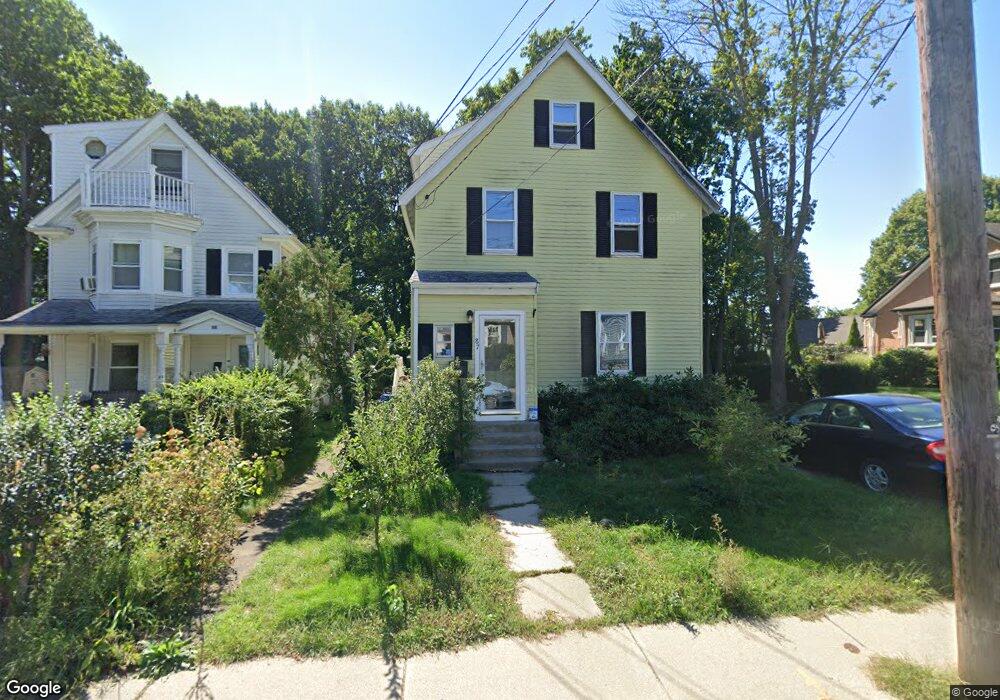
87 Adams Ave West Newton, MA 02465
West Newton NeighborhoodEstimated Value: $1,107,000 - $1,319,264
4
Beds
2
Baths
1,634
Sq Ft
$731/Sq Ft
Est. Value
About This Home
This home is located at 87 Adams Ave, West Newton, MA 02465 and is currently estimated at $1,194,066, approximately $730 per square foot. 87 Adams Ave is a home located in Middlesex County with nearby schools including Franklin Elementary School, C.C. Burr, and F.A. Day Middle School.
Ownership History
Date
Name
Owned For
Owner Type
Purchase Details
Closed on
Jul 1, 2008
Sold by
Lesser Adam M and Lesser Nicole F
Bought by
Marino Lisa J
Current Estimated Value
Home Financials for this Owner
Home Financials are based on the most recent Mortgage that was taken out on this home.
Original Mortgage
$260,000
Interest Rate
6.07%
Mortgage Type
Purchase Money Mortgage
Purchase Details
Closed on
Feb 13, 2003
Sold by
Deleon Sarah T
Bought by
Lesser Adam M and Lesser Nicole F
Home Financials for this Owner
Home Financials are based on the most recent Mortgage that was taken out on this home.
Original Mortgage
$270,000
Interest Rate
5.88%
Mortgage Type
Purchase Money Mortgage
Purchase Details
Closed on
Mar 13, 1990
Sold by
Bolio Robert H
Bought by
Rangel Roberto J
Create a Home Valuation Report for This Property
The Home Valuation Report is an in-depth analysis detailing your home's value as well as a comparison with similar homes in the area
Home Values in the Area
Average Home Value in this Area
Purchase History
| Date | Buyer | Sale Price | Title Company |
|---|---|---|---|
| Marino Lisa J | $500,000 | -- | |
| Lesser Adam M | $478,000 | -- | |
| Rangel Roberto J | $150,000 | -- |
Source: Public Records
Mortgage History
| Date | Status | Borrower | Loan Amount |
|---|---|---|---|
| Open | Rangel Roberto J | $260,000 | |
| Closed | Marino Lisa J | $260,000 | |
| Previous Owner | Lesser Adam M | $270,000 | |
| Previous Owner | Rangel Roberto J | $150,000 |
Source: Public Records
Tax History Compared to Growth
Tax History
| Year | Tax Paid | Tax Assessment Tax Assessment Total Assessment is a certain percentage of the fair market value that is determined by local assessors to be the total taxable value of land and additions on the property. | Land | Improvement |
|---|---|---|---|---|
| 2025 | $8,439 | $861,100 | $801,000 | $60,100 |
| 2024 | $8,159 | $836,000 | $777,700 | $58,300 |
| 2023 | $7,647 | $751,200 | $590,800 | $160,400 |
| 2022 | $7,318 | $695,600 | $547,000 | $148,600 |
| 2021 | $7,061 | $656,200 | $516,000 | $140,200 |
| 2020 | $6,851 | $656,200 | $516,000 | $140,200 |
| 2019 | $6,658 | $637,100 | $501,000 | $136,100 |
| 2018 | $6,299 | $582,200 | $454,700 | $127,500 |
| 2017 | $6,107 | $549,200 | $429,000 | $120,200 |
| 2016 | $5,841 | $513,300 | $400,900 | $112,400 |
| 2015 | $5,539 | $477,100 | $374,700 | $102,400 |
Source: Public Records
Map
Nearby Homes
- 11 Derby St
- 214 River St Unit 214
- 31-37 Washington Ave
- 101-103 Lexington St
- 24 Tolman St Unit 1
- 7 Westland Terrace
- 74 Rumford Ave
- 73 Orange St Unit 2
- 14 Cottage Place Unit 14
- 133 Ash St Unit 3
- 8 Elm St Unit 8
- 106 River St Unit 18
- 16 Elm St Unit 16
- 2 Elm St Unit 2
- 138 Myrtle St Unit 2
- 160 Pine St Unit 12
- 13 Robbins St Unit 1
- 312 Newton St Unit 1A
- 308 Newton St Unit 1
- 163-165 Chestnut St
- 89 Adams Ave
- 83 Adams Ave
- 66 James St
- 88 Adams Ave
- 97 Adams Ave
- 84 Adams Ave
- 84 Adams Ave Unit 84
- 84 Adams Ave Unit 1
- 70 James St
- 73 Adams Ave Unit 75
- 73 Adams Ave Unit 1
- 73 Adams Ave Unit 73
- 75 Adams Ave Unit 73
- 64 William St
- 62 James St
- 138 Tolman St
- 60 William St
- 105 Adams Ave
- 129 Tolman St Unit 131
- 65 Adams Ave