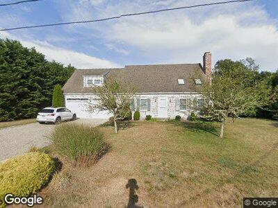
87 Seastrand Way Chatham, MA 02633
West Chatham NeighborhoodEstimated Value: $1,117,614 - $1,537,000
3
Beds
2
Baths
2,102
Sq Ft
$669/Sq Ft
Est. Value
About This Home
This home is located at 87 Seastrand Way, Chatham, MA 02633 and is currently estimated at $1,405,404, approximately $668 per square foot. 87 Seastrand Way is a home located in Barnstable County with nearby schools including Chatham Elementary School, Harwich Elementary School, and Monomoy Regional Middle School.
Ownership History
Date
Name
Owned For
Owner Type
Purchase Details
Closed on
Jun 25, 2024
Sold by
White David E and White Marisel S
Bought by
White Irret Indenture and White Damato
Current Estimated Value
Purchase Details
Closed on
May 11, 1999
Sold by
Baron Mimon
Bought by
White David E and White Marisel S
Create a Home Valuation Report for This Property
The Home Valuation Report is an in-depth analysis detailing your home's value as well as a comparison with similar homes in the area
Home Values in the Area
Average Home Value in this Area
Purchase History
| Date | Buyer | Sale Price | Title Company |
|---|---|---|---|
| White Irret Indenture | -- | None Available | |
| White Irret Indenture | -- | None Available | |
| White David E | $65,000 | -- | |
| White David E | $65,000 | -- |
Source: Public Records
Tax History Compared to Growth
Tax History
| Year | Tax Paid | Tax Assessment Tax Assessment Total Assessment is a certain percentage of the fair market value that is determined by local assessors to be the total taxable value of land and additions on the property. | Land | Improvement |
|---|---|---|---|---|
| 2025 | $3,413 | $983,700 | $472,600 | $511,100 |
| 2024 | $3,314 | $928,200 | $445,800 | $482,400 |
| 2023 | $3,166 | $816,000 | $371,500 | $444,500 |
| 2022 | $3,155 | $682,900 | $371,500 | $311,400 |
| 2021 | $3,005 | $603,400 | $316,600 | $286,800 |
| 2020 | $2,857 | $592,700 | $295,500 | $297,200 |
| 2019 | $2,894 | $596,700 | $296,000 | $300,700 |
| 2018 | $2,784 | $571,600 | $296,000 | $275,600 |
| 2017 | $2,807 | $558,100 | $287,300 | $270,800 |
| 2016 | $2,763 | $550,300 | $281,700 | $268,600 |
| 2015 | $2,682 | $537,500 | $273,700 | $263,800 |
| 2014 | $2,725 | $536,500 | $273,700 | $262,800 |
Source: Public Records
Map
Nearby Homes
- 56 Monomoit Ln
- 723 Main St
- 33 Jessies Landing
- 33 Jessie's Landing
- 45 Meadow View Rd S
- 15 Stephen Dr
- 0 George Ryder Rd Unit 22301591
- 0 George Ryder Rd Unit 73104629
- 1761 Main St
- 30 Indian Trail
- 56 Barn Hill Ln
- 86 Vineyard Ave
- 14 Squanto Dr
- 155 Cranberry Ln
- 25 Crosby Ln
- 7 Pond View Ave
- 61 Pond View Ave
- 67 The Cornfield
- 87 Seastrand Way
- 12 Seastrand Way Unit 2
- 14 Seastrand Way Unit 4
- 32 Seastrand Way Unit 6
- 99 Seastrand Way
- 73 Seastrand Way
- 66 Youngs Rd
- 6 Seastrand Ln
- 9 Seastrand Ln
- 96 Seastrand Way
- 65 Seastrand Way
- 54 Seastrand Way
- 60 Youngs Rd
- 60 Youngs Rd Unit 7
- 16 Seastrand Ln
- 15 Seastrand Ln
- 113 Seastrand Ln
- 42 Seastrand Way
- 113 Seastrand Way
- 110 Seastrand Way