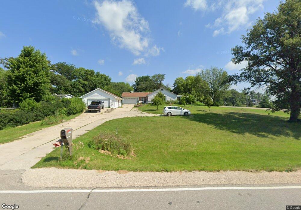
8736 W Cedar Wapsie Rd Cedar Falls, IA 50613
Estimated Value: $305,000 - $544,000
3
Beds
3
Baths
2,379
Sq Ft
$171/Sq Ft
Est. Value
About This Home
This home is located at 8736 W Cedar Wapsie Rd, Cedar Falls, IA 50613 and is currently estimated at $406,167, approximately $170 per square foot. 8736 W Cedar Wapsie Rd is a home located in Black Hawk County with nearby schools including Helen A. Hansen Elementary School, Holmes Junior High School, and Cedar Falls High School.
Ownership History
Date
Name
Owned For
Owner Type
Purchase Details
Closed on
Sep 26, 2016
Sold by
Poliak Edward J and Poliak Linda K
Bought by
Poliak Linda K and Poliak Edward J
Current Estimated Value
Purchase Details
Closed on
Apr 13, 2007
Sold by
Secor William S and Secor Holly R
Bought by
Poliak Edward J and Poliak Linda K
Create a Home Valuation Report for This Property
The Home Valuation Report is an in-depth analysis detailing your home's value as well as a comparison with similar homes in the area
Home Values in the Area
Average Home Value in this Area
Purchase History
| Date | Buyer | Sale Price | Title Company |
|---|---|---|---|
| Poliak Linda K | -- | None Available | |
| Poliak Edward J | $225,000 | Black Hawk County Abstract C |
Source: Public Records
Tax History Compared to Growth
Tax History
| Year | Tax Paid | Tax Assessment Tax Assessment Total Assessment is a certain percentage of the fair market value that is determined by local assessors to be the total taxable value of land and additions on the property. | Land | Improvement |
|---|---|---|---|---|
| 2025 | $3,704 | $350,240 | $75,150 | $275,090 |
| 2024 | $3,704 | $331,440 | $66,800 | $264,640 |
| 2023 | $3,938 | $331,440 | $66,800 | $264,640 |
| 2022 | $3,970 | $282,420 | $58,450 | $223,970 |
| 2021 | $3,620 | $282,420 | $58,450 | $223,970 |
| 2020 | $3,564 | $261,270 | $37,300 | $223,970 |
| 2019 | $3,564 | $261,270 | $37,300 | $223,970 |
| 2018 | $3,626 | $261,340 | $37,300 | $224,040 |
| 2017 | $3,626 | $261,340 | $37,300 | $224,040 |
| 2016 | $3,374 | $261,340 | $37,300 | $224,040 |
| 2015 | $3,374 | $261,340 | $37,300 | $224,040 |
| 2014 | $3,348 | $261,340 | $37,300 | $224,040 |
Source: Public Records
Map
Nearby Homes
- 8470 W Cedar Wapsi Rd
- 7937 N Union Rd
- 10241 Winslow Rd
- 7931 Clark St
- 0 Finchford Rd
- 9706 Sylvan Dr
- 6410 N Butler Rd
- 711 W 6th St
- 701 Hickory St
- 531 Hickory St
- 903 S Main St
- 407 Maple St
- 112 N Birch Cir
- 8052 Buck Ridge Rd
- Lot 14 Pine St
- Lot 11 Pine St
- Lot 16 Pine St
- Lot 13 Pine St
- Lot 10 Pine St
- Lot 12 Pine St
- 7012 Pioneer Dr
- 7033 N Union Rd
- 7032 Pioneer Dr
- 8680 W Cedar Wapsie Rd
- 7046 Pioneer Dr
- 8836 Union Cir
- 7106 Pioneer Dr
- 7047 Pioneer Dr
- 7100 N Union Rd
- 7125 N Union Rd
- 8843 W Cedar Wapsie Rd
- 8841 Union Cir
- 7111 Pioneer Dr
- 8808 Union Cir
- 7112 Pioneer Dr
- 8849 Union Cir
- 7131 Pioneer Dr
- 8856 Union Cir
- 7130 Pioneer Dr
- 8857 Union Cir