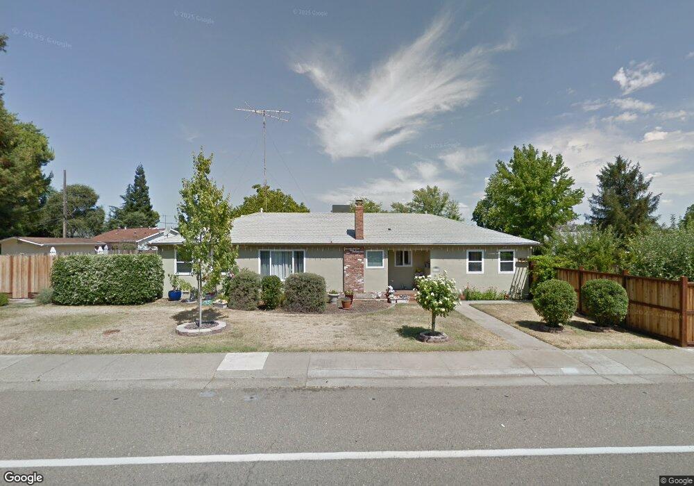
8737 Pershing Ave Orangevale, CA 95662
Estimated Value: $459,000 - $588,613
4
Beds
2
Baths
1,430
Sq Ft
$368/Sq Ft
Est. Value
About This Home
This home is located at 8737 Pershing Ave, Orangevale, CA 95662 and is currently estimated at $526,403, approximately $368 per square foot. 8737 Pershing Ave is a home located in Sacramento County with nearby schools including Pershing Elementary School, Andrew Carnegie Middle School, and Bella Vista High School.
Ownership History
Date
Name
Owned For
Owner Type
Purchase Details
Closed on
Apr 14, 2017
Sold by
Harp David D and Harp Jodi
Bought by
Harp Family Revocable Trust
Current Estimated Value
Purchase Details
Closed on
Apr 23, 2013
Sold by
Quinn Justin
Bought by
Harp David D and Harp Jodi
Home Financials for this Owner
Home Financials are based on the most recent Mortgage that was taken out on this home.
Original Mortgage
$188,000
Outstanding Balance
$39,515
Interest Rate
3.38%
Mortgage Type
New Conventional
Estimated Equity
$486,888
Purchase Details
Closed on
Jul 14, 2010
Sold by
Golden 1 Credit Union
Bought by
Quinn Justin
Home Financials for this Owner
Home Financials are based on the most recent Mortgage that was taken out on this home.
Original Mortgage
$182,442
Interest Rate
4.75%
Mortgage Type
FHA
Purchase Details
Closed on
May 13, 2010
Sold by
Gordon Michael and Gordon Betty
Bought by
Golden 1 Credit Union
Purchase Details
Closed on
May 23, 2004
Sold by
Gordon Michael and Gordon Betty
Bought by
Gordon Michael and Gordon Betty
Home Financials for this Owner
Home Financials are based on the most recent Mortgage that was taken out on this home.
Original Mortgage
$265,500
Interest Rate
5.86%
Mortgage Type
New Conventional
Purchase Details
Closed on
May 7, 2002
Sold by
Gordon Michael D
Bought by
Gordon Michael D and Gordon Betty
Home Financials for this Owner
Home Financials are based on the most recent Mortgage that was taken out on this home.
Original Mortgage
$197,100
Interest Rate
8.99%
Purchase Details
Closed on
Dec 5, 1997
Sold by
Gordon Betty R
Bought by
Gordon Michael D
Home Financials for this Owner
Home Financials are based on the most recent Mortgage that was taken out on this home.
Original Mortgage
$113,600
Interest Rate
10.25%
Purchase Details
Closed on
Dec 4, 1997
Sold by
Smith Guy Allen and Smith Susan K
Bought by
Gordon Michael D
Home Financials for this Owner
Home Financials are based on the most recent Mortgage that was taken out on this home.
Original Mortgage
$113,600
Interest Rate
10.25%
Create a Home Valuation Report for This Property
The Home Valuation Report is an in-depth analysis detailing your home's value as well as a comparison with similar homes in the area
Home Values in the Area
Average Home Value in this Area
Purchase History
| Date | Buyer | Sale Price | Title Company |
|---|---|---|---|
| Harp Family Revocable Trust | -- | None Available | |
| Harp David D | $270,000 | North American Title Company | |
| Quinn Justin | $185,000 | First American Title Company | |
| Golden 1 Credit Union | $202,500 | Accommodation | |
| Gordon Michael | -- | Fidelity Natl Title Co Of Ca | |
| Gordon Michael D | -- | Financial Title Company | |
| Gordon Michael D | -- | Placer Title Company | |
| Gordon Michael D | $142,000 | Placer Title Company |
Source: Public Records
Mortgage History
| Date | Status | Borrower | Loan Amount |
|---|---|---|---|
| Open | Harp David D | $188,000 | |
| Previous Owner | Quinn Justin | $182,442 | |
| Previous Owner | Gordon Michael | $265,500 | |
| Previous Owner | Gordon Michael D | $197,100 | |
| Previous Owner | Gordon Michael D | $113,600 | |
| Closed | Gordon Michael D | $14,200 |
Source: Public Records
Tax History
| Year | Tax Paid | Tax Assessment Tax Assessment Total Assessment is a certain percentage of the fair market value that is determined by local assessors to be the total taxable value of land and additions on the property. | Land | Improvement |
|---|---|---|---|---|
| 2025 | $3,882 | $332,471 | $77,449 | $255,022 |
| 2024 | $3,882 | $325,953 | $75,931 | $250,022 |
| 2023 | $3,783 | $319,563 | $74,443 | $245,120 |
| 2022 | $3,762 | $313,298 | $72,984 | $240,314 |
| 2021 | $3,699 | $307,155 | $71,553 | $235,602 |
| 2020 | $3,630 | $304,007 | $70,820 | $233,187 |
| 2019 | $6,794 | $298,047 | $69,432 | $228,615 |
| 2018 | $3,514 | $292,204 | $68,071 | $224,133 |
| 2017 | $3,478 | $286,476 | $66,737 | $219,739 |
| 2016 | $3,250 | $280,860 | $65,429 | $215,431 |
| 2015 | $3,194 | $276,643 | $64,447 | $212,196 |
| 2014 | $3,127 | $271,225 | $63,185 | $208,040 |
Source: Public Records
Map
Nearby Homes
- 8758 Corinne Dr
- 8858 Kona Way
- 5564 Fetz Ln
- 5556 Fetz Ln
- 8832 Canarsie Ave
- 5548 Fetz Ln
- 5596 Fetz Ln
- 5540 Fetz Ln
- 5817 Husker St
- 8928 Pershing Ave
- 8770 Greenback Ln
- 5330 Illinois Ave
- 8949 Genoa Ave
- 8934 Oro Way
- 5302 Illinois Ave
- 6013 Mcneely Way
- 6051 Kenneth Oak Way
- 8488 Mallee Cir
- 8641 Stratus Dr
- 8497 Mallee Cir
- 8742 Baxter Way
- 8733 Pershing Ave
- 8749 Baxter Way
- 8740 Pershing Ave
- 8753 Baxter Way
- 8744 Pershing Ave
- 8736 Pershing Ave
- 8741 Baxter Way
- 8729 Pershing Ave
- 8736 Baxter Way
- 8748 Pershing Ave
- 8748 Pershing Ave
- 8732 Pershing Ave
- 8721 Steve Way
- 8715 Steve Way
- 8749 Pershing Ave
- 8727 Steve Way
- 8737 Baxter Way
- 8707 Steve Way
- 8725 Pershing Ave
Your Personal Tour Guide
Ask me questions while you tour the home.