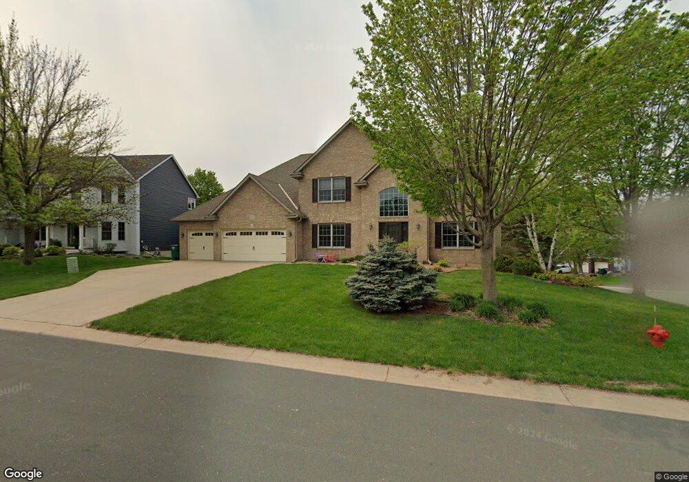
874 Govern Cir Saint Paul, MN 55123
Estimated Value: $711,097 - $762,000
5
Beds
4
Baths
4,159
Sq Ft
$177/Sq Ft
Est. Value
About This Home
This home is located at 874 Govern Cir, Saint Paul, MN 55123 and is currently estimated at $736,774, approximately $177 per square foot. 874 Govern Cir is a home located in Dakota County with nearby schools including Woodland Elementary School, Dakota Hills Middle School, and Eagan Senior High School.
Ownership History
Date
Name
Owned For
Owner Type
Purchase Details
Closed on
Sep 16, 2021
Sold by
Lachney Randy J and Lachney Alyce P
Bought by
Nason Bennett and Nason Bridget
Current Estimated Value
Home Financials for this Owner
Home Financials are based on the most recent Mortgage that was taken out on this home.
Original Mortgage
$461,999
Outstanding Balance
$389,039
Interest Rate
2.8%
Mortgage Type
New Conventional
Estimated Equity
$347,735
Purchase Details
Closed on
Feb 28, 2002
Sold by
Stadler Joseph J and Tollefson Shelly A
Bought by
Roiland Thomas S and Roiland Joann K
Purchase Details
Closed on
Sep 30, 1999
Sold by
Dr Horton Inc
Bought by
Stadler Joseph J and Stadler Shelly A
Create a Home Valuation Report for This Property
The Home Valuation Report is an in-depth analysis detailing your home's value as well as a comparison with similar homes in the area
Home Values in the Area
Average Home Value in this Area
Purchase History
| Date | Buyer | Sale Price | Title Company |
|---|---|---|---|
| Nason Bennett | $660,000 | Burnet Title | |
| Roiland Thomas S | $424,000 | -- | |
| Stadler Joseph J | $336,055 | -- | |
| Nason Bennett Bennett | $660,000 | -- |
Source: Public Records
Mortgage History
| Date | Status | Borrower | Loan Amount |
|---|---|---|---|
| Open | Nason Bennett | $461,999 | |
| Closed | Nason Bennett Bennett | $650,000 |
Source: Public Records
Tax History Compared to Growth
Tax History
| Year | Tax Paid | Tax Assessment Tax Assessment Total Assessment is a certain percentage of the fair market value that is determined by local assessors to be the total taxable value of land and additions on the property. | Land | Improvement |
|---|---|---|---|---|
| 2024 | $7,288 | $662,600 | $184,100 | $478,500 |
| 2023 | $7,288 | $644,800 | $184,600 | $460,200 |
| 2022 | $6,230 | $629,600 | $184,100 | $445,500 |
| 2021 | $5,948 | $529,300 | $160,100 | $369,200 |
| 2020 | $5,982 | $496,400 | $152,500 | $343,900 |
| 2019 | $5,418 | $485,200 | $148,000 | $337,200 |
| 2018 | $5,469 | $460,000 | $141,000 | $319,000 |
| 2017 | $5,266 | $447,700 | $134,300 | $313,400 |
| 2016 | $5,116 | $431,600 | $127,900 | $303,700 |
| 2015 | $4,995 | $415,600 | $127,900 | $287,700 |
| 2014 | -- | $412,603 | $124,371 | $288,232 |
| 2013 | -- | $347,966 | $111,164 | $236,802 |
Source: Public Records
Map
Nearby Homes
- 826 Hidden Meadow Trail
- 999 Northview Park Rd
- 977 Greensboro Ln
- 785 Canter Glen Cir
- 4124 New York Ave
- 3806 Bridgewater Dr
- 3675 Woodland Trail
- 4027 Camberwell Dr N
- 3860 Westbury Ln
- 3664 Falcon Way
- 3631 Woodcrest Cir
- 4162 Pennsylvania Ave
- 3655 Falcon Way
- 4080 Camberwell Dr N
- 3933 Westbury Way
- 4125 Pennsylvania Ave
- 3910 Westbury Trail
- 790 Summerbrooke Ct
- 1021 Diffley Rd
- 1067 Hummingbird Ln
- 870 Govern Cir
- 3840 Overlook Ct
- 3837 Overlook Ct
- 3841 Overlook Ct
- 866 Govern Cir
- 3845 Overlook Ct
- 3844 Overlook Ct
- 3849 Overlook Ct
- 873 Govern Cir
- 3849 Big Timber Trail
- 861 Govern Cir
- 869 Govern Cir
- 877 Govern Cir
- 3840 N Ridge Dr
- 3836 N Ridge Dr
- 881 Govern Cir
- 865 Govern Cir
- 3844 N Ridge Dr
- 3844 Big Timber Trail
- 3848 N Ridge Dr