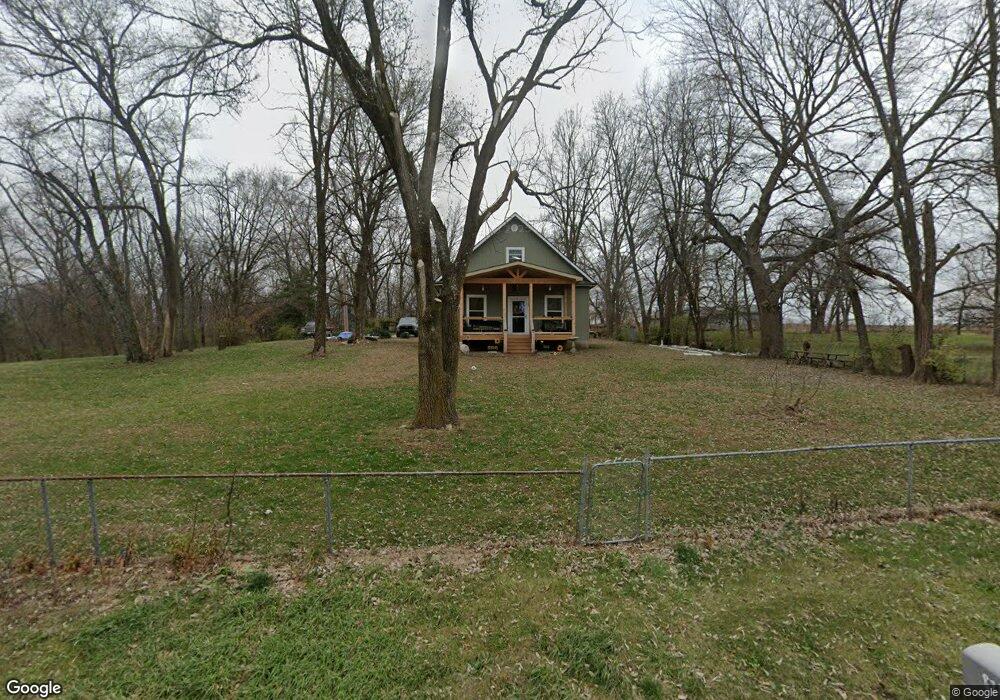
8785 Hoover Rd Platte City, MO 64079
Estimated Value: $278,366 - $385,000
2
Beds
2
Baths
1,200
Sq Ft
$274/Sq Ft
Est. Value
About This Home
This home is located at 8785 Hoover Rd, Platte City, MO 64079 and is currently estimated at $329,092, approximately $274 per square foot. 8785 Hoover Rd is a home located in Platte County with nearby schools including Platte County High School.
Ownership History
Date
Name
Owned For
Owner Type
Purchase Details
Closed on
Jan 24, 2024
Sold by
Burkin Deborah Ann and Burkin John Robert
Bought by
Burkin Deborah Ann and Burkin John Robert
Current Estimated Value
Home Financials for this Owner
Home Financials are based on the most recent Mortgage that was taken out on this home.
Original Mortgage
$172,975
Outstanding Balance
$169,948
Interest Rate
6.95%
Mortgage Type
FHA
Estimated Equity
$159,144
Create a Home Valuation Report for This Property
The Home Valuation Report is an in-depth analysis detailing your home's value as well as a comparison with similar homes in the area
Home Values in the Area
Average Home Value in this Area
Purchase History
| Date | Buyer | Sale Price | Title Company |
|---|---|---|---|
| Burkin Deborah Ann | -- | Security 1St Title |
Source: Public Records
Mortgage History
| Date | Status | Borrower | Loan Amount |
|---|---|---|---|
| Open | Burkin Deborah Ann | $172,975 |
Source: Public Records
Tax History Compared to Growth
Tax History
| Year | Tax Paid | Tax Assessment Tax Assessment Total Assessment is a certain percentage of the fair market value that is determined by local assessors to be the total taxable value of land and additions on the property. | Land | Improvement |
|---|---|---|---|---|
| 2024 | $1,791 | $26,922 | $3,800 | $23,122 |
| 2023 | $1,791 | $26,922 | $3,800 | $23,122 |
| 2022 | $1,578 | $23,513 | $3,800 | $19,713 |
| 2021 | $1,582 | $23,513 | $3,800 | $19,713 |
| 2020 | $1,427 | $20,963 | $3,800 | $17,163 |
| 2019 | $1,427 | $20,963 | $3,800 | $17,163 |
| 2018 | $1,439 | $20,963 | $3,800 | $17,163 |
| 2017 | $1,432 | $20,963 | $3,800 | $17,163 |
| 2016 | $1,420 | $20,963 | $3,800 | $17,163 |
| 2015 | $1,419 | $20,963 | $3,800 | $17,163 |
| 2013 | $1,300 | $20,963 | $0 | $0 |
Source: Public Records
Map
Nearby Homes
- 8422 Hoover Rd
- 16695 B Hwy
- 14660 Cobblestone Dr
- 5500 W Gale Rd
- 15145 Lakeport Ln
- 13201 NW Interurban Rd
- 707 Ridge Dr
- 12815 NW 145th St
- 24 Timber Creek Dr
- 17135 Smith Rd
- 0 Smith Rd
- 7816 NW 124th St
- 7724 NW 124th St
- 7711 NW 123rd Terrace
- 7743 NW 123 Terrace
- 12215 N Rhode Ct
- 2705 Mercer Ln
- 2609 Mercer Ln
- 2701 Mercer Ln
- 2709 Mercer Ln
- 15135 Interurban Rd
- 8850 Hoover Rd
- 8625 Hoover Rd
- 15205 Interurban Rd
- 9285 N Conant Ave
- 8565 Hoover Rd
- 9405 N Conant Ave
- 15100 Interurban Rd
- 9020 Hoover Rd
- 9535 N Conant Ave
- 15125 Interurban Rd
- 9655 N Conant Ave
- 15260 Interurban Rd
- 14980 Interurban Rd
- 8406 Hoover Rd
- 9710 N Conant Ave
- 9400 N Conant Ave
- 8435 Hoover Rd
- 9640 N Conant Ave
- 14985 Interurban Rd