Estimated Value: $409,000 - $464,000
4
Beds
3
Baths
1,670
Sq Ft
$257/Sq Ft
Est. Value
About This Home
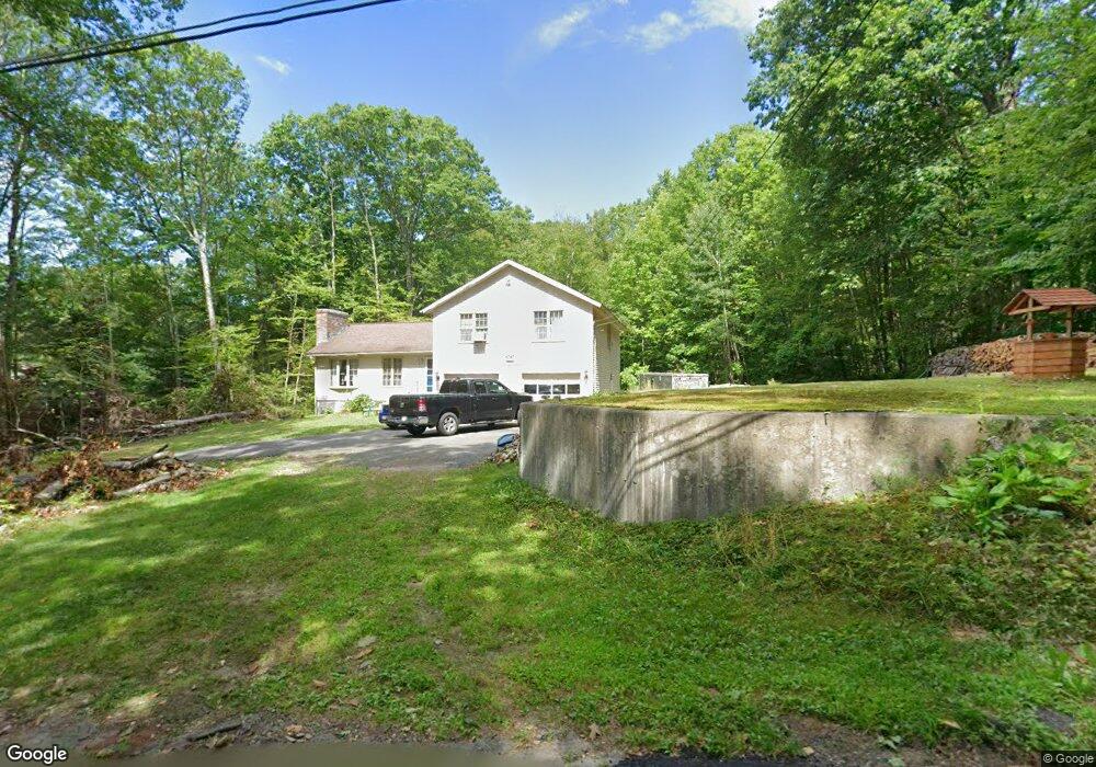
This home is located at 879 Conant Rd, Athol, MA 01331 and is currently estimated at $428,471, approximately $256 per square foot. 879 Conant Rd is a home located in Worcester County with nearby schools including Athol High School.
Ownership History
Date
Name
Owned For
Owner Type
Purchase Details
Closed on
Jul 28, 2000
Sold by
Noyes-Renaud Susan F
Bought by
Folmsbee David M and Folmsbee Michele J
Current Estimated Value
Purchase Details
Closed on
Nov 24, 1992
Sold by
Provost David A and Provost Kathy
Bought by
Renaud Susan F
Purchase Details
Closed on
Sep 27, 1991
Sold by
Dupuis Dennis J and Dupuis Lisa M
Bought by
Provost David A and Provost Kathy A
Create a Home Valuation Report for This Property
The Home Valuation Report is an in-depth analysis detailing your home's value as well as a comparison with similar homes in the area
Home Values in the Area
Average Home Value in this Area
Purchase History
| Date | Buyer | Sale Price | Title Company |
|---|---|---|---|
| Folmsbee David M | $150,000 | -- | |
| Renaud Susan F | $135,000 | -- | |
| Provost David A | $142,500 | -- |
Source: Public Records
Mortgage History
| Date | Status | Borrower | Loan Amount |
|---|---|---|---|
| Open | Provost David A | $147,500 | |
| Closed | Provost David A | $130,000 |
Source: Public Records
Tax History
| Year | Tax Paid | Tax Assessment Tax Assessment Total Assessment is a certain percentage of the fair market value that is determined by local assessors to be the total taxable value of land and additions on the property. | Land | Improvement |
|---|---|---|---|---|
| 2025 | $4,253 | $334,600 | $51,300 | $283,300 |
| 2024 | $4,074 | $317,500 | $51,300 | $266,200 |
| 2023 | $4,051 | $288,500 | $38,300 | $250,200 |
| 2022 | $3,777 | $235,300 | $36,600 | $198,700 |
| 2021 | $3,352 | $189,800 | $33,400 | $156,400 |
| 2020 | $3,046 | $177,300 | $30,800 | $146,500 |
| 2019 | $3,115 | $178,500 | $29,000 | $149,500 |
| 2018 | $3,436 | $175,600 | $26,100 | $149,500 |
| 2017 | $3,543 | $173,700 | $26,100 | $147,600 |
| 2016 | $3,260 | $164,400 | $26,100 | $138,300 |
| 2015 | $3,129 | $164,400 | $26,100 | $138,300 |
| 2014 | $3,030 | $164,400 | $26,100 | $138,300 |
Source: Public Records
Map
Nearby Homes
- 0 Riceville Rd Unit 73429842
- 321 Doe Valley Rd
- 1 Batchelder Rd
- 0 Miles Rd
- Lot-2 Petersham Rd
- Lot 3 Petersham Rd
- 156 Vaughn Rd
- 288 Chase Rd
- 572 Pleasant St
- 114 Smith St
- 62 Lindsay Ln
- 0000 Gage Rd
- 132 Simonds St
- 221 Harvard Ave
- 217 Spring St
- 990 S Main St
- 140 Spring St
- 121 Spring St
- 53 Lake Ellis Rd
- 2428 Main St
Your Personal Tour Guide
Ask me questions while you tour the home.