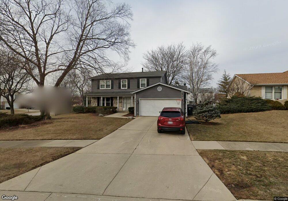
879 Deerpath Ct Hoffman Estates, IL 60169
South Hoffman Estates NeighborhoodEstimated Value: $527,666 - $579,000
4
Beds
3
Baths
2,326
Sq Ft
$240/Sq Ft
Est. Value
About This Home
This home is located at 879 Deerpath Ct, Hoffman Estates, IL 60169 and is currently estimated at $558,917, approximately $240 per square foot. 879 Deerpath Ct is a home located in Cook County with nearby schools including Hoover Math And Science Academy, Dwight D Eisenhower Junior High School, and Hoffman Estates High School.
Ownership History
Date
Name
Owned For
Owner Type
Purchase Details
Closed on
Aug 31, 2004
Sold by
Rakers Michael S and Rakers Laura M
Bought by
Krogstad Eric W and Krogstad Susan R
Current Estimated Value
Home Financials for this Owner
Home Financials are based on the most recent Mortgage that was taken out on this home.
Original Mortgage
$160,000
Outstanding Balance
$71,679
Interest Rate
4.87%
Mortgage Type
Unknown
Estimated Equity
$487,238
Purchase Details
Closed on
Sep 25, 1998
Sold by
Marquis Larry D and Marquis Pamela
Bought by
Rakers Michael S and Rakers Laura M
Home Financials for this Owner
Home Financials are based on the most recent Mortgage that was taken out on this home.
Original Mortgage
$222,300
Interest Rate
6.88%
Create a Home Valuation Report for This Property
The Home Valuation Report is an in-depth analysis detailing your home's value as well as a comparison with similar homes in the area
Home Values in the Area
Average Home Value in this Area
Purchase History
| Date | Buyer | Sale Price | Title Company |
|---|---|---|---|
| Krogstad Eric W | $405,000 | -- | |
| Rakers Michael S | $247,000 | -- |
Source: Public Records
Mortgage History
| Date | Status | Borrower | Loan Amount |
|---|---|---|---|
| Open | Krogstad Eric W | $160,000 | |
| Previous Owner | Rakers Michael S | $222,300 |
Source: Public Records
Tax History
| Year | Tax Paid | Tax Assessment Tax Assessment Total Assessment is a certain percentage of the fair market value that is determined by local assessors to be the total taxable value of land and additions on the property. | Land | Improvement |
|---|---|---|---|---|
| 2025 | $9,967 | $48,000 | $10,744 | $37,256 |
| 2024 | $9,967 | $35,795 | $8,953 | $26,842 |
| 2023 | $9,919 | $35,795 | $8,953 | $26,842 |
| 2022 | $9,919 | $36,818 | $8,953 | $27,865 |
| 2021 | $9,148 | $30,635 | $6,267 | $24,368 |
| 2020 | $9,009 | $30,635 | $6,267 | $24,368 |
| 2019 | $8,962 | $34,039 | $6,267 | $27,772 |
| 2018 | $7,837 | $27,468 | $5,371 | $22,097 |
| 2017 | $8,261 | $29,169 | $5,371 | $23,798 |
| 2016 | $9,050 | $32,874 | $5,371 | $27,503 |
| 2015 | $7,092 | $24,704 | $4,700 | $20,004 |
| 2014 | $6,984 | $24,704 | $4,700 | $20,004 |
| 2013 | $6,787 | $24,704 | $4,700 | $20,004 |
Source: Public Records
Map
Nearby Homes
- 712 Scarbrough Cir Unit 126
- 1300 Chatsworth Ln
- 658 Claridge Cir Unit 99
- 1025 Higgins Quarters Dr Unit 4-109
- 1085 Higgins Quarters Dr Unit 104
- 730 Hill Dr Unit 9205
- 670 Lakeview Ln
- 630 Bode Rd
- 426 Argyll Ln
- 720 Hill Dr Unit 8303
- 600 Mesa Dr Unit 104
- 600 Mesa Dr Unit 103
- 1365 Newcastle Ln
- 1180 Meadow Ln Unit 108
- 1335 Blair Ln
- 555 Heritage Dr Unit 315
- 860 Olive St
- 755 Cambridge Ln
- 845 Harmon Blvd
- 1975 Leiter Way Unit 12002
- 875 Deerpath Ct
- 1095 Worthington Dr
- 1085 Worthington Dr
- 870 Deerpath Ln
- 880 Deerpath Ln
- 871 Deerpath Ct
- 1075 Worthington Dr
- 890 Deerpath Ln
- 855 Deerpath Ln
- 870 Deerpath Ln
- 1115 Worthington Dr
- 860 Deerpath Ln
- 1065 Worthington Dr
- 867 Deerpath Ct
- 859 Deerpath Ct
- 863 Deerpath Ct
- 845 Deerpath Ct
- 845 Deerpath Ln
- 850 Deerpath Ln
- 850 Deerpath Ct
Your Personal Tour Guide
Ask me questions while you tour the home.